MyTopo
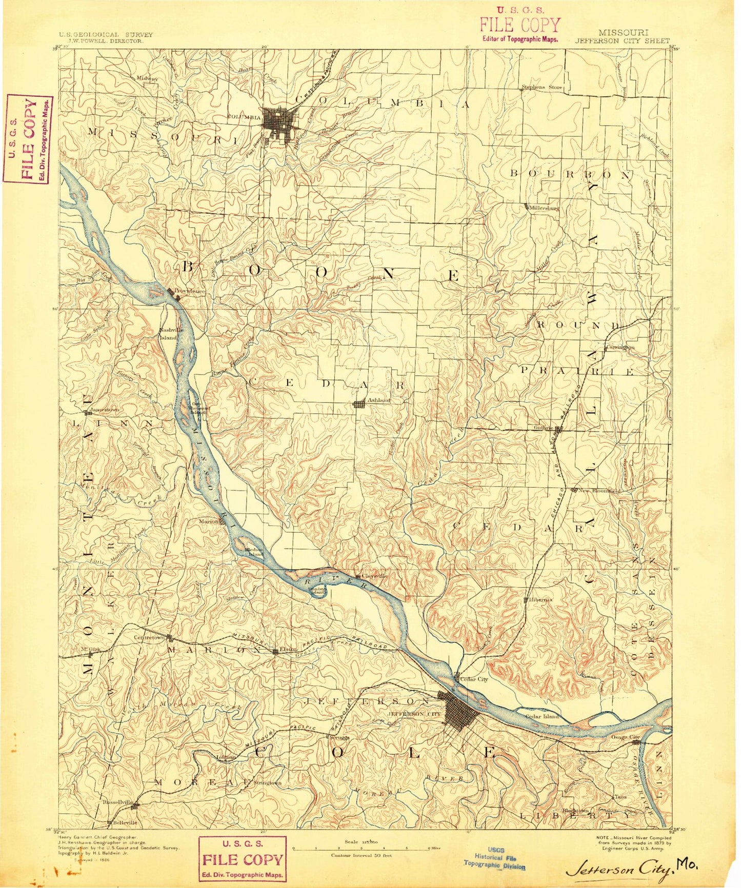
Historic 1886 Jefferson City Missouri 30'x30' Topo Map
Couldn't load pickup availability
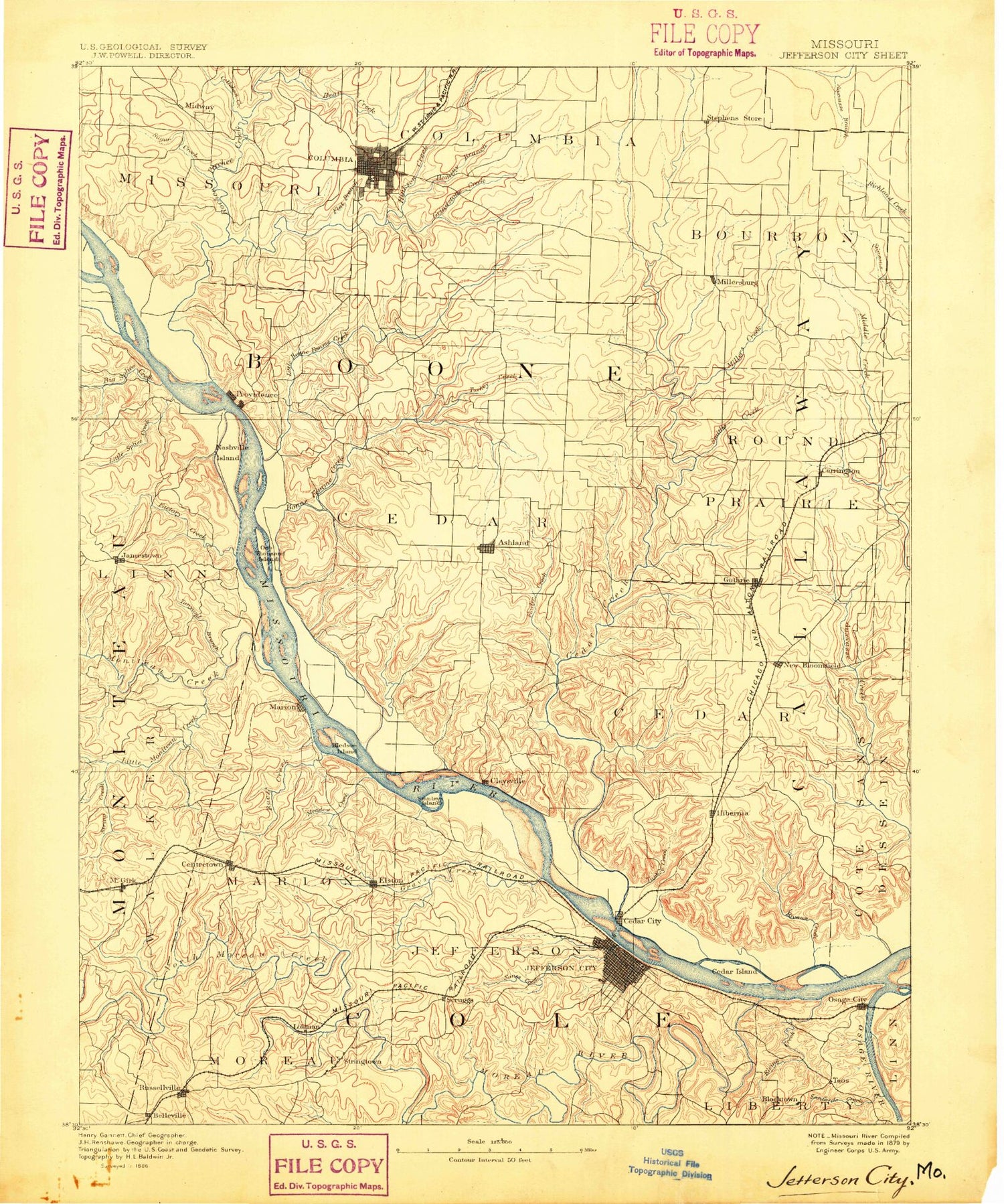
Historical USGS topographic map of Jefferson City in the state of Missouri. Scale: 1:125000. Print size: 17" x 24"
This map was published in 1886 and is in the following counties: Boone, Callaway, Cole, Cooper, Moniteau, Osage.
The map contains contour lines, roads, rivers, towns, streams, and lakes. Printed on high-quality waterproof paper with UV fade-resistant inks.
Contains the following named places: Apache Flats, Ashland, Bear Creek, Bennie Branch, Binder Memorial Park, Black Branch, Boggs Creek, Brushwood Lake, Cadet Creek, Callahan Creek, Cedar City, Centertown, Clear Creek, Cliffty Branch, Columbia, Coon Creek, Cosmo Park, County House Branch, Cow Branch, Devils Icebox, Dickerson Creek, Easley, Ellis-Porter Park, Elston, Factory Creek, Flat Branch, Fox Hollow Branch, Frog Hollow, Turner, Goodin Branch, Grays Creek, Grindstone Creek, Grocery Branch, Haldiman Branch, Harmony Creek, Hauck Branch, Henderson Branch, Herbrandt Branch, Hough Park, Howe Branch, Hulen Lake, Huntsdale, Jaeger Creek, Jamestown, Kautsch Branch, Kiwanis Park, Lavinia Park, Little Bonne Femme Creek, Little Moniteau Creek, Little Splice Creek, Logan Creek, Lohman, Lupus, Maupin Branch, Mayhan Branch, McBaine, McClung Park, McGirk, Merideth Branch, Midway, Midway Branch, Mill Creek, Moores Lake, Morton Branch, Nickell Park, Osage City, Petite Saline Creek, Pierpont, Renns Lake, Rising Creek, Rock Bridge Memorial State Park, Rocky Fork Creek, Russellville, Saint Martins, Sanford Creek, Sapp, Scotts Branch, Smith Branch, South Fork Cadet Creek, South Moreau Creek, Splice Creek, Steinhauer Branch, Stephens Lake, Stephens Park, String Creek, Strobel Branch, Strobel Branch, Sugar Branch, Tadpole Island, Terrapin Creek, Thompson Branch, Turtle Spring Branch, Van Pool Branch, Wainwright, Washington Park, Wears Creek, Westing Branch, Wieneke Branch, Woodhaven Childrens Home, Neighorn Branch, Perche Creek, Sandy Hook, Moreau River, Whist Landing, Chariton River Hills, Ewings, Bacon, Cole Junction, Earl, North Jefferson, Plummer, Providence, Schubert, Scott, Scruggs, Stringtown, Forum Shopping Center, Southwest Plaza, Shoppers Mart, Gerbes Center, Jefferson Plaza, Dix Road Shopping Center, Mart Shopping Center, Southridge Shopping Center, West Village Plaza, Capital Mall, Rock Bridge Shopping Center, Columbia Plaza, Broadway Center, Biscayne Mall, Crossroads West, Columbia Mall, Eastgate Plaza, North County Shopping Center, Whitegate Shopping Center, Parkade Plaza, Algoa Farms, Bougher, Moreau, Bass Creek, Bass Lake, Big Branch, Big Branch, Bone Branch, Bonne Femme Creek, Boydsville, Brushy Creek, Bump Hollow, Caldwell Branch, Camp Keown, Carrington, Cason Branch, Cedar Creek, Claysville, Clifton Creek, Conner Creek, Corns Lake, Davis Creek, Deer Park, Devils Backbone, Dixie, Dry Fork, Eastville, Elkhurst, Englewood, Fitzhugh Branch, Foster Branch, Fowler Creek, Gans Creek, Glascock Branch, Grand Prairie, Grider Branch, Guthrie, Harg, Hart Creek, Hartsburg, Hereford, Hinkson Creek, Holts Summit, Hominy Branch, Jemerson Creek, Kelly Branch, Lawson Branch, Lindbergh, Little Cedar Creek, Little Dixie Lake, Little Dixie State Wildlife Management Area, Manacle Creek, Marion, Meadows Creek, Middle Branch, Mill Site Bluff, Millers Creek, Millersburg, Moniteau Creek, Mud Creek, Murphy Branch, Murray Branch, New Bloomfield, Nichols Branch, Nichols Creek, Niemans Creek, North Fork Grindstone Creek, North Fork Turkey Creek, Oldham, Owl Creek, Reeds Lake, Riley Branch, Rivaux Creek, Rock Creek, Rocky Branch, Sally Branch, Sand Springs Branch, Shaw, Skunk Creek, Slate Creek, Smith Creek, South Fork Grindstone Creek, South Fork Turkey Creek, Stephens, Stump Creek, Sugar Loaf Rock, Toneys Branch, Town Creek, Turkey Creek, Turkey Creek, University of Missouri Ashland Wildlife Research Area, Wilton, Winterbows Branch, Workman Creek, Stanley Island, Fox Island, McKinney, Folsom, Bull Rock, Crooked Creek Campground


