MyTopo
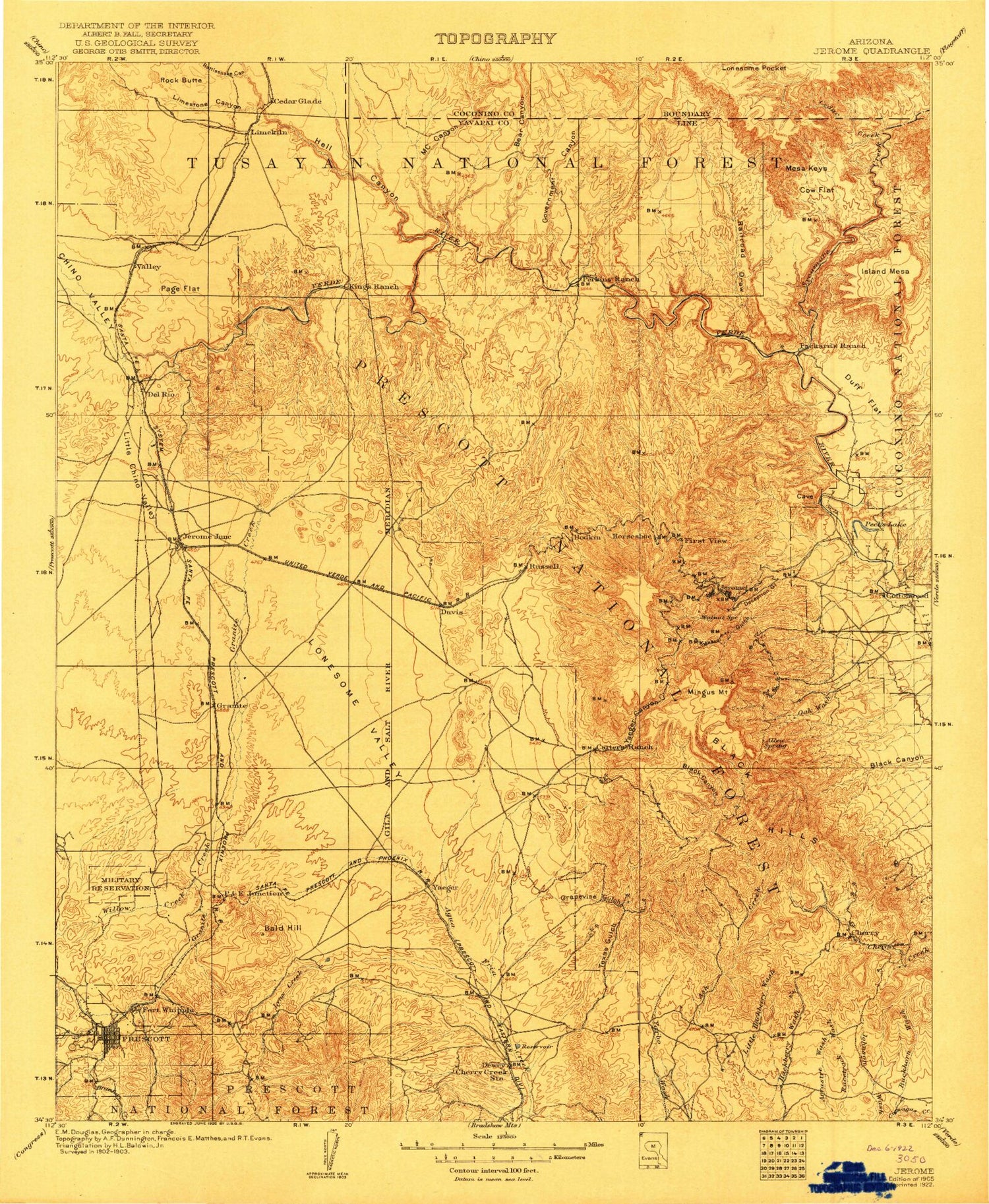
Historic 1905 Jerome Arizona 30'x30' Topo Map
Couldn't load pickup availability
Historical USGS topographic map of Jerome in the state of Arizona. Scale: 1:125000. Print size: 17" x 24"
This map was published in 1905 and is in the following counties: Coconino, Yavapai.
The map contains contour lines, roads, rivers, towns, streams, and lakes. Printed on high-quality waterproof paper with UV fade-resistant inks.
Contains the following named places: Sycamore Canyon Wilderness, A and A Shaft, Abra, Aikens Tank, Ambassador Mine, Antelope Hills, Antelope Tank, Archibald Tank, Arrow Tank, Aspen Creek, Badger Mountain, Bakers Pass, Bakers Pass Tank, Bald Hill, Balky Tank, Banning Creek, Bar Heart Ranch, Barney Draw, Bear Canyon, Bear Tank, Benjamin Gulch, Bettys Tank, Big Chino Valley, Big Chino Wash, Bitter Creek, Black Hill, Black Hill Tank, Black Hills, Black Hills Tank, Black Mesa Tank Number One, Black Mesa Tank Number Two, Black Mountain, Black Mountain Tank, Blowout Creek, Bodkin Tank, Boggy Tank, Bottleneck Wash, Bottleneck Wash Dam, Boundary Tank, Brindle Pup Mine, Buck Tank, Buckbed Tank Number One, Buckbed Wash, Bull Basin Canyon, Bull Tank, Bull Tank, Bunker Mine, Burnt Canyon, Burnt Tank, Bushy Tank, Butte Creek, C and J Shaft, C F Canyon, CCC Canyon, CCC Tank, Canyon Tank, Cedar Creek, Cement Tank, Centerville, Charcoal Gulch, Cherry, Cherry King Mine, Chester Tank, Chino Valley, Chino Valley Irrigation Ditch, Christina Draw, Christina Draw Tank, Clarkdale, Cliff Tank, Clipper Wash, Collins Tank, Conger Mine, Contrary Tank, Copper Chief Mine, Cottonwood, Cottonwood Ditch, Cow Flat, Coyote Canyon, Coyote Wash, Crater Mountain, Crater Tank, Cross D Tank, Deadman Tank, Deception Gulch, Deep Hole Tank, Del Monte Gulch, Del Rio Ranch, Dewey, Dogie Tank, Doodlebug Diggings, Drake, Drake Tank, Dripping Spring Tank, Dry Lake Tank, Duck Tank, Duff Flat, Duff Tank, Dundee Shaft, Eds Tank, Entro, Fain Tank, Federal Mine, First View, Forbing Park, Gaddes Canyon, Gadsden Shaft, Gale Tank, Gas Tank, Gates Tank, Glassford Hill, Goat Peak, Goddard Tank Number One, Goddard Tank Number Two, Gold Basin Canyon, Gold Basin Tank, Gold Bullion Mine, Gold Coin Mine, Gold Eagle Mine, Gold Tank, Golden Idol Mine, Government Canyon, Government Canyon, Granite Siding, Granite Creek, Granite Creek Park, Granite Dells, Granite Dells, Grapevine Gulch, Gray Hills Tank, Green Gulch, Green Gulch Tank, Grindstone Tank, Grindstone Wash, Halfway Tank, Halfway Tank, Hanks Tank, Harolds Tank, Hayfield Tank, Haynes Shaft, Haywood Canyon, Hell Canyon, Hell Point, Hell Tank, Henderson Flat, Hickey Mountain, Hickey Tanks, Hieneken Tank, Highway Tank, Hilltop Campground, Honey Bee Tank, Hopewell Tunnel, Horney Tank, Horse Camp Tanks, Horseshoe Canyon, Horseshoe Tank, Howards Tank, Hull Canyon, Humboldt, Indian Hill, Indian Tank, Iron King Mine, Iron King Mine, James Tank, Jerome, Jerome Grande Shaft, Jerome-Del Monte Shaft, Jerry Tank, Jimmy Tank, Joes Tank, Johns Tank, Josephine Tunnel, Juniper Heights, Juniper Mesa Tank, Juniper Tank, Kendall Peak, King Canyon, King Tanks, Kuhne Hill, Lamb Tank, Lang Canyon, Leghorn Mine, Limestone Canyon, Little Black Hill Tank, Little Black Mesa, Little Chino Valley, Little Coyote Canyon, Little Hackberry Wash, Little Page Tank, Little Tank, Little Yaeger Canyon, Logan Mine, Lonesome Pocket Tank, Lonesome Valley, Lower Dam, Lower Limestone Tank, Lower Wildcat Tank, Lucky Tank, Lynx Campground, Lynx Creek, Lynx Lake, M C Canyon, M C Tank, Manzanita Creek, Mark Tank, Martin Canyon, Martin Canyon Tank, McClure Tank, McDaniel Tank, Mescal Gulch, Mescal Tank, Mexican Tank, Mexican Tank, Middle Trail Tank, Midway Tank, Midway Tank, Miller Creek, Miller Valley, Mingus Lake, Mingus Mountain, Mingus Springs Ranch, Monarch Mine, Montezuma Tank, Mormon Pocket, Mormon Pocket Tank, Mulberry Tank, Muldoon Canyon, Muldoon Tank, Munds Draw, Munds Tank Number One, Munds Tank Number Two, Narrow Gauge Tank, Nelson Tank, Nunn Tank, Oak Knoll Village, Oak Wash, Ocotillo Tank


