MyTopo
Historic 1932 Kirtland New Mexico 30'x30' Topo Map
Couldn't load pickup availability
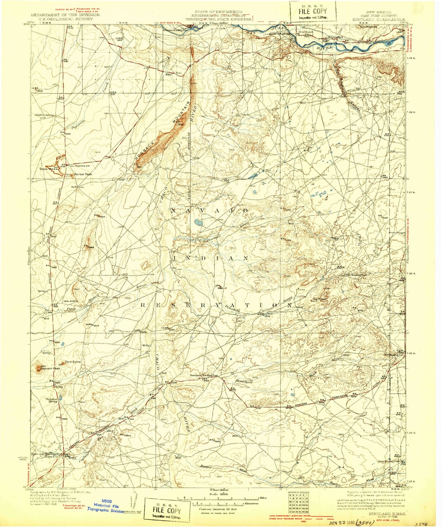
Historical USGS topographic map of Kirtlandin the states of New Mexico, Arizona, Colorado. Scale: 1:125000. Print size: 17" x 24"
This map was published in 1932 and is in the following counties: San Juan.
The map contains contour lines, roads, rivers, towns, streams, and lakes. Printed on high-quality waterproof paper with UV fade-resistant inks.
Contains the following named places: Sanostee Wash, Dead Mans Wash, Barber Peak, Bisti Trading Post, Brimhall Wash, Burnham Trading Post, Cactus Peak, Cathedral Cliff, Coal Creek, Coolidge Arroyo, Cottonwood Arroyo, Dain Arroyo, Farmers Mutual Ditch, Locke Arroyo, Morgan Lake, Navajo Mine, Ojo Amarillo Canyon, Pinabete Arroyo, Sheep Springs Wash, Ship Rock Campground, Sulphur Spring Campground, Teec-ni-di-tso Wash, To-dil-hil Wash, Tocito Lake, Tocito Wash, Tse-nas-chii Wash, Tse-ni-cha, Twin Mounds, Captain Tom Wash, Ford Butte, Hunter Wash, La Plata River, Pena Blanca Arroyo, Sanostee Wash, Stevens Arroyo, Chaco Plateau, The Pillar, Bennett Peak, Little Water, Table Mesa, Fruitland, Kirtland, Newcomb, To-nil-choni Wash, Tuntsa Wash, Twin Mountain, Sulphur Spring, Richey Pit, San Juan Pit, Lookout Mine, Harper Hill Pit, Borrow Pit, Borrow Pit, Navajo Strip, Wheller Pit, Brewster Dam, Morgan Dam, Captain Tom Dam, Bisti Clinic, Chinde Wash, Fruitland Irrigation Canal, Hogback Canal, Hogback Field, The Hogback, Ash Pond Number Three Dam, Four Corners Powerplant, Table Mesa Oil Field, Fruitland Weather Station, Hogback Historical Marker, CGP-56 Historic Site, San Juan County, Rio Chusca, Tunicha Valley, Arroyo Medio, Upper Fruitland, Ojo Amarillo, Nenahnezad, Nenahnezad-Burnham Division, Fruitland Chapter, Nenahnezad/San Juan Chapter, Newcomb Chapter, Burnham Chapter, Town of Kirtland, Sanostee Wash, Sanostee Wash, La Plata River