MyTopo
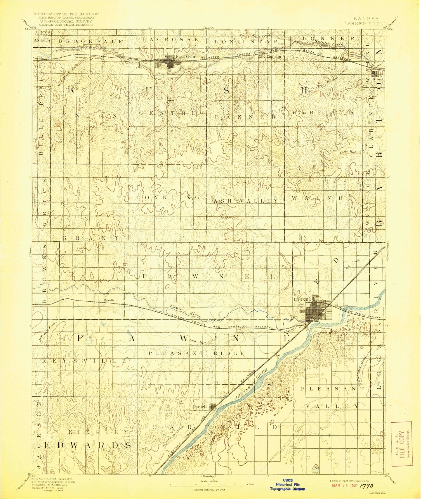
Historic 1891 Lakin Kansas 30'x30' Topo Map
Couldn't load pickup availability
Historical USGS topographic map of Lakinin the states of Kansas, Colorado. Scale: 1:125000. Print size: 17" x 24"
This map was published in 1891 and is in the following counties: Finney, Grant, Haskell, Kearny.
The map contains contour lines, roads, rivers, towns, streams, and lakes. Printed on high-quality waterproof paper with UV fade-resistant inks.
Contains the following named places: Bear Creek, Township of Lincoln, Township of Dudley, Township of Kendall, Sand Creek, Southside Ditch, Sand Creek, Louck Park, Lakin, Clear Lake, Township of Southside, Martin Ditch, Lake McKinney, Deerfield, Brown Ranch, Township of Sherlock, Wolf Creek, Pleasant Prairie Oil Field, Reeve Ranch, Sullivans Track, Pioneer Co-op Spur, Ulysses, Lakin Draw, Columbian Track, Township of Sherman, Grant County Fairgrounds, Ulysses City Dam, Ulysses City Lake, Sutton, Hartland, Stano, Hickok, Grant County, Township of Hartland, Amazon Ditch, Township of Lakin, Eubank Oil Field, City of Deerfield, City of Lakin, City of Ulysses, Lakin Power Plant, Deerfield Wastewater Plant, Lakin Wastewater Plant, Ulysses Wastewater Treatment Facility, Unruh Trailer Mobile Home Park, Bedrock Mobile Home Park, Hillcrest Trailer Court, Mavarick Trailer Court, S and S Trailer Court, Lakin Country Club, Bentwood Golf Course, Kearny County Fairgrounds, Bear Creek