MyTopo
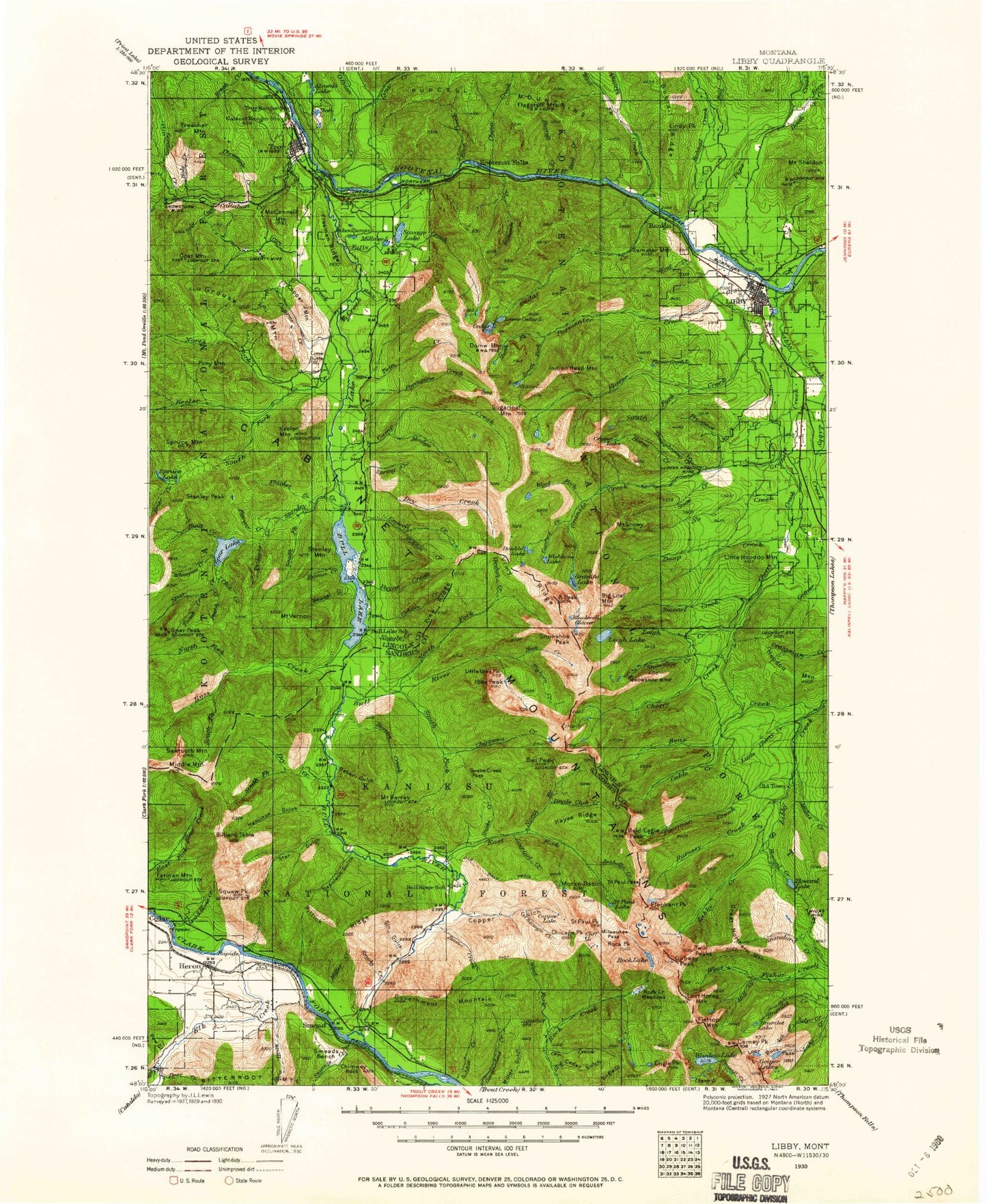
Historic 1930 Libby Montana 30'x30' Topo Map
Couldn't load pickup availability
Historical USGS topographic map of Libby in the state of Montana. Scale: 1:125000. Print size: 18" x 24"
This map was published in 1930 and is in the following counties: Lincoln, Sanders.
The map contains contour lines, roads, rivers, towns, streams, and lakes. Printed on high-quality waterproof paper with UV fade-resistant inks.
Contains the following named places: Cabinet Mountains, West Fork Elk Creek, Martin Lake, Gordon Mountain, A Peak, Alaska Peak, American Kootenai Mine, Baker Gulch, Bald Eagle Peak, Basin Creek, Bear Creek, Beaver Gulch, Berray Creek, Berray Mountain, Berray Mountain Trail, Big Cedar Gulch, Big Cherry Creek, Big Cherry Lake, Big Eddy Creek, Big Eight Mine, Big Hoodoo Mountain, Big Loaf Mountain, Bighorn Creek, Billiard Table, Black Bear Creek, Blacktail Creek, Blackwell Glacier, Bob C Creek, Bobtail Creek, Bobtail Ridge, Bockman Peak, Bramlet Lake, Branagan Mine, Briar Creek, Brown Hill Mine, Buck Lake, Bull Creek, Bull Lake, Bull River, Bull River Campground, Bull River Guard Station, Burrell Creek, Cabinet Gorge Reservoir, Cabinet Mountains Wilderness, Cable Creek, Cable Mountain, Callahan Creek, Callows Island, Camp Creek, Carney Pass, Carney Peak, Carr Draw, Cedar Creek, Chicago Creek, Chicago Peak, Chimney Rock, China Creek, Chippewa Creek, Cliff Lake, Club Creek, Contact Creek, Copper Creek, Copper Gulch, Copper Lake, Copper Mountain, Crater Lake, Crescent Tunnel, Crowell Creek, Crowell Mountain, Cub Creek, Dad Creek, Dad Peak, Dead Horse Creek, Deep Creek, Deer Creek, Devils Club Creek, Doak Creek, Dome Mountain, Doonan Peak, Dorr Skeels Campground, Double Lake, Double Mac Mine, Double N Lake, Drift Creek, Dry Creek, Dry Creek, Duck Lake, East Fork Bull River, East Fork Elk Creek, Elephant Peak, Elk Creek, Ellis Gulch, Emma Gulch, Engle Peak, Engle Peak Trail, Fairway Creek, Falls Creek, Fatman Mountain, Felix Creek, Flagstaff Mountain, Flat Top Mountain, Flavel Ridge, Flower Creek, Flower Lake, Flower Point, Fourth of July Creek, Freeman Ridge, Geiger Lakes, Getner Creek, Giant Sunrise Mine, Gin Gulch, Gloria Mine, Goat Creek, Goat Mountain, Goat Rocks, Golden West Mine, Gordon Creek, Government Mountain, Grambauer Mountain, Granite Creek, Granite Lake, Great Northern Mountain, Grouse Lake, Grouse Mountain, Grouse Mountain Mine, Gus Brink Mountain, Hale Creek, Hamilton Gulch, Hanging Valley, Hayes Ridge, Heidelberg Mine, Hemlock Gulch, Herbert Mine, Heron, Hiatt Creek, Hidden Creek, Horse Creek, Houser Peak, Howard Creek, Howard Lake, Ibex Creek, Ibex Peak, Indian Head, Irish Boy Mine, Iron Creek, Isabella Creek, Isabella Lake, July Creek, Jumbo Mine, Keeler Creek, Keeler Mountain, King Mountain, Klatawa Lake, Kool Creek, Kootenai Falls, Kootenai Falls, Kootenai Mountain, Lake Creek, Lake Creek Trail, Lamoka Creek, Leigh Creek, Leigh Lake, Lentz Peak, Libby, Libby Creek, Libby Lakes, Liberty Mine, Lime Butte, Lindy Peak, Little Cherry Creek, Little Hoodoo Mountain, Little Ibex Peak, Lost Buck Pass, Lost Creek, Lost Girl Creek, Lost Horse Mountain, Lower Cedar Lake, Moose Lake, Lukens Hazel Mine, Lynx Creek, Lynx Creek Flats, Madge Creek, McConnell Mountain, McDonald Mountain, McKay Mountain, Michaels Draw, Midas Creek, Midas Mine, Midas Point, Middle Fork Bull River, Middle Mountain, Mill Creek, Miller Creek, Milnor Lake, Milwaukee Pass, Minor Lake, Montana Morning Mine, Montana Premier Mine, Moran Basin, Mountain View Park, Mud Lake, Napoleon Gulch, No Creek, Noggle Creek, Norman Mountain, North Fork Bull River, North Fork Keeler Creek, North Fork Parmenter Creek, North Fork Ross Creek, Noxon Siding, O'Brien Creek, Ojibway Peak, Old Daly Trail, Orr Creek, Lake Osakis, Ozette Lake, Parmenter Creek, Parmenter Mountain, Payne Creek, Pew Gulch, Pheasant Point, Pilik Ridge, Pine Ridge, Pioneer Junction, Pioneer Park, Pipe Creek, Placer Creek, Pony Mountain, Pooch Creek, Poorman Creek, Poplar Point, Porcupine Creek, Preacher Mountain, Prospect Creek, Prospect Hill, Quartz Creek


