MyTopo
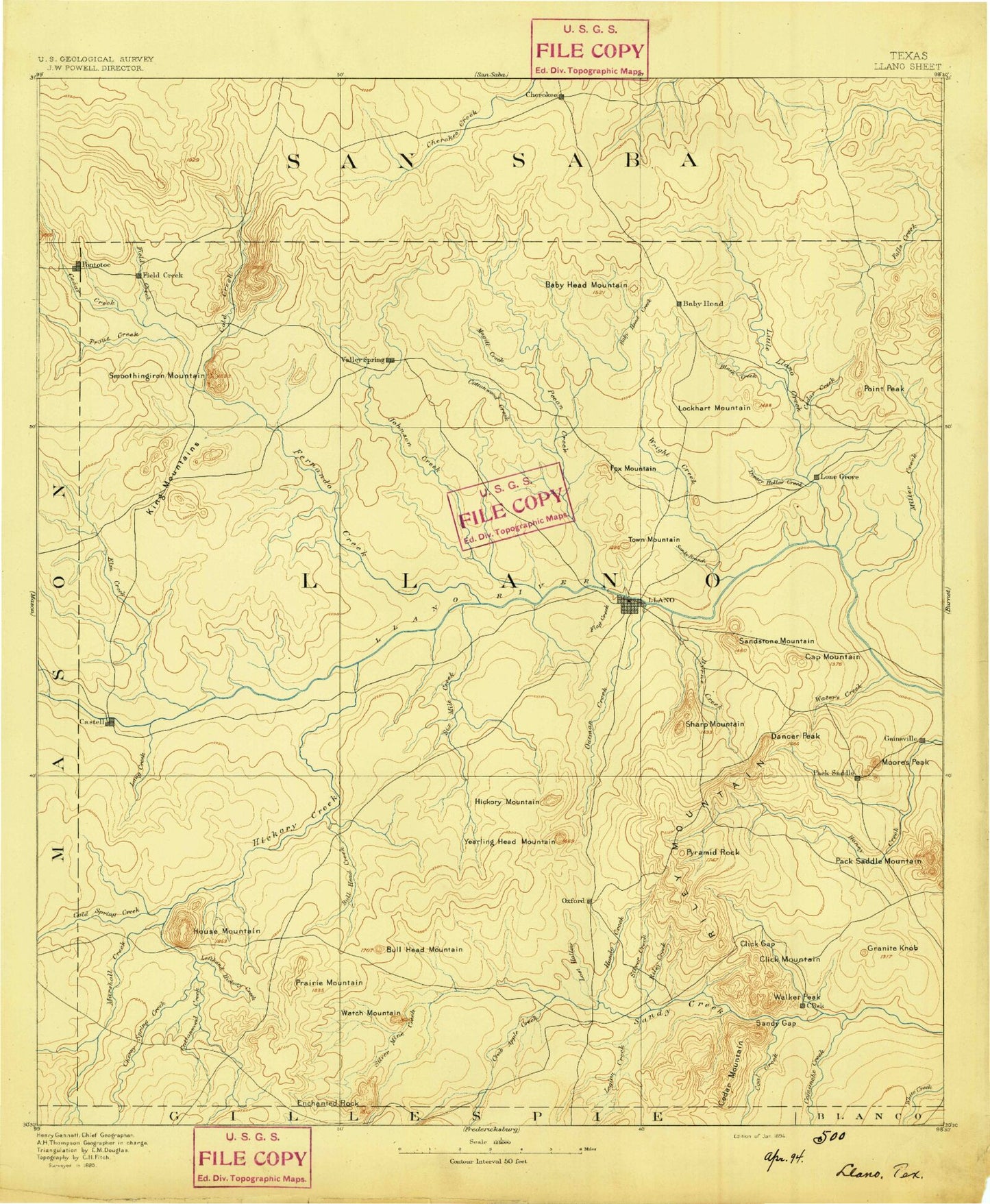
Historic 1894 Llano Texas 30'x30' Topo Map
Couldn't load pickup availability
Historical USGS topographic map of Llano in the state of Texas. Scale: 1:125000. Print size: 17" x 24"
This map was published in 1894 and is in the following counties: Blanco, Llano, Mason, San Saba.
The map contains contour lines, roads, rivers, towns, streams, and lakes. Printed on high-quality waterproof paper with UV fade-resistant inks.
Contains the following named places: Babyhead Creek, Babyhead Mountain, Bachelor Peak, Bailey Branch, Bald Mountain Hollow, Barker Hill, Barnett Branch, Bear Mountain, Bedford Creek, Bennett Creek, Bernst Creek, Big Windmill, Blockhouse Creek, Blount Mountain, Board Branch, Bodie Peak, Bowie Mountain, Briscoe Mountain, Bullhead Creek, Bullhead Mountain, Bunker Hill, Bush Windmill, Buttery Creek, Byrnes Creek, Cap Mountain, Cedar Hollow, Cedar Hollow, Cherokee, Cherry Spring Creek, Click Gap, Coal Creek, Cold Creek, Cold Spring Creek, Comanche Creek, Cottonwood Creek, Cottonwood Creek, Cottonwood Creek, Cottonwood Creek, Coulee Hollow, Cowen Rocks, Crabapple Creek, Crump Creek, Dancer Flats, Dancer Peak, Deep Creek, Deer Mountain, Devils Hollow, Devils Toenail, Duncan Community Center, Dutch Mountain, East Murray Windmill, Elm Creek, Elm Hollow, Enchanted Rock, Field Creek, Flag Creek, Flat Branch, Fool Gap, Fool Mountain, Fowler Ranch, Fox Mountain, Gersdorf Creek, Goldmine Creek, Granite Hills Ranch, Granite Knob, Grape Creek, Graze Mountain, Green Mountain, Harris Branch, Helms Creek, Hickory Bluff, Hickory Creek, Hickory Creek, Hickory Mountain, Hickory Mountain Branch, High Rock, High Windmill, Hobson Mountain, Hog Branch, Hog Mountain, Hondo Creek, Horse Mountain, House Mountain, House Mountain Branch, Hutchinson School, Indian Hills, Javelina Windmill, Jenkins Windmill, Johnson Creek, Johnson Creek, Jones Windmill, Keener Branch, Keyser Creek, Kings Mountain, Left Hand Creek, Legion Creek, Little Llano River, Little Murray Mountain, Little Sandy Creek, Llano, Llano City Lake, Llano City Park, Lockhart Mountain, Lone Mountain, Lone Oak Mountain, Long Bottom Creek, Long Waterhole Branch, Lost Hollow Creek, Lovers Rock, Lucky Mountain, Magill Creek, Magill Mountain, Marchison Creek, Marley Peaks, Marschall Creek, Martin Creek, McBrown Mountain, Mesquite Windmill, Miller Creek, Miller Mountain, Mining House Windmill, Molasses Creek, Moore Peak, Morris Hill, Mud Creek, Mule Mountain Branch, Nine-Bar Ranch, North Fork Cherokee Creek, North Fork San Fernando Creek, North Helms Creek, North Willow Creek, Oatman Creek, Packsaddle Mountain, Panther Creek, Panther Rock, Pecan Creek, Pecan Spring Creek, Phillips Rock, Pluto Mountain, Point Peak, Pontotoc, Pontotoc Creek, Potato Hill, Potter Flats, Prairie Mountain, Prairie Mountain Spring Branch, Pyramid Creek, Pyramid Rock, Quartz Knob, Railbrake Mountain, Red Mountain, Red Mountain Branch, Reed Creek, Rhodes Creek, Riley Creek, Rocky Creek, Rocky Creek, Rough Ridge, Salt Branch, Salt Hollow, San Fernando Creek, Sand Creek, Sand Spring Creek, Sandstone Mountain, Sharp Mountain, Shin Oak Mountain, Silver Creek, Silvermine Creek, Sixmile Creek, Slick Mountain, Smoothingiron Mountain, South Fork San Fernando Creek, South Helms Creek, South Prong Cottonwood Creek, South Willow Creek, Spring Branch, Taylor Ranch, Town Peak, Turkeyroost Mountain, Vasterling Creek, Walker Peak, Walnut Spring Creek, Watch Mountain, Waters Creek, Watson Mountain, Weide Creek, Wilberns Glen, Willow Branch, Willow Creek, Wolf Creek, Wolf Hollow, Wolf Mountain, Woodward Branch, Wright Knobs, Wrights Creek, Yearling Head Mountain, Kemp Creek, Baumann Branch, Cedar Mountain, Lang Creek, Owen Creek, Riley Mountains, Rough Mountain, Straight Fork, Meusebach Ridge, Castell, Click, Field Creek, Gainesville, Lone Grove, Oxford, Prairie Mountain, Scotts Crossing, Stolz, Valley Spring, Putman Mountain, Llano County, Ratliff Dam, Ratliff Lake, Llano River Dam, Llano River Lake, Llano Park Dam, Llano Park Lake, Moss Dam 2, Moss Lake 2, Llano North Division, Llano South Division, Indian Stadium, Enchanted Rock State Natural Area, Llano County Courthouse Historic District, Echo Canyon Trail, Summit Trail, City of Llano


