MyTopo
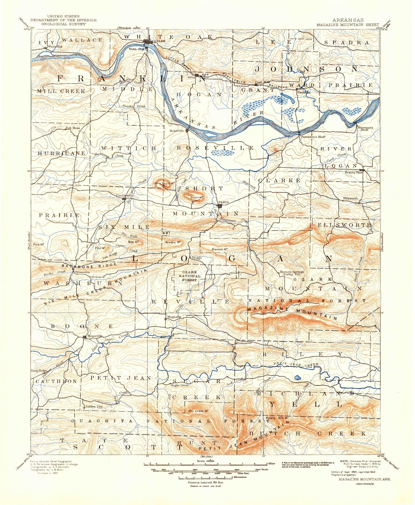
Historic 1890 Magazine Mountain Arkansas 30'x30' Topo Map
Couldn't load pickup availability
Historical USGS topographic map of Magazine Mountain in the state of Arkansas. Scale: 1:125000. Print size: 18" x 24"
This map was published in 1890 and is in the following counties: Franklin, Johnson, Logan, Scott, Yell.
The map contains contour lines, roads, rivers, towns, streams, and lakes. Printed on high-quality waterproof paper with UV fade-resistant inks.
Contains the following named places: Alix, Altus, Booneville Creek, Cecil, Cecil Gas Field, Cedar Creek, Center Point, Coal Creek, Denning, Fox Valley, Goose Camp, Guthrie Island, Hartman, Hays Chapel, Hicks Creek, Hogskin Creek, Little Creek, Little Sixmile Creek, Lowes Creek, McLean Bottom Cutoff, Mikes Creek, Moores Creek, Moores Island, North Cecil Gas Field, Perry Creek, Pine Hollow, Pine Ridge, Pond Creek, Pony Creek, Prairie Creek, Rattlesnake Creek, Rocky Creek, Sacred Heart, Skaggs Island, Slough Creek, Smith Creek, West Creek, Ferguson Valley, Chismville, Greenwood, Hinkle, Hoyt, Poping, Roseville, Shady Grove, Sulphur Springs, Booneville Mountain, Branch, Metcalf Hill, Mill Creek Mountain, Montana, New Spadra, Pilot Mountain, Pine Mountain, Ratcliff, South Ozark, Webb City, Booneville, Buzzard Bluff, Whiteoak Valley, Alix Gas Field, Altus Gas Field, Aux Arc Park, Citadel Bluff Park, Eastside Park, Meg, Ozark Gas Field, Reed Mountain Park, West City Park, White Oak Park, Scranton Gas Field, Paris Gas Field, Prairie View Gas Field, Chismville Extension Gas Field, Williams Lake, Marcelle Phillips Park, Bearcat Stadium, Booneville Lake, Brownsville, Chismville Gas Field, Fletcher Lake, Racoon Creek, Cauthron, Magazine Gas Field, Turkey Ridge, The Narrows, Revilee, Pleasant Hill, Crocker Creek, Cove Lake Recreation Area, Arkansas Childrens Colony, Jack Creek Recreation Area, Mountain Grove, Logan Eddy, Smiths Branch, Horseshoe Bend, Scott Lake, Beason Cove, Hise Hill Recreation Area, Coal Hill Gas Field, Union City Gas Field, Bald Knob, Knoppers Ford Recreation Area, North Petit Jean Mountain, Township of Alix, Township of Barham, Township of Donald, Township of Grover, Township of Hogan, Township of Hurricane, Township of Middle, Township of Six Mile, Township of Wallace, Township of Wittich, Township of Grant, Township of Lee, Township of Prairie, Township of Ward, Magazine Mountain, Petit Jean Mountain, Township of Blue Mountain, Township of Boone, Township of Cauthron, Township of Clark, Township of Driggs, Township of Ellsworth, Township of Johnson, Township of Logan, Township of Mountain, Township of Petit Jean, Township of Reveilee, Township of River, Township of Roseville, Township of Short Mountain, Township of Six Mile, Township of Sugar Creek, Township of Washburn, Township of Richland, Township of Riley, Township of Waveland, Crow Creek, Right Hand Sugar Creek, Alder Gap, Ashley Creek, Backbone Mountain, Bakers Creek, Barber Creek, Barn Hill, Bear Mountain, Bear Hollow, Bee Mountain, Ben Cove, Big Piney Creek, Blue Mountain, Briar Creek, Brown Springs Recreation Area, Brushy Creek, Brushy Creek, Brushy Mountain, Buck Knob, Buck Knob Creek, Buck Ridge, Calico Creek, Calico Mountain, Cameron Bluff Recreation Area, Cane Creek, Caney Creek, Carbon City, Carolan, Cedar Creek, Cedar Creek, Cedar Creek, Chigger Creek, Clear Creek, Cockrell Creek, Corley, Cotton Town, Cove Creek, Crowell Creek, Donathan Ridge, Driggs, Dry Creek, Dry Creek Mountain, Dry Fork, Earl Prairie, East Bass Creek, East Cedar Creek, East End Recreation Area, East Fork Gar Creek, East Fork Horsehead Creek, East Lacey Creek, East Snake Knob, Flattop Mountain, Fletcher Branch, Fletcher Creek, Flood Mountain, Gack Creek, Garner Creek, Geneva Park, Gin Branch, Gobbel Branch, Golden City, Gray Rock, Greasy Creek, Greasy Valley, Green Bench, Greenfield Recreation Area, Gulf Creek, Gum Creek, Gutter Rock Creek, Havana, Hegwood Creek, Hickory Ridge, Hole in the Ground Mountain, Horseshoe Mountain, House Gap, Huckleberry Creek, Huckleberry Flat, Huckleberry Mountain, Hurricane Creek, Jack Creek, Jack Creek, Grayson, Kalamazoo, Ladds Creek, Lee Creek, Lick Creek, Lick Creek, Lick Creek Recreation Area, Little Piney Creek, Long Branch, Long Hollow, Magazine, Magazine Mountain Lodge, Marvinville, McKinney Creek


