MyTopo
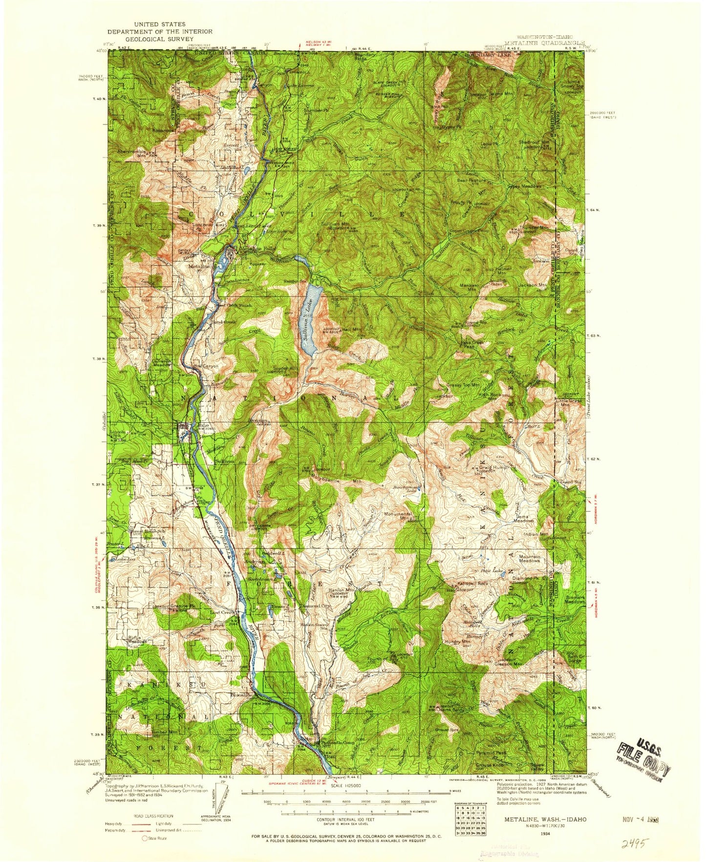
Historic 1934 Metaline Washington 30'x30' Topo Map
Couldn't load pickup availability
Historical USGS topographic map of Metaline in the state of Washington. Scale: 1:125000. Print size: 18" x 24"
This map was published in 1934 and is in the following counties: Bonner, Boundary, Pend Oreille, Stevens.
The map contains contour lines, roads, rivers, towns, streams, and lakes. Printed on high-quality waterproof paper with UV fade-resistant inks.
Contains the following named places: Bad River, Bath Creek, Bench Creek, Ledge Creek, Nuisance Creek, Skip Creek, Jackson Creek, Muskegon Creek, Bunchgrass Lake, Bunchgrass Meadow, Cache Creek, Chute Creek, Colza Creek, Deerhorn Creek, Diamond Creek, Diamond Fork, Diamond Peak, Fourth of July Peak, Gleason Mountain, Gold Creek, Granite Falls, Granite Pass, Grouse Knob, Helmer Creek, Helmer Mountain, Hemlock Creek, High Rock Creek, High Rock Mountain, Huff Lake, Hungry Creek, Hungry Mountain, Indian Creek, Indian Mountain, Jackson Mountain, Jungle Creek, Kalispell Falls, Kalispell Rock, Klahowya Creek, Last Chance Mine, Lunar Creek, Mankato Mountain, Monumental Mountain, Mountain Meadows, Mush Creek, Muskegon Lake, North Fork Tillicum Creek, Orwig Creek, Orwig Hump, Pable Creek, Packrat Gorge, Paqua Creek, Petit Lake, Playa Lake, Pyramid Pass, Rapids Creek, Roosevelt Grove of Ancient Cedars, Saucon Creek, Second Creek, Sema Creek, Sema Meadows, Sockwa Creek, South Fork Middle Creek, South Fork Mountain, Stagger Inn Campground, Tillicum Creek, Tobasco Creek, Virgin Creek, Wanless Creek, LaSota Falls, Gold and Granite Pass, Indian Mountain Lookout, Orwig Hump Lookout, South Fork Lookout, North Baldy, Tillicum Peak, Onota Creek, Petit Lake Access Recreation Area, Petit Lake Campground, Abercrombie Mountain, Ace Creek, Anderson Lake, Basalt Hill, Bear Pasture, Beaver Creek, Beaver Mountain, Bella May Mine, Big Muddy Creek, Blue Bird Ridge, Blueslide, Boundary Dam, Boundary Lake, Boundary Mountain, Boundary Ridge, Box Canyon, Box Canyon Dam, Browns Lake, Brush Ridge, Caldwell Lake, Cameron Meadow, Cascade Creek, Cato Creek, Cedar Creek, Cement Mountain, Confusion Ridge, Contact Mountain, Conto Gulch, Copper Creek, Coyote Hill, Crater Lake, Crescent Lake, Crescent Lake Campground, Crowell Mountain, Crowell Ridge, Crutch Creek, Deadmans Eddy, Deception Lake, Deemer Creek, Deer Mountain, Diamond City, Diamond Creek, Divide Peak, Dolomite Mountain, Dry Canyon, Dry Canyon Ridge, East Branch Le Clerc Creek, Eldorado Creek, Everett Creek, Exposure Creek, Fence Creek, Fetus Creek, Fireline Creek, Flume Creek, Forest Mountain, Fourth of July Creek, Frater Lake, Frisco Mountain, Gold Hill Mine, Grandview Flats, Grandview Mine, Grandview Point, Granite Meadows, Granite Peak, Grassy Top Mountain, Grease Creek, Green Mountain, Gypo Creek, Gypsy Creek, Gypsy Lakes, Gypsy Meadows, Gypsy Peak, Gypsy Ridge, Hall Creek, Hall Mountain, Hanlon Mountain, Harvey Creek, Henry Brown Meadow, High Noon Mine, Hooknose Lake, Hooknose Mountain, Hooknose Ridge, Horsefly Hill, Ione, Ione Millpond, Jack Creek, Jim Creek, Johns Creek, Jordan Creek, Josephine Mine, Kinyon Creek, Last Chance Cabin, Last Chance Cabin Creek, Le Clerc Creek, Lead Hill, Lead Hill Mine, Lead King Hills, Ledbetter Lake, Lake Leo, Leola Creek, Leola Peak, Lime Creek, Lime Lake, Limestone Hill, Linton Creek, Linton Mountain, Little Anderson Lake, Little Muddy Creek, Little Ruby Creek, Lookout Creek, Lost Creek, Lost Creek, Lost Creek, Lost Lake, Lost Lake Creek, Lost Meadow, Lower Lead King Lake, Lucky Strike Mine, Lunch Creek, Maitlen Creek, Mankato Creek, Metaline, Metaline Falls, Mickey Creek, Middle Branch Le Clerc Creek, Middle Creek, Middle Fork Flume Creek, Middle Fork Harvey Creek, Mill Pond, Mineral Creek, Misery Lake, Molybdenite Mountain, Morning Mine, Nile Lake, Noisy Creek, Noisy Creek Campground, North Fork Harvey Creek, North Fork Ruby Creek, North Fork Sullivan Creek, North Fork Willow Creek, Oriole Mine, Outlet Creek, Pass Creek, Pass Creek Pass, Paupac Creek, Pend Oreille Mine, Pend Oreille Village, Pewee Creek, Pewee Falls, Pocahontas Creek, Prouty Peak, Queen Creek, Rainy Creek, Red Man Creek, Renshaw Creek, Ridge Lake, Riverside Mine, Rocky Fork