MyTopo
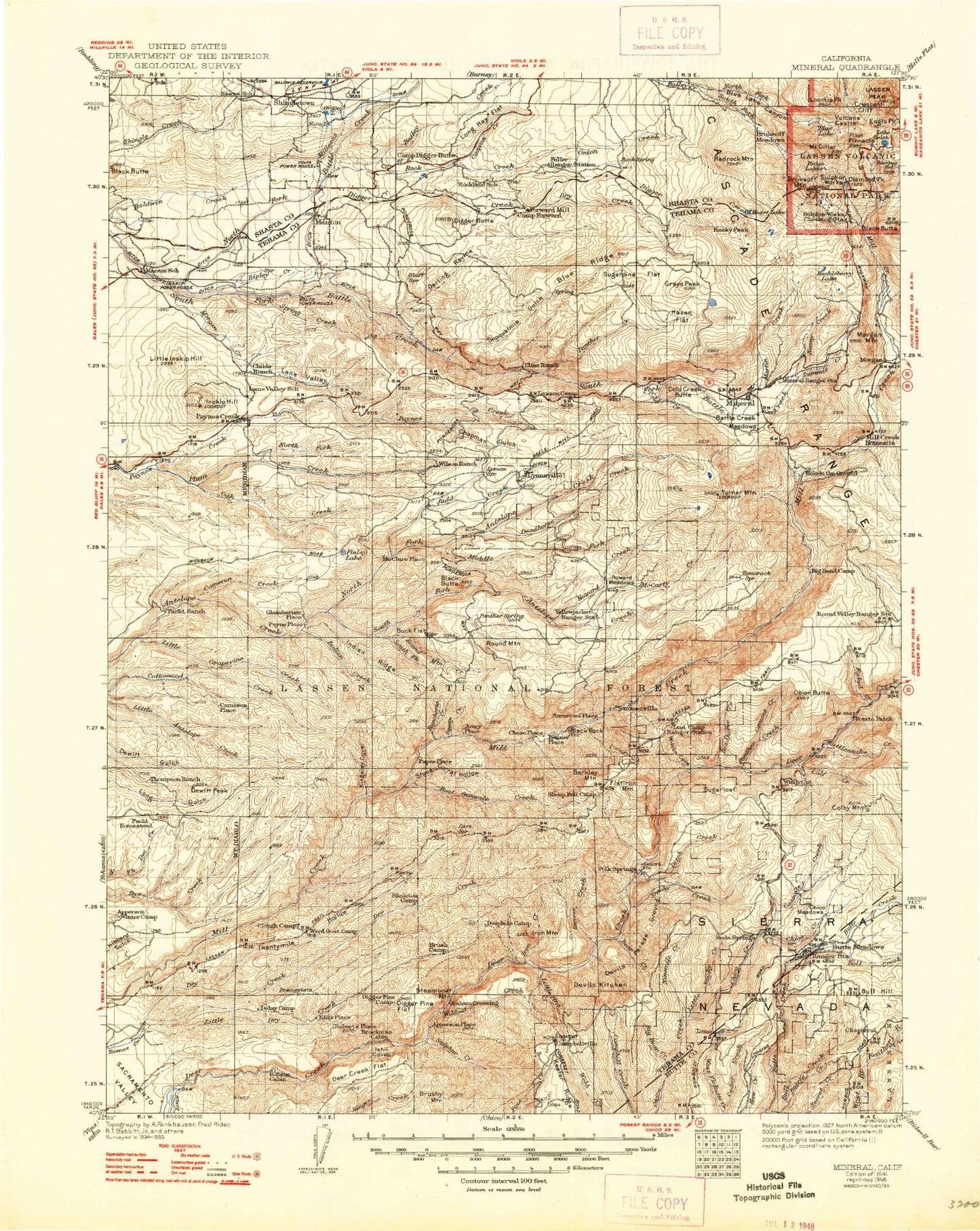
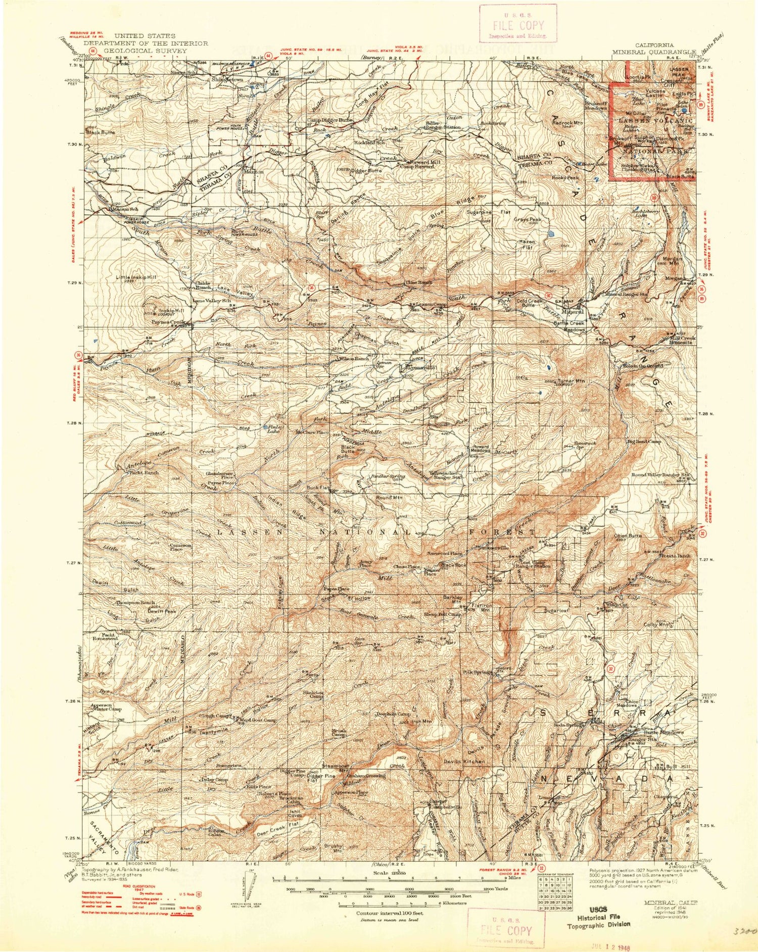
Historic 1941 Mineral California 30'x30' Topo Map
Couldn't load pickup availability
Historical USGS topographic map of Mineral in the state of California. Scale: 1:125000. Print size: 17" x 24"
This map was published in 1941 and is in the following counties: Butte, Shasta, Tehama.
The map contains contour lines, roads, rivers, towns, streams, and lakes. Printed on high-quality waterproof paper with UV fade-resistant inks.
Contains the following named places: Bald Knob, Berry Creek, Brush Creek, Cameron Creek, Carobe Lake, Chicken Hollow, Childs Ranch, Cross Country Ditch, Darrah Springs State Fish Hatchery, Delay Camp, Devils Gulch, Dewitt Peak, Digger Butte, Digger Creek, Durley Flat, Eagle Canyon, Eagle Canyon Ditch, Facht Homestead, Grace Lake, Hobson Camp, Hogs Back, Initial Gulch, Inskip Hill, Jackass Butte, Juniper Gulch, Keswick Ditch, Lee Camp, Little Inskip Hill, Little North Fork North Fork Dye Creek, Little Smoky Creek, Long Hay Flat, Long Ranch, Long Ridge, Manton Fire Control Station, Millseat Creek, Mount Lassen Trout Farm, Ninemile Creek, Nora Lake, North Fork Battle Creek, Paynes Creek, Ripley Creek, Shaw Creek, Shingletown Ridge, Shults Ranch, Black Butte, Campo Seco Ridge, Soap Creek, South Ditch, South Fork Battle Creek, South Fork Calf Creek, Spring Creek, Spring Creek, Spring Gardens, Tenmile Hollow, The Narrows, The Vineyard, Turner Lake, Union Canal, Wildcat Dam, Wildcat Ditch, Willards Camp, North Fork Bailey Creek, Heart Lake, Black Rock Campground, Butte Meadows Campground, Lower Deer Creek Falls, Thatcher Ridge, Onion Summit, Avery Creek, Bailey Creek, Balls Camp, Barkley Mountain, Battle Creek Meadows, Bear Canyon, Bear Creek, Bear Wallow Campground, Beaver Creek, Belfast Meadows, Big Bear Creek, Big Bend, Big Smoky Creek, Black Butte, Black Oak Campground, Black Oak Grove, Black Rock, Blue Lake, Blue Lake Canyon, Bluff Falls, Bluff Falls Campground, Boat Gunwale Creek, Bolt Creek, Boots Bend, Bottle Creek, Bottle Hill, Brazell Meadows, Brokeoff Meadows, Brokeoff Mountain, Bryant Ridge, Buckhorn Gulch, Bucks Flat, Bull Creek, Bull Hill, Bumpass Hell, Butte Meadows, Cabin Spring, Calf Creek, Calf Creek, Camp Five, Camp Forward, Camp Lassen, Camp Tehama, Campbell Ridge, Campbellville, Canyon Creek, Canyon Creek, Carpenter Ridge, Cascade Creek, Cedar Creek, Cement Creek, Chaparral Guard Station, Chapman Gulch, Chico Meadows, Christie Hill, Cohasset Ridge, Colby Mountain, Cold Creek, Cold Creek Meadows, Cold Spring Hill, Conard Meadows, Mount Conard, Coon Creek, Cowslip Campground, Crazy Canyon, Crescent Cliff, Cub Creek, Cuddleback Flat, Dead Horse Creek, Deadhorse Creek, Deadhorse Falls, Deadman Gulch, Deer Creek Falls, Devils Den, Devils Kitchen, Devils Parade Ground, Diamond Lake, Diamond Peak, Mount Diller, Doe Mountain, Dotys Camp, Dry Gulch, Dry Lake Campground, Eagle Peak, East Sulphur Creek, Emerald Lake, Finley Butte, Finley Lake, Flatiron Mountain, Forest Lake, Forked Creek, Forward Mill, Four Lantern Flat, Glassburner Meadows, Glines Ranch, Grapevine Canyon, Grays Peak, Gunbarrel Creek, Hawkins Camp, Hazen Flat, Heart Lake, Heart Lake Twin Meadows Trail, Lake Helen, Hillhouse, Hole in the Ground, Horseback Ridge, Howard Creek, Howard Meadows, Howell Ridge, Huckleberry Lake, Ike Dye Hill, Indian Creek, Indian Ridge, Ink Lake, Iron Creek, Iron Mountain, Jackass Gulch, Jones Valley, Judd Creek, Kingsley Cove, Lane Valley, Lassen Lodge, Lassen Peak, Little Bear Creek, Little Grapevine Creek, Little Hot Springs Valley, Little Pine Creek, Little Round Valley, Lomo, Long Point, Loomis Peak, Lyons Peak, Martin Creek, McCarthy Point, McCarty Creek, McGowan Lake, Middle Fork Antelope Creek, Middle Ridge, Mill Creek Plateau, Mill Creek Rim, Mineral Summit, Monterey Point, Nanny Creek, North Fork Antelope Creek, North Fork Calf Creek, North Fork Plum Creek, Oat Creek, Onion Butte, Onion Creek, Panther Creek, Panther Creek, Panther Spring Guard Station, Payne Spring Cabin, Pear Lake, Peligreen Gulch, Philbrook Creek, Pilot Pinnacle, Plantation Gulch, Plum Creek, Polk Springs, Ponderosa Sky Ranch, Potato Patch Campground, Rancheria Creek, Rattlesnake Creek, Rattlesnake Point, Red Rock Mountain, Ridge Lakes, Rock Creek


