MyTopo
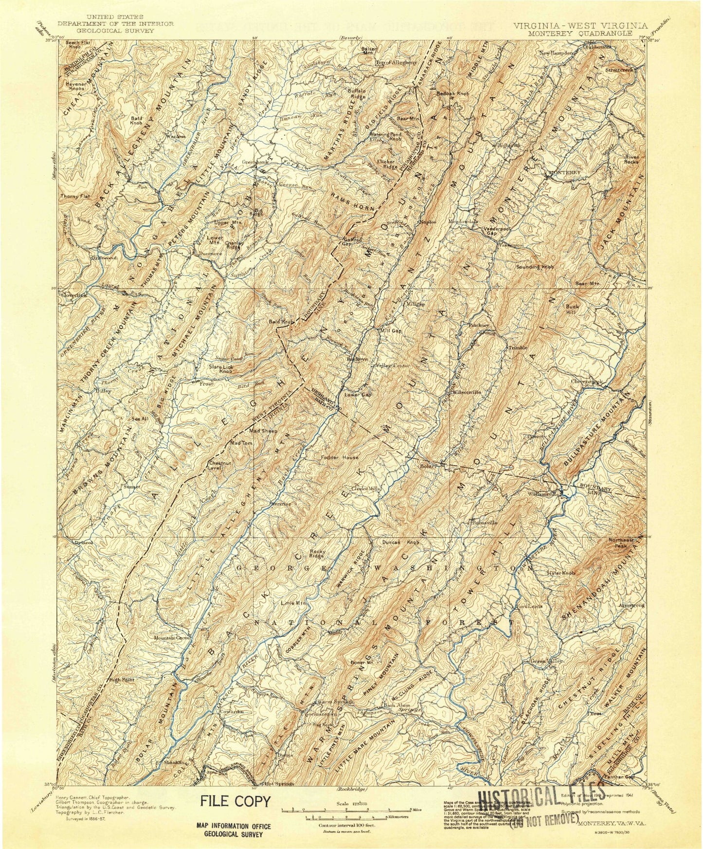
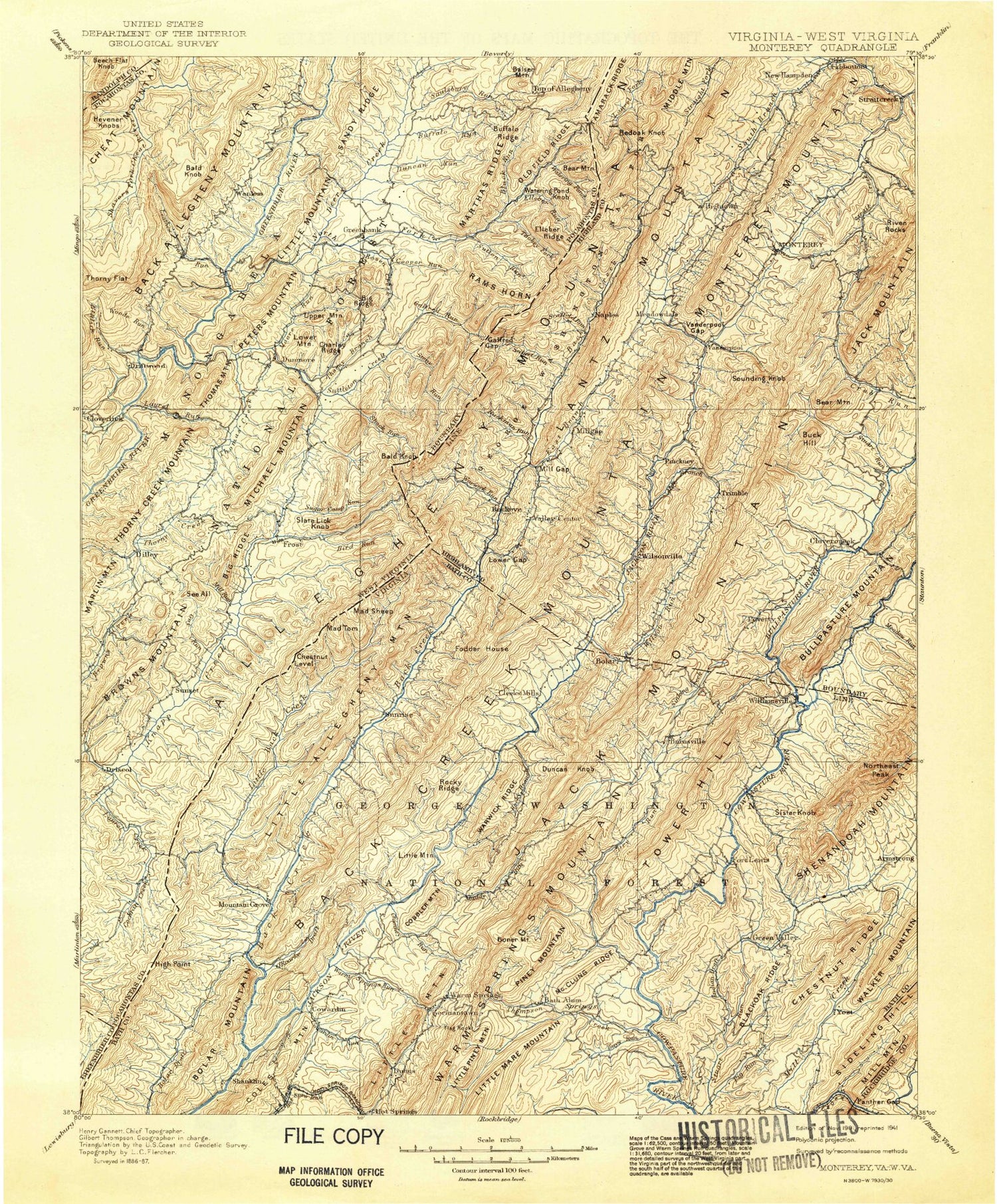
Historic 1901 Monterey Virginia 30'x30' Topo Map
Couldn't load pickup availability
Historical USGS topographic map of Monterey in the state of Virginia. Scale: 1:125000. Print size: 17" x 24"
This map was published in 1901 and is in the following counties: Augusta, Bath, Greenbrier, Highland, Pendleton, Pocahontas, Randolph, Rockbridge.
The map contains contour lines, roads, rivers, towns, streams, and lakes. Printed on high-quality waterproof paper with UV fade-resistant inks.
Contains the following named places: Gathright Wildlife Management Area, Alex Run, Apple Tree Hollow, Armstrong, Ash Cabin Hollow, Ayers Hollow, Back Creek, Back Creek Mountain, Barn Ridge, Barnetts Run, Barney Run, Barracks Draft, Bath Alum, Bear Hole Run, Bear Hollow, Bear Rock Trail, Bear Rocks, Bearcamp Knob, Beaver Run, Big Crooked Ridge, Big End, Big Lick Run, Big Piney Hollow, Big Piney Mountain, Big Pond, Big Ridge, Big Ridge, Big Run, Big Turn Run, Big Valley, Birch Run, Black Oak Ridge, Blackies Hollow, Blights Run, Blowing Springs Campground, Bluegrass Hollow, Board Hollow, Bogan Run, Bolar Gap, Bolar Mountain, Bolar Run, Bolshers Run, Bonner Mountain, Bridge Hollow, Broad Run, Browns Pond, Brushy Fork, Brushy Ridge, Brushy Ridge, Buck Hill, Buck Lick Hollow, Buck Lick Hollow, Buck Lick Hollow, Buck Lick Run, Buckeye Hollow, Buckhorn Draft, Buckhorn Quarters, Bullpasture Gorge, Bullpasture River, Burners Run, Byrd Point, Camp Kannata, Campbell Run, Campbell Run, Campground Hollow, Mount Carlyle, Castle Run, Cave Run, Chestnut Levels, Chestnut Ridge, Chestnut Ridge, Chimney Rocks, Chimney Run, Clark Ridge, Clay Lick Hollow, Claylick Hollow, Cobbler Mountain, Coles Hollow, Collins Run, Combs Trail, Coursey Springs State Fish Hatchery, Cowardin Run, Crab Run, Cub Run, Cummings Run, Daggy Hollow, Dam Hollow, Davis Hollow, Davis Run, Dean Spur, Deep Hollow, Deerlick Trail, Dickenson Ridges, Dixon Hills, Doelick Cove, Donley Hollow, Dry Branch, Dry Run, Dry Run, Dry Run, Duncan Knob, Duncan Ridge, Dunns Gap, East Back Creek, Elk Run, Ellis Trail, Erwin Draft, Flagg Knob, Flood, Ford Run, Forks of Waters, Fort Lewis Trail, Foxtail Hollow, Frank Run, Gabe Hollow Trail, Galford Gap, Gap Run, Gates Hollow, Gibson Hollow, Gill Gum Hollow, Ginseng Mountain, Givens Run, Graveyard Run, Gregory Ridge, Gulf Mountain, Gulley Run, Gum Tree Mountain, Guys Run, Hacken Run, Hevener Run, Hickman Draft, Hickory Hollow, Hidden Valley, Highland Wildlife Management Area, Homestead Trail, Hoover Run, House Hole, House Rock, Hupman Valley, Indian Draft, Indian Fort Trail, Jack Mountain, Jerkemtight Trail, Jerry Run, Jewel Hole, Jim Dave Run, Joe Hollow, John Bolar Draft, John Landes Hollow, Johnson Hollow, Jones Run, Jordan Hollow, Jordan Run, Katydid Trail, Kellison Hollow, Kellison Ridge, Kelly Run, Kent Simmons Hollow, Kettle Hollow, Key Run, Knox Lick Draft, Landes Hollow, Lantz Mountain, Laurel Branch, Laurel Run, Laurel Run, Lick Draft, Lick Draft, Lick Points, Lick Ridge, Lightner Run, Limekiln Run, Little Back Creek, Little Doe Hill, Little Mill Creek, Little Piney Hollow, Little Piney Mountain, Little Ridge, Little Valley, Little Valley Run, Long Run, Long Spring Run, Lower Gap, Lucy Cabin Hollow, Lynn Stand Hollow, Mad Sheep, Mare Run, Mare Run Trail, Marshall Draft, Marshall Draft Trail, McClung, McClung Ridge, McCowan Spring, McCrays Draft, McDonald Trail, McGuffin Trail, Meadow Draft, Meadow Knob, Meadow Lick Hollow, Meva Cove, Middle Knob, Middle Mountain, Mikes Ridge, Mill Gap, Mill Run, Mill Run, Mine Hollow, Miracle Ridge, Monterey Mountain, Morris Run, Mountain Path, Mud Lick Run, Muddy Run, Neal Run, Ned Hollow, Nelson Draft, North Sister Knob, Northeast Peak, O'Farrell Hollow, O'Roarke Draft, Old Hump Ridge, Orchard Hollow, Paddy Bee Tree Run, Paddy Knob, Paddy Lick, Page Run, Panther Gap, Panther Gap Draft, Panther Run, Peak Run, Peck Run, Pheasanty Run, Pig Run, Pine Hollow, Pine Ridge, Piney Ridge


