MyTopo
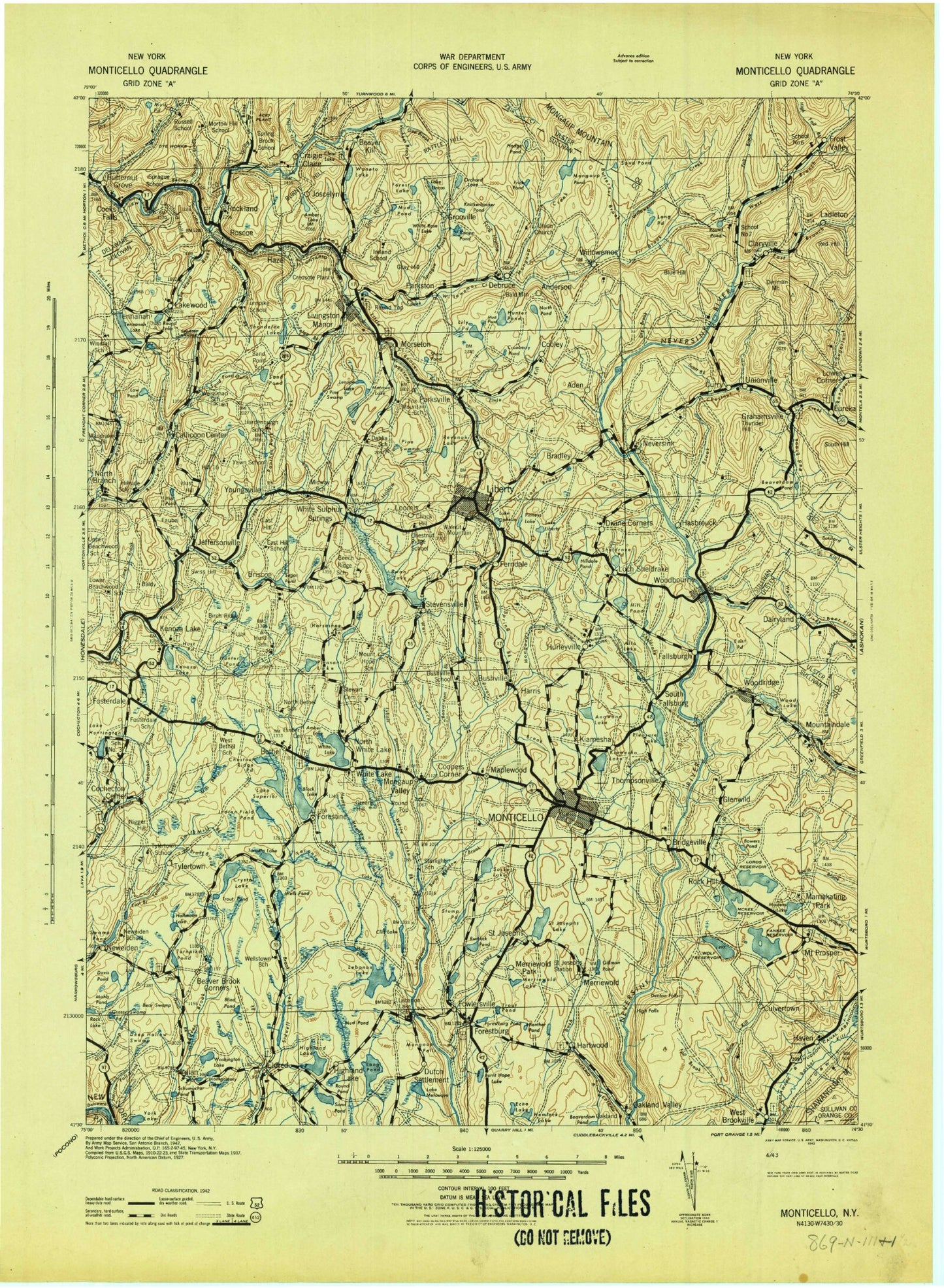
Historic 1943 Monticello New York 30'x30' Topo Map
Couldn't load pickup availability
Historical USGS topographic map of Monticello in the state of New York. Scale: 1:125000. Print size: 17" x 24"
This map was published in 1943 and is in the following counties: Delaware, Orange, Pike, Sullivan, Ulster.
The map contains contour lines, roads, rivers, towns, streams, and lakes. Printed on high-quality waterproof paper with UV fade-resistant inks.
Contains the following named places: Abe Wood Brook, Acadia Camp, Aden Brook, Alta Lake, Amber Lake, Amber Lake, Anawana Lake, Anawanda Lake, Anderson, Angel Mill Brook, Ash Swamp, Baileys Lake, Bald Mountain, Baldy, Balsam Brook, Balsam Pond, Lake Barnabee, Barnhardt Pond, Bascom Brook, Bear Swamp, Beaver Brook Corners, Beaver Lake, Beaver Pond, Beaverdam Brook, Beaverdam Pond, Beaverkill, Beaverkill Campground, Benton Hollow, Berry Brook, Bethel, Big Brady Swamp, Birch Ridge, Birch Ridge Brook, Birch Ridge Pond, Birchwood Pond, Biscuit Brook, Bishops Pond, Black Ash Swamp, Black Brook, Black Joe Brook, Black Lake, Black Lake, Blind Pond, Blue Hill, Blueberry Hill Camp, Bodine Lake, Bowers Pond, Boyds Pond, Braden Brook, Bradley, Bridgeville, Briscoe, Briscoe Lake, Buck Brook, Burnt Hope Lake, Burnt Meadow Brook, Bush Kill, Bushville, Butternut Brook, Butternut Grove, Callicoon Center, Camp Forestburg, Camp Highmount, Camp Olympus, Camp Pine, Camp Raleigh, Camp Wawayanda, Carlson Pond, Cattail Brook, Lake Champion, Chapin Hill, Chestnut Creek, Chestnut Ridge, Chestnut Ridge Pond, Chuck Hill, Claryville, Clear Lake, Cliff Lake, Cochecton Center, Conklin Brook, Cook Brook, Cooks Falls, Cooks Hollow, Cooley, Coopers Corners, Covered Bridge Campsite, Cow Swale Brook, Cow Swale Swamp, Craigie Clair, Cranberry Pond, Crane Pond, Creamery Brook, Crescent Lake, Curry, Dairyland, Davis Lake, Davis Pond, Lake DeVenoge, Debruce, Decker Swamp, Deckertown, Deep Hollow Brook, Deep Hollow Swamp, Delfongos Pond, Denman Lake, Denman Mountain, Denton Falls, Divine Corners, Dixie Lake, Dodge Pond, Dry Brook, Dunn Brook, de Hoyos Memorial Park, East Branch Neversink River, East Delaware Aqueduct, East Hill, East Mongaup River, East Pond, Echo Lake, Eden Brook, Edgewood Lakes, Eldred, Elm Hollow, Evens Lake, Fall Brook, Fall Brook, Fall Brook, Fallsburg, Ferndale, Fieldston Lake, Filippini Pond, Fir Brook, Flat Brook, Lake Florence, Forest Glen Lake, Forest Lake, Forestburg, Forestburg Pond, Fosterdale, Fowlwood Brook, Fox Lake, Frasers Brook, Freys Pond, Frick Pond, Frog Hollow, Froschs Swamp, Frost Valley, Fulton Hill, Gabriel Lake, Gee Brook, Gillman Pond, Gimlet Hole, Glen Wild, Gold Point, Gossweyler Pond, Grahamsville, Grants Hill, Grassy Swamp, Grassy Swamp Pond, Gray Hill, Greens Hill, Grooville, Grossingers Lake, Halfmoon Lake, Hankins Pond, Hardin Brook, Harris, Hartwood Club, Hasbrouck, Haven, Hazel, Hemlock Lake, Hi-Li International Boys Camp, High Falls, High Falls Brook, Highland Lake, Highland Lake, Hill 16, Hilldale Pond, Hodge Pond, Hollow Brook, Holp Pond, Horse Brook, Horseshoe Brook, Horseshoe Lake, Huggins Hollow, Hull Pond, Hunter Brook, Hunter Lake, Hunter Pond, Lake Huntington, Hurd Brook, Hurleyville, Hust Hill, Hust Pond, Hust Pond, Indian Field Pond, Jaketown Creek, Lake Jefferson, Jeffersonville, Jersey Brook, Jones Brook, Judson Brook, Lake Kabau, Katrina Falls, Katz Pond, Kauneonga Lake, Kazens Pond, Kees Lake, Kenoza Lake, Kenoza Lake, Kiamesha Creek, Kiamesha Lake, Kiamesha Lake, Kilcoin Pond, Kinne Brook, Knickerbocker Pond, Kohlertown, Krom Hollow, Lake La Barr, Lake Huntington, Lanfield Hollow, Laundry Brook, Lebanon Lake, Lebanon Lake Brook, Lees Pond, Lemons Brook, Lenape Lake, Liberty, Liberty Municipal Park, Lily Brook, Lily Pond, Little Beaver Kill, Little Black Lake, Little Eden Brook, Livingston Manor


