MyTopo
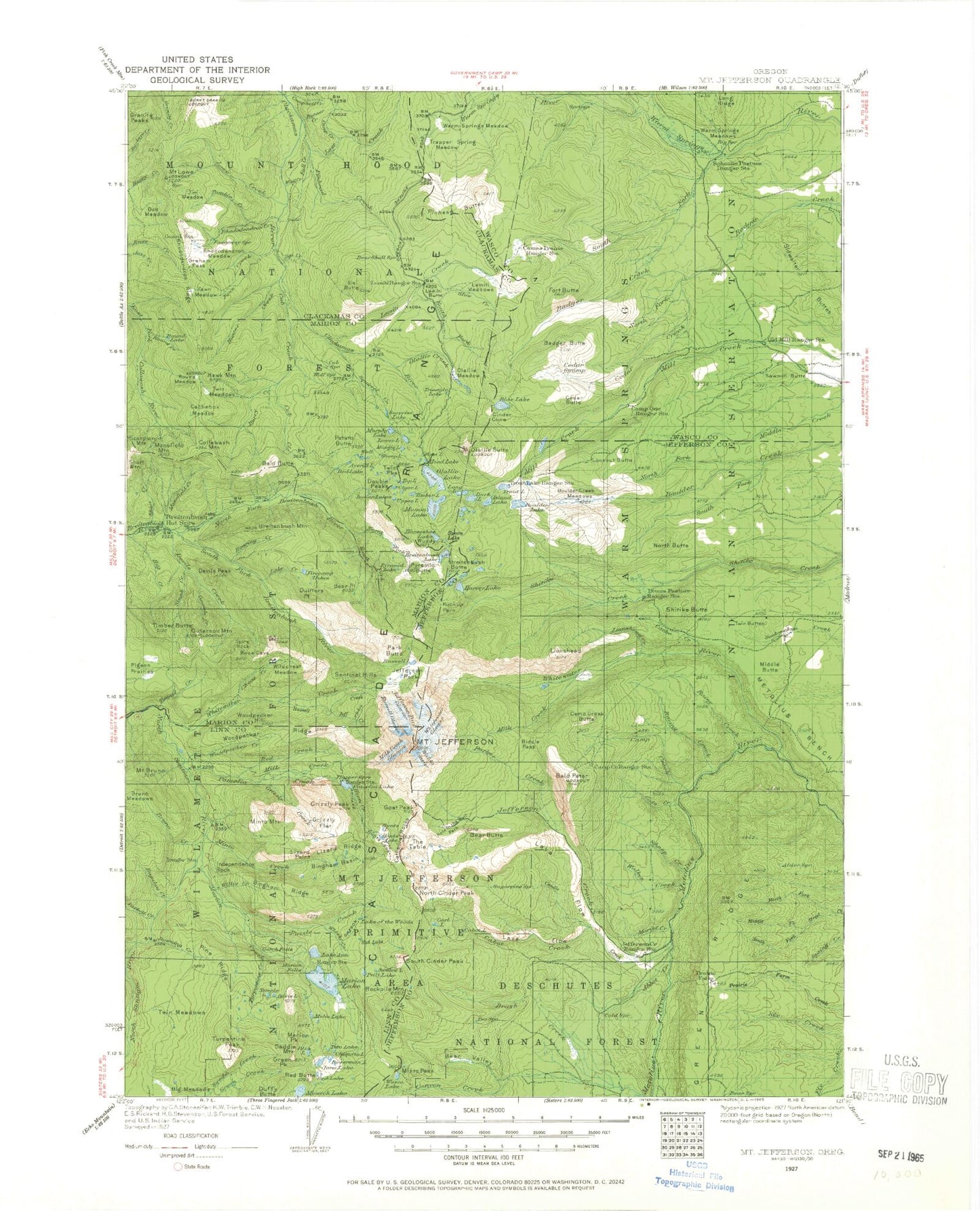
Historic 1927 Mount Jefferson Oregon 30'x30' Topo Map
Couldn't load pickup availability
Historical USGS topographic map of Mount Jefferson in the state of Oregon. Scale: 1:125000. Print size: 18" x 24"
This map was published in 1927 and is in the following counties: Clackamas, Jefferson, Linn, Marion, Wasco.
The map contains contour lines, roads, rivers, towns, streams, and lakes. Printed on high-quality waterproof paper with UV fade-resistant inks.
Contains the following named places: Marion Forks Forest Service Station, Marion Forks Recreation Site, Bear Valley Lake, Minto Lake, Camp Creek Reservoir, Breiten Guard Station, Averill Lake, Badger Butte, Big Meadows, Blue Lake, Boulder Creek Meadows, Boulder Lake, Mount Bruno, Camp One Trail, Cedar Butte, Cedar Meadow, Cheat Creek, Cleo Lake, Crag Creek, Davis Lake, Downing Creek, Fay Lake, Fir Lake, Gooch Falls, Green Creek, Green Peak, Green Peak Lake, Grenet Lake, Horn Creek, Independence Rock, Little Pigeon Prairie, Lula Lake, Marion Falls, Marion Forks, Maude Lake, Meadow Creek, Mill Creek Lateral, Minto Mountain, Monty Lake, Mowich Lake, Nan Creek, Nan-Scott Lake, North Butte, North Fork Boulder Creek, Old Mill Camp, Outerson Mountain, Pigeon Prairie, Pika Lake, Pine Ridge, Pine Ridge Lake, Pinet Lake, Presley Lake, Pyramid Butte, Riverside Recreation Site, Saddle Mountain, Sawmill Butte, Schoolie Pasture, South Fork Boulder Creek, Spire Rock, Swallow Lake, Temple Lake, Triangulation Peak, Trout Lake, Tunnel Creek, Turpentine Creek, Turpentine Lake, Turpentine Peak, Turpentine Peak Trail, Twin Meadows, Upper Lake, Widgeon Lake, Wild Cheat Meadow, Willis Creek, Woodpecker Creek, Woodpecker Ridge, O A Lake, Francis Lake, Marion Flats, Cinder Cone, Lookout Butte, Sidwalter Buttes, Timber Butte, Woodpecker Hill, Abbot Butte, Abbot Creek, Alder Spring Creek, Alder Spring Lookout, Alice Lake, Lake Alice, Lake Ann, Babe Lake, Bachelor Mountain Trail, Bald Butte, Bald Peter, Bays Lake, Bear Butte, Bear Lake, Bear Point, Bear Valley, Bear Valley Creek, Berry Creek, Biddle Pass, Bingham Basin, Bingham Lake, Bingham Ridge, Bingham Ridge Trail, Blue Lake, Blue Lake Camas Prairie Trail, Blue Lake Trail, Bob Meadow, Bonner Creek, Boundary Trail, Bowerman Lake, Breitenbush Recreation Site, Breitenbush Hot Springs, Breitenbush Lake, Breitenbush Mountain, Brook Lake, Bruno Creek, Bruno Meadows, Brush Creek, Brush Creek Trail, Bugaboo Creek, Bump Creek, Bump Lake, Bunchgrass Creek, Burnt Granite, Bypass Trail, Cabot Creek, Cabot Lake, Cabot Lake Trail, Cache Creek, Cachebox Creek, Camas Prairie, Camas Prairie Trail, Camp Creek, Camp Creek, Camp Creek, Camp Creek Butte, Camp Marion, Campbell Butte, Candle Creek, Candle Creek Recreation Site, Canyon Creek, Canyon Creek Recreation Site, Carl Lake, Cascade Creek, Castle Rock, Cathedral Rocks, Catlin Lake, Cedar Creek, Chiquito Lake, Cigar Lake, Claggett Lake, Cleator Bend Recreation Site, Code Creek, Collawash Mountain, Cornpatch Meadow, Coyote Lake, Crown Lake, Cub Creek, Cub Creek Trail, Dark Lake, Davey Lake, Devils Creek, Devils Peak, Devils Peak Trail, Double Peaks, Double Peaks Lake, Dyke Creek, East Fork Way, Eds Meadow, Eight Lakes Basin, Eight Lakes Creek, Eloise Lake, Fall Creek, Fawn Creek, Fawn Meadow, Finley Lake, Firecamp Lakes, First Lake, Fish Lake, Fish Lake Trail, Flapper Springs Guard Station, Fork Lake, Forked Butte, Fort Butte, Gibson Lake, Gifford Lakes, Goat Peak, Graham Pass, Granite Peaks, Green Ridge, Grizzly Creek, Grizzly Flat, Grizzly Peak, Gyp Creek, Gyp Point, Hanks Lake, Harvey Lake, Hawk Mountain, Lake Hazel, Head Lake, Lake Hilda, Hill Creek, Hole-in-the-Wall Park, Horse Pasture Creek, Horseshoe Lake, Hunter Camp Way, Hunter Creek, Hunter Creek Trail, Hunts Cove, Hunts Creek, Hunts Lake, Indian Lakes, Island Lake, Jack Creek, Janus Butte Trail, Jeff Creek, Jefferson Creek, Jefferson Creek Trail, Jefferson Lake, Jefferson Lake Trail, Jefferson Park Glacier, Jefferson Park Trail, Mount Jefferson, Jenny Lake, Jim Meadow, Jorn Lake, Jude Lake, Junction Lake, Kansas Creek, Kuckup Park, Lake Creek, Last Creek, Lemiti Butte


