MyTopo
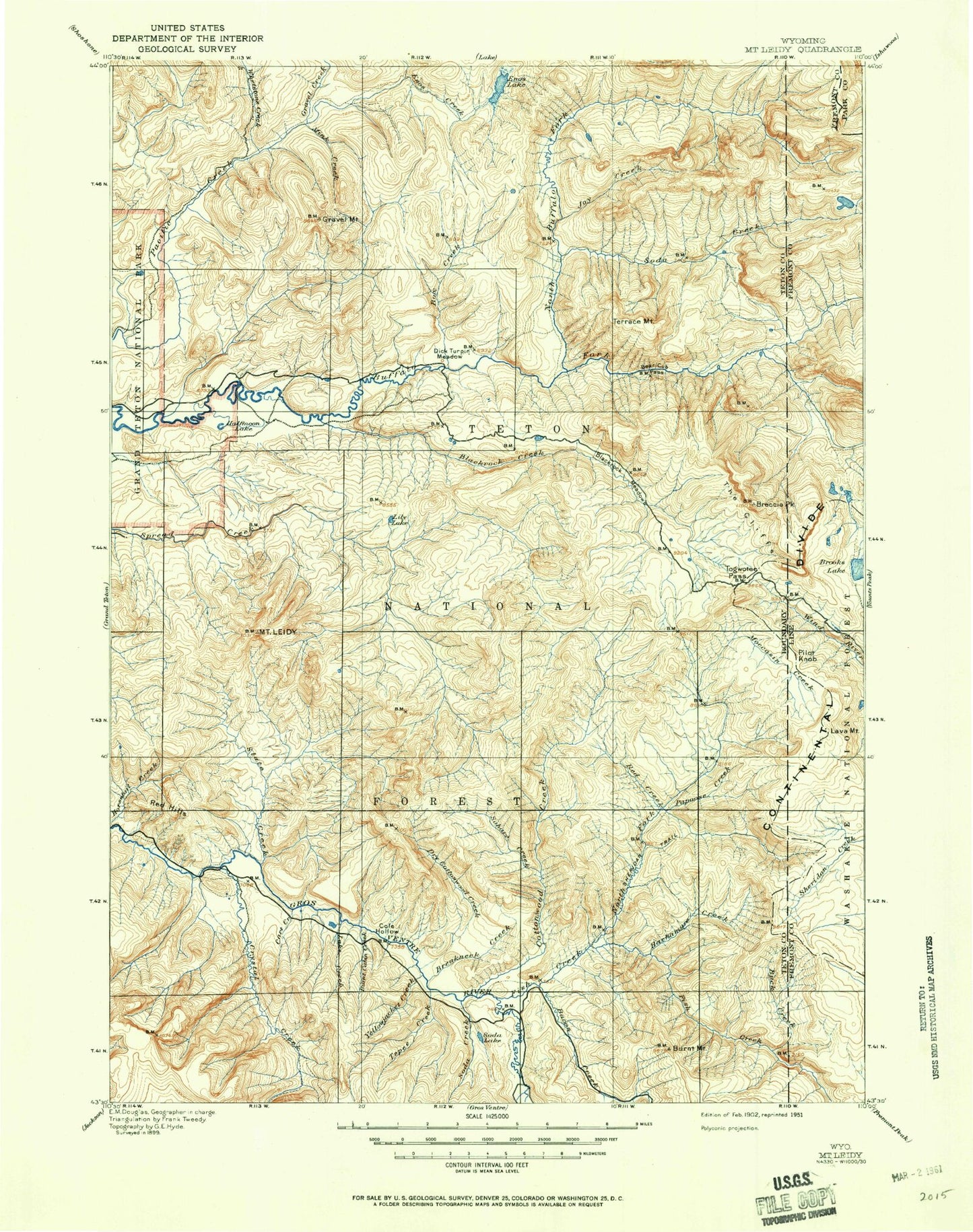
Historic 1902 Mount Leidy Wyoming 30'x30' Topo Map
Couldn't load pickup availability
Historical USGS topographic map of Mount Leidy in the state of Wyoming. Scale: 1:125000. Print size: 17" x 24"
This map was published in 1902 and is in the following counties: Fremont, Park, Teton.
The map contains contour lines, roads, rivers, towns, streams, and lakes. Printed on high-quality waterproof paper with UV fade-resistant inks.
Contains the following named places: Alkali Gulch, Bar B Creek, Buffalo Valley Ranch, Bull Creek Patrol Cabin, Burnt Mountain, Coal Mine Draw, Crater Lake, Davis Hill, Deer Creek, Deer Creek Lookout, Devils Dip Creek, Dog Creek, Elk Ranch Reservoir, Eynon Draw, Fish Creek, Halfmoon Lake, Harness Gulch, Heart Six Ranch, Lava Creek Campground, North Fork Falls, Nowlin Meadow, Poison Creek, Pond Creek, Rat Creek, Smokehouse Mountain, Three Rivers Ranch, Trail Creek, Uhl Draw, Uhl Hill, Upper Nowlin Meadow, Water Gulch, Wolf Gulch, Teton National Forest, Saint John Overlook, Alkali Creek, Angle Mountain, Aspen Creek, Atlantic Pacific Creek Trail, Bacon Creek, Baldy Mountain, Bang Creek, Barbers Point, Bear Cub Pass, Bear Cub Pass, Bear Paw Fork, Beauty Park, Beauty Park Creek, Bell Creek, Blackrock Creek, Blackrock Meadows, Blackrock Ranger Station, Bonneville Creek, Box Creek, Breakneck Creek, Breccia Cliffs, Breccia Peak, Bridge Creek, Brooks Lake, Brooks Lake Creek, Brooks Lake Lodge, Buck Creek, Buckskin Point, Buckskin Ridge, Bull Creek, Bull Creek, Burnt Creek, Burnt Fork, Burnt Ridge, Burro Hill, Cabin Creek, Carmichael Fork, Cavy Creek, Clear Creek, Clear Creek Lake, Coal Mine Draw, Cottonwood Creek, County Line Creek, Crows Nest Creek, Crystal Creek, Crystal Creek Campground, Dallas Creek, Dallas Fork, Dallas Lake, Devils Basin Creek, Divide Lake, Dry Cottonwood Creek, Dry Dallas Creek, Dry Gulch, Dry Lake Creek, Dude Creek, East Leidy, East Miner Creek, Elkhorn Creek, Enos Lake, Enos Lake Trail, Falls Creek, First Gulch, Flagstaff Creek, Fourmile Meadow, Fourmile Meadow Picnic Area, Game Warden Creek, Goosewing Creek, Goosewing Guard Station, Gravel Creek, Gray Hills, Green Mountain, Grizzly Creek, Grizzly Lake, Grouse Creek, Grouse Mountain, Gunsight Pass, Hackamore Creek, Hardscrabble Creek, Hatchet Campground, Haystack Fork, Heifer Creek, Hereford Creek, Hidden Basin, Hidden Lake, Holmes Cave Creek, Horsetail Creek, Indian Creek, Jagg Creek, Joy Creek, Joy Peak, Joy Peak Lake, Kettle Creek, Lake Creek, Larkspur Creek, Lava Creek, Lava Creek Trail, Lava Mountain, Lavender Hills, Leidy Creek, Leidy Lake, Mount Leidy, Lightning Creek, Lily Lake, Little Bear Paw Fork, Little Devils Basin Creek, Little Sohare Creek, Lost Creek, Lost Lake, Lower Jade Lake, Maverick Creek, McMichael Draw, Moccasin Basin, Moccasin Creek, Moosehorn Creek, Mountain Creek, Mud Lake, Nation Creek, Negrohead Fork, No Feed Creek, North Buffalo Fork, North Fork Fish Creek, North Fork Meadows, North Fork Spread Creek, Open Fork, Packsaddle Creek, Papoose Creek, Pass Creek, Pelham Lake, Pill Creek, Pilot Knob, Pink Creek, Poison Creek, Purdy Basin, Purdy Creek, Rainbow Lake, Red Creek, Red Hills, Red Hills Campground, Red Rock Ranch, Redmond Creek, Road Camp Draw, Rosies Ridge, Sagebrush Flat, Second Gulch, Sheridan Pass, Shorty Creek, Simpson Peaks, Skull Creek, Skull Creek Meadows, Slate Creek, Soda Creek, Soda Fork, Soda Fork Meadows, Soda Lake, Soda Mountain, Sohare Creek, South Fork Falls, South Fork Fish Creek, South Fork Spread Creek, Split Rock Creek, Spruce Creek, Square Lake, Squaw Basin, Squaw Creek, Starvation Creek, Steep Creek, Stove Creek, Sublette Peak, Tepee Creek, Terrace Meadows, Terrace Mountain, Togwotee Lodge, Togwotee Pass, Toppan Lake, Toppings Lakes, Tracy Lake, Tripod Creek, Tripod Peak, Clear Creek Trail, Turpin Meadow, Turpin Meadow Campground, Turpin Meadow Lodge, Two Echo Park, Two Ocean Mountain, Two Water Creek, Upper Brooks Lakes, Upper Jade Lake, Upper Slide, Upper Slide Lake, Wallace Draw, Washakie Park, West Goosewing Creek, West Miner Creek, Whetstone Creek, Whetstone Creek Trail, Whetstone Mountain, Wilderness Ranch, Wind River Lake, Yellowjacket Creek, Yellowjacket Flat, Angle Lakes


