MyTopo
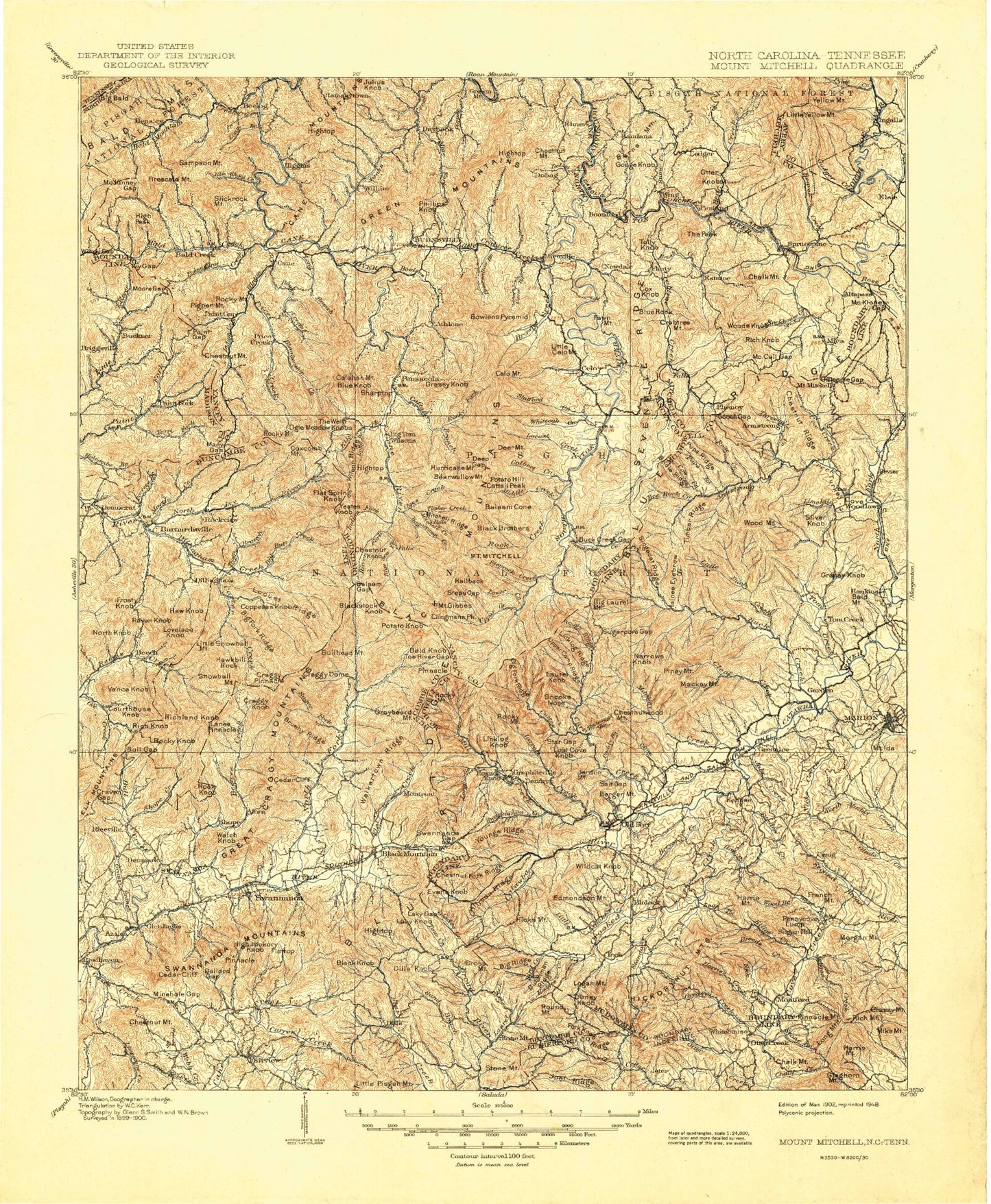
Historic 1902 Mount Mitchell North Carolina 30'x30' Topo Map
Couldn't load pickup availability
Historical USGS topographic map of Mount Mitchell in the state of North Carolina. Scale: 1:125000. Print size: 18" x 24"
This map was published in 1902 and is in the following counties: Avery, Buncombe, Henderson, Madison, McDowell, Mitchell, Rutherford, Unicoi, Yancey.
The map contains contour lines, roads, rivers, towns, streams, and lakes. Printed on high-quality waterproof paper with UV fade-resistant inks.
Contains the following named places: Merril Cove, Asheville Recreation Park, Baldwin Cove, Ballard Creek, Ballard Gap, Beacon Reservoir, Big Flats, Bradley Gap, Bridge Branch, Bright Branch, Buckeye Cove, Camp Blackfoot, Camp Swannanoa, Cedar Cliff, Cedar Mountain Lake, Chalk Creek, Craig Cove, Davidson Cove, Davis Lake, Deer Park Lake, Dicks Mountain, Elliot Creek, Elliot Mountain, Eskridge Cove, Fellowship of Southern Churchmen Camp, Four Brothers Knobs, Grassy Creek Falls, Grassy Knob, Gringer Branch, Harris Creek, Harris Mountain, Haw Branch, Haynes Gap, Jim Branch, Jones Mountain, Kelley Cove, Laurel Branch, LeRoy Lake, Ledbetter Ridge, Lewis Creek, Marks Creek, Merrill Cove, Mike Mountain, Mill Creek, Minehole Gap, Morgan Creek, Nolan Field, Old Boney Creek, Owen Cove, Owenby Cove, Painters Gap, Patton Cove, Penley Cove, Pennycove Lump, Pinner Cove, Porter Cove, Queen Gap, Reed Creek, Roaring Branch, Sherwood Lake, Shoal Creek, Shoal Ridge, Silvers Lake, Spivey Lake, Stone Creek, Swannanoa, Tharp Mountain, Trantham Creek, Two Inch Gap, Upper Pine Tunnel, Webb Creek, West Fork Goose Creek, Wildcat Gap, Wilson Branch, Wilson Cove, Windy Gap, Wood Branch, Woodall Lake, Woodfin Reservoir, Wright Cove, Flattop Mountain Dam, Flat Top Mountain Lake, Asheville Recreation Park Lake, Beacon Reservoir Dam, Lake Lure Mountain Estates, Yancey County, Setrock Creek, Acorn Bottoms, Acorn Branch, Alexander Branch, Allen Branch, Allison Cove, Allison Ridge, Anderson Gap, Angel Ridge, Anglin Branch, Armstrong Creek, Asheville Watershed, Ashworth Creek, Austin Mountain, Ayles Creek, Bad Fork, Bailey Branch, Bailey Branch, Bailey Branch, Bailey Branch, Bailey Cove, Bailey Meadows, Baker Creek, Bald Creek, Bald Knob Ridge, Bald Knob Ridge, Bald Mountain Creek, Bald Mountain Trail, Ballard Cove, Ballew Store, Balsam Cone, Balsam Gap, Banks Creek, Barn Branch, Barrett Cove, Bartlett Creek, Bear Creek, Bear Gap, Bear Gap, Bear Ridge, Bearpen Gap, Bearpen Gap, Bearpen Ridge, Bearwallow Branch, Bearwallow Branch, Bearwallow Gap, Bearwallow Knob, Bearwallow Ridge, Bearwallow Stand Ridge, Beatty Branch, Beaver Creek, Bee Branch, Bee Branch, Bee Branch, Bee Ridge, Bee Rock Creek, Bee Tree Ridge, Beech, Beech Nursery Creek, Beech Nursery Gap, Beetree Creek, Beetree Gap, Beetree Reservoir, Bell Branch, Bent Ridge, Bergen Mountain, Betsy Ridge, Big Andy Ridge, Big Bald, Big Bald, Big Branch, Big Branch, Big Branch, Big Cove, Big Crabtree Creek, Big Creek, Big Deadening Branch, Big Fork Ridge, Big Fork Ridge, Big Fork Ridge, Big Pine Mountain, Big Piney Branch, Big Piney Ridge, Big Poplar Creek, Big Ridge, Big Ridge, Big Ridge, Big Ridge, Big Tom, Biggerstaff Branch, Bill Autrey Branch, Bill Davenport Branch, Birch Ridge, Bird Creek, Bird Ridge Tunnel, Black Knob, Black Mountains, Blackberry Inn, Blankenship Creek, Blevins Knob, Bloody Fork, Blue Ridge Y M C A Camp, Blue Rock Branch, Blue Rock Mountain, Blue Sea Creek, Blue Sea Falls, Bluerock Knob, Boardpan Branch, Bobs Creek, Bobs Gap, Boone Ridge, Bowlens Creek, Bowlens Pyramid, Bowman Gap, Bradley Gap, Brevard Creek, Briar Branch, Bridle Ridge, Brittin Cove, Brown Branch, Brown Creek, Brush Fence Ridge, Brushy Branch, Brushy Creek, Brushy Ridge, Buchanan Creek, Buck Creek, Buck Creek, Buck Gap, Buck Ridge, Buck Ridge, Buck Ridge, Buckeye Cove, Buckner Branch, Bull Creek, Bull Gap, Bullhead Gap, Bullhead Ridge, Buncombe Horse Range Ridge, Burgin Cove, Burgin Cove, Burgins Fork, Burleson Branch, Burleson Branch, Burnett Branch, Burnett Reservoir, Burnsville, Butler Gap, Byrds Branch, Cabin Cove


