MyTopo
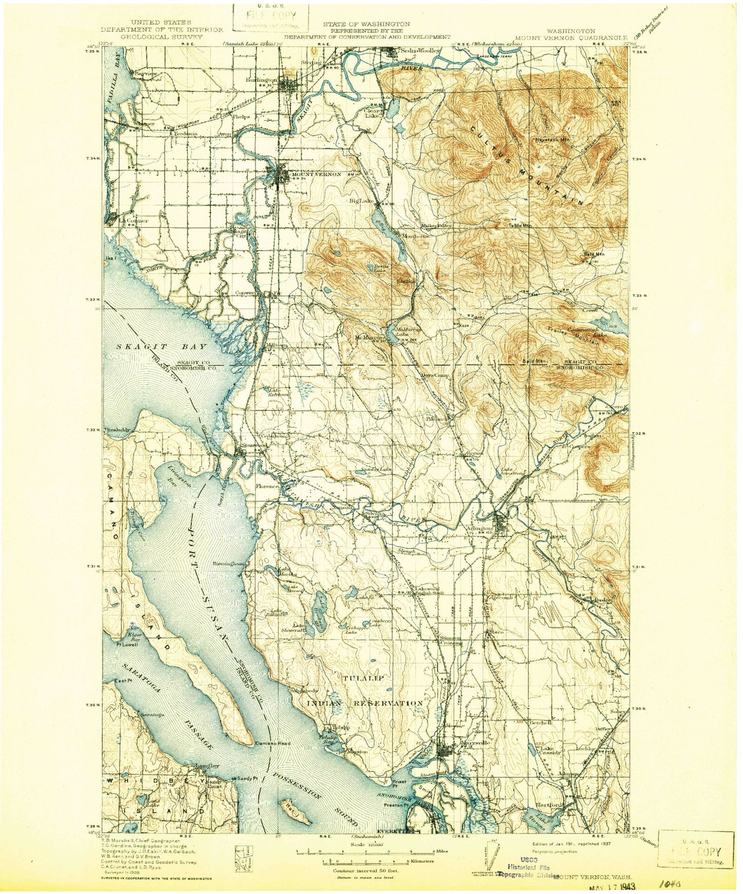
Historic 1911 Mount Vernon Washington 30'x30' Topo Map
Couldn't load pickup availability
Historical USGS topographic map of Mount Vernon in the state of Washington. Scale: 1:125000. Print size: 17" x 24"
This map was published in 1911 and is in the following counties: Island, Skagit, Snohomish.
The map contains contour lines, roads, rivers, towns, streams, and lakes. Printed on high-quality waterproof paper with UV fade-resistant inks.
Contains the following named places: Allen Creek, Armstrong Creek, Arrowhead Beach, Barney Lake, Barnum Point, Beaver Lake, Bells Beach, Big Lake, Big Rock, Boom Slough, Brandstedt Slough, Britt Slough, Browns Slough, Bryant Lake, Bulson Creek, Camano Country Club, Camano Head, Camano Island State Park, Camp Killoqua, Carpenter Creek, Catherine Creek, Cedarhome, Church Creek, Clear Lake, Connor Lake, Cook Slough, Crabapple Lake, Craft Island, Cranberry Lake, Crooked Slough, Cultus Mountain, Cummings Lake, Davis Slough, Deepwater Slough, Devils Lake, Dodge Valley, Douglas Slough, East Fork Nookachamps Creek, East Point, Ebey Slough, Edgewater Park, Elger Bay, Erickson Island, Fir Station, Freshwater Slough, Fryberg Lake, Gages Lake, Gages Slough, Gedney Island, Getchell, Lake Goodwin, Lake Goss, Granville Grange, Green Wood Grange, Hall Slough, Happy Valley, Hart Island, Hat Slough, Hawk Point, Hermosa Point, Hillcrest Park, Lake Howard, Irvine Slough, Isohis Slough, Jackson Gulch, John Sam Lake, Johnson Creek, Kayak Point, Kellogg Marsh Grange, Lake Ketchum, Lake Ki, Kruse, Lindsay Lake, Livingston Bay, Lochsloy, Lost Lake, March Creek, Martha Lake, Mary Shelton Lake, Marysville Receiver Site, Meadow Grange, Milltown Island, Mission Creek, Mountain View, Mountain View Beach, Mud Lake, Mundt Creek, Munson Creek, Nookachamps Creek, Old River, Paul Sevenich Boy Scout Camp, Port Susan, Prestliens Bluff, Preston Point, Priest Point, Priest Point Grange, Quilceda Creek, Ross Lake, Lake Rowland, Sandy Creek, Sandy Point, Lake Shoecraft, Sisco Heights, Sixteen Lake, Skagit Bay, Skiyou Island, Skiyou Slough, Smith Island, Smith Lake, Snohomish River, South Fork Skagit River, South Pass, South Slough, Steamboat Slough, Steamboat Slough, Lake Stevens, Stillaguamish Grange, Stillaguamish River, Stimson Crossing, Sturgeon Creek, Sunday Lake, Sunrise Point, Ten Lake, The Island, Tillicum Beach, Tom Moore Slough, Triangle Cove, Tulalip Bay, Tulalip Creek, Tulalip Shores, Turner Creek, Union Slough, Walker Valley, Weallup Lake, Wenberg State Park, West Fork Quilceda Creek, West Pass, Western Washington Indian Agency, Wiley Slough, Cold Spring Creek, Shiner Lake, Salmon Creek, Pigeon Creek, Jetty Island, Cougar Creek, Pilchuck Bridge Campground, Summer Lake, Seabury Pond, Jorgenson Slough, Arlington Junction, Baker Heights, Big Lake, Cedardale, Chuckanut Junction, Bretland, Delta Junction, Driftwood Shores, Fish Town, Juniper Beach, Kruse Junction, Mabana, Milltown, Norman, Riverside, Silvana Terraces, Sisco, Skagit City, Sterling, Terrys Corner, American Legion Memorial Park, Tulalip Reservation, Brown Point, Hartford, Cascade Mall Shopping Center, Fisher Creek, Hill Ditch, Little Mountain Lookout, Mount Vernon Mall, Mount Vernon Center, Bryant, Burlington, Burlington Hill, Camp Diana, Clear Lake, Conway, East Stanwood, Florence, Hyland, Langley, Little Mountain, Marysville, McKees Beach, McMurray, Mission Beach, Montborne, Mount Vernon, Pebble Beach, Saratoga, Scott Mountain, Silvana, Smokey Point, Spee-Bi-Dah, Stanwood, Sterling Hill, Lake Stevens, Sunny Shores, Tulalip, Tulare Beach, Tyee Beach, Utsalady, Warm Beach, Pilchuck, Skagit Valley Mall, Utsalady Bay, English, Getchell Hill, Lake Agnes, Cavelero Beach, Devils Mountain, English Boom, Lake Loma, Lona Beach, Lowell Point, Lake McMurray, Sundins Beach, Sunny Shore Acres, Kristoferson Lake, Lake Mall Shopping Center, Skagit State Wildlife Recreation Area, Albertsons Shopping Center, Maryville Fred Meyer, Town Center Mall, Arlington Airport Park, Blue Stilly Park, Haller Bridge Park, Port of Everett


