MyTopo
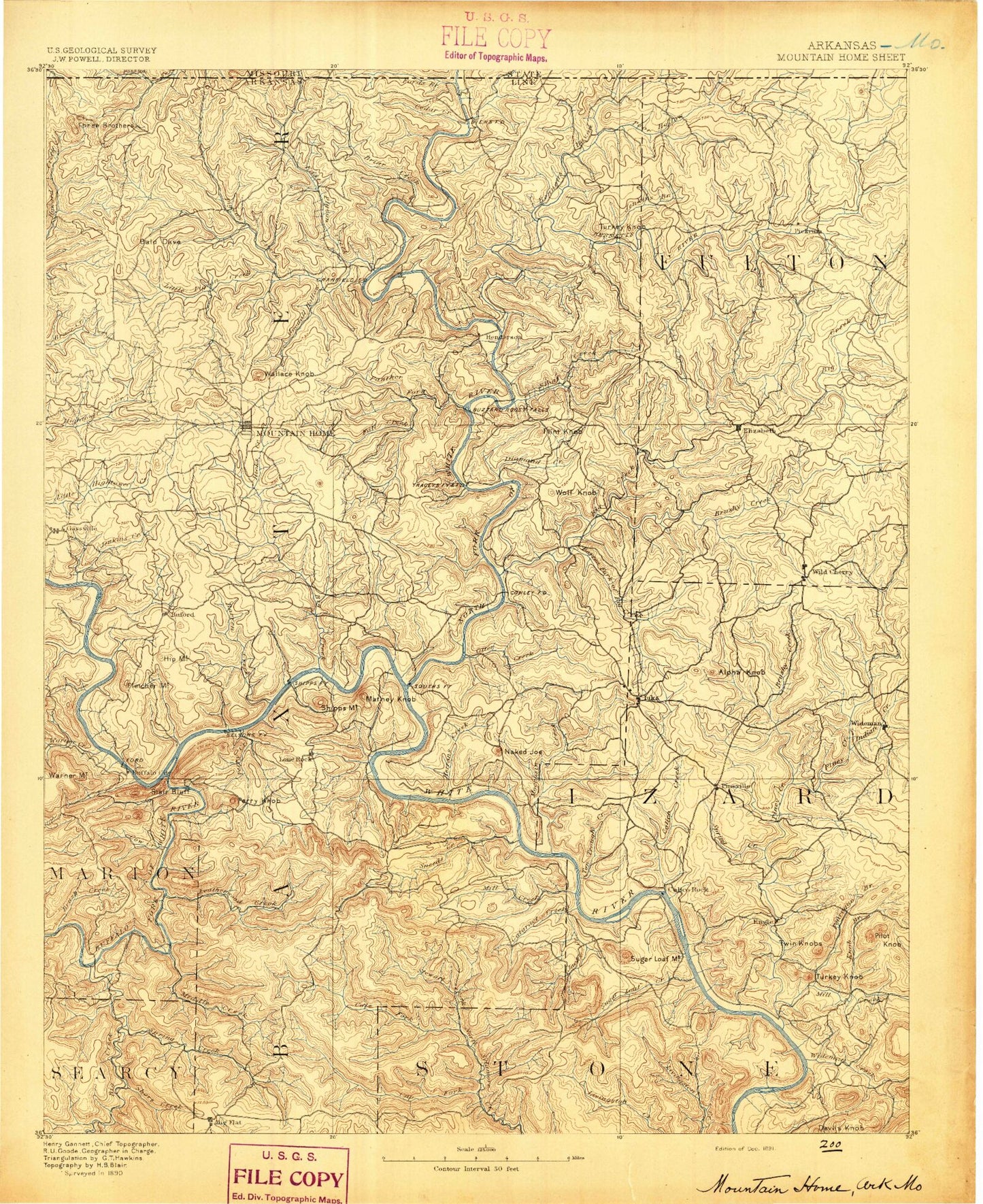
Historic 1891 Mountain Home Arkansas 30'x30' Topo Map
Couldn't load pickup availability
Historical USGS topographic map of Mountain Home in the state of Arkansas. Scale: 1:125000. Print size: 17" x 24"
This map was published in 1891 and is in the following counties: Baxter, Fulton, Howell, Izard, Marion, Ozark, Searcy, Stone.
The map contains contour lines, roads, rivers, towns, streams, and lakes. Printed on high-quality waterproof paper with UV fade-resistant inks.
Contains the following named places: Barren Creek, Bean Bluff, Bear Creek, Bennetts Bayou, Bennetts River, Bidwell Point, Big Creek, Briar Creek, Brushy Creek, Camp Spring Hollow, Cedar Creek, Colfax, Cotter Branch, Diamond Creek, Dodd Creek, Dry Hollow, East Pigeon Creek, Fall Creek, Flat Rock Creek, Float Creek, Foster Branch, Goodall Hollow, Heart Bald, Henderson, Hicks Creek, Hively Mountain, Howard Cove, Hutch Creek, Hutchinson Creek, Indian Creek, Jenkins Branch, Jenkins Creek, Keeter Creek, Little Brushy Creek, Little Creek, Little Creek, Little Pigeon Creek, Mallard Point, Mashie Hollow, Nasty Creek, North Brushy Creek, Panther Creek, Panther Fork, Pigeon Creek, Poor Hollow Branch, Rose Hollow, Shipman Creek, Smith Hollow, South Brushy Creek, Spring Creek, Stone Hollow, Tanner Creek, Taylor Foster Branch, Teal Point, Three Brothers, Walker Creek, Walker Hollow, Forty Four, Ott, Shady Grove, Vidette, Birdsong Mountain, Buzzard Roost Landing, Capitol Hill, Gepp, Cranfield Landing, Cumi, Dolph, Elizabeth, Gamaliel, Gamaliel Landing, Hand Landing, Hickman Knob, Jordan Landing, Midway, Mitchell, Negro Knob, Newton Landing, Old Lonon Mountain, Push Mountain, Quarry Landing, Red Bank Landing, Robinson Point Landing, Ruth, Salem Landing, Talbert Landing, Traceys Landing, Turkey Knob, Wallace Knob, Wideman, Wild Cherry, Wolf Knob, Woods Point Landing, County Line, Calico Rock Historic District, Township of Big Creek, Township of Cleveland, Township of Vidette, Township of Athens, Township of Bryan, Township of Claiborne, Township of Guthrie, Township of Mount Olive, Township of Union, Township of Rock Creek, Bidwell Point Use Area, Briarcliff, Buzzard Roose Use Area, College Plaza Shopping Center, Cranfield Use Area, Diamond Bay, Dogwood Park, Fawn Park, Gamaliel Use Area, Georges Cove Public Use Area, Hand Use Area, Henderson Use Area, Heritage Estates, Herron, Hopewell, Howard Cove Use Area, Jordan Use Area, Kingswood Estates, Lakeside Terrace, Mallard Point, Norfork Landing, Norfork National Fish Hatchery, Norfork Village, Monkey Run Creek, Monkey Run Hill, Ozark Center Shopping Center, Panther Bay Public Use Area, Pigeon Creek Public Use Area, Quarry Use Area, Red Bank Use Area, Robinson Point Use Area, Seward Point Public Use Area, Shipps Landing, Shoal Creek, Spring Lake Estates, Sycamore Heights, Sycamore Spring, Talbert Use Area, Timber Lake Manor, Tracy Use Area, Turkey Knob, Village Mall Shopping Center, Walker Branch, Whiteville, Wood Point Use Area, Township of Bayou, Township of Big Flat, Township of Buckhorn, Township of Buford, Township of Greenwood, Township of Independence, Township of Logan, Township of Lone Rock, Township of Matney, Township of Mill, Township of Mountain Home, Township of North Fork, Township of Pigeon, Township of Union, Township of Whiteville, Baxter County, Buffalo Landing, Campbells Shoal, Caney Branch, Cow Rock Shoals, Fishtrap Creek, Fishtrap Shoal, Fox Bar Shoal, Gin Eddy, Greasy Shoal, Hudsons Bend, Laffoon Creek, Leatherwood Shoal, Rose Berry Chute, Sheep Jump Creek, Shields Chute, Slick Rock Creek, Tinnan Rock Shoals, Advance, Almus Knob, Arkana, Arkana Station, Bailey Creek, Barkshed Creek, Barren Creek, Barren Fork, Bear Hollow, Bear Pen Creek, Bearhead Branch, Bee Branch, Bee Hollow, Big Creek, Big Spring Hollow, Birch Minick Hollow, Birmingham Hollow, Blue Branch, Blue Steer Branch, Boswell, Boulder Mountain, Bridge Hollow, Brush Creek, Brush Creek, Bucker Gap, Buford, Buford Station, Buzzard Roost, Calico Bluff, Calico Creek, Canes Fork, Caney Hollow, Caney Hollow, Cap Berry Hollow, Cap Fork, Caroline Gap, Cartney, Cat Creek, Cataract Creek, City Rock Bluff, Cleveland Knob, Clifty Canyon, Clint Hollow, Cockran Creek, Cold Spring Hollow, Coldwater Creek, Cole Fork, Cow Creek, Creswell Island, Creswell Mountain, Crib Hollow, Crooked Creek, Crystal Point