MyTopo
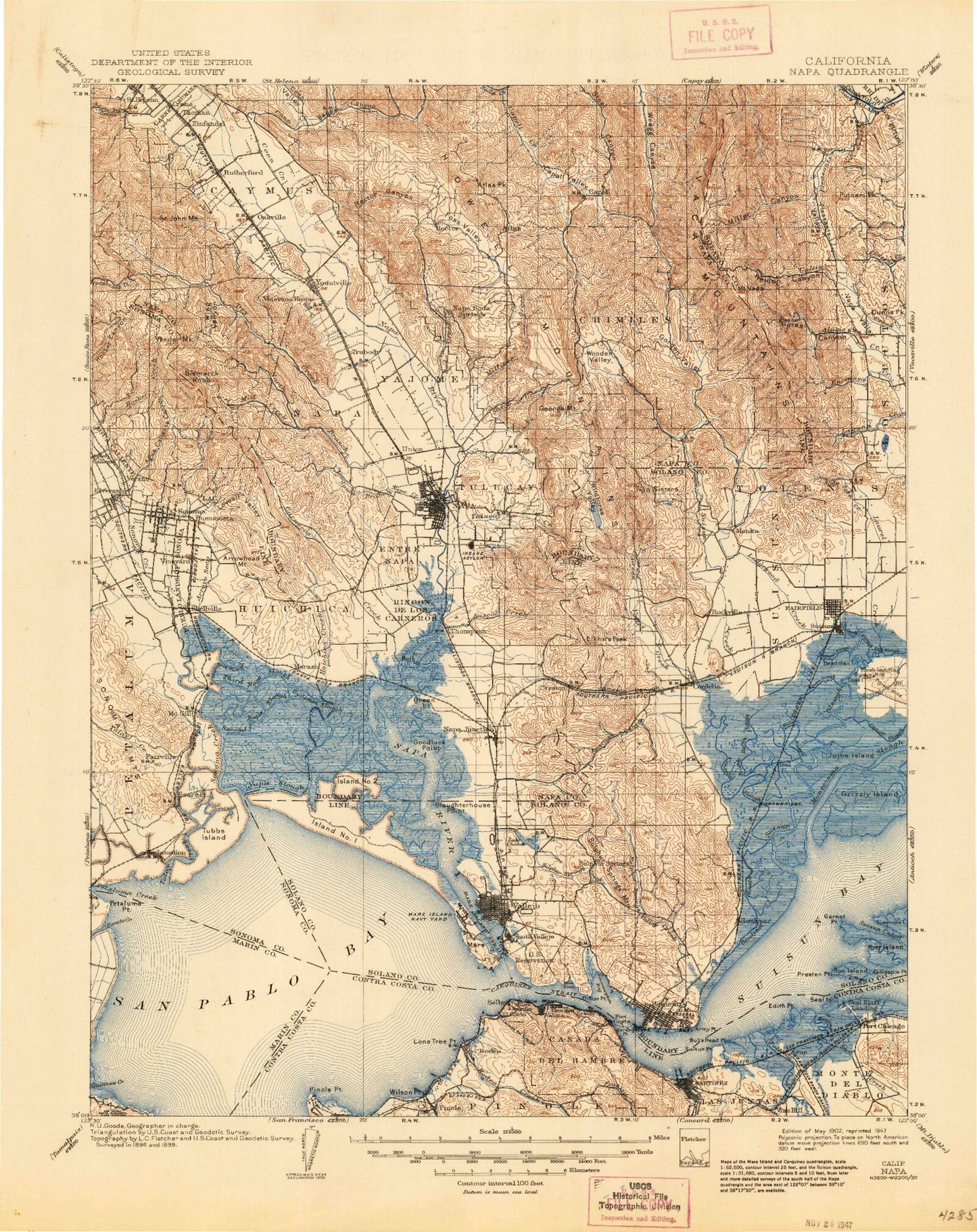
Historic 1902 Napa California 30'x30' Topo Map
Couldn't load pickup availability
Historical USGS topographic map of Napa in the state of California. Scale: 1:125000. Print size: 17" x 24"
This map was published in 1902 and is in the following counties: Contra Costa, Marin, Napa, Solano, Sonoma, Yolo.
The map contains contour lines, roads, rivers, towns, streams, and lakes. Printed on high-quality waterproof paper with UV fade-resistant inks.
Contains the following named places: Adams Flat, Agua Caliente, Agua Caliente Canyon, American Canyon, American Canyon Creek, Appleby Bay, Agua Caliente Creek, Army Point, Arnold Club, Arrowhead Mountain, Arroyo Seco, Bald Mountain, Bale Slough, Bar B Ranch, Bear Canyon, Bear Flat, Bella Oak Mine, Belloma Slough, Benicia Point, Benicia Shoals, Big Bend, Big Bull Valley, Blue Rock Springs Creek, Blue Rock Springs Park, Boynton Slough, Brazos, Browns Creek, Browns Valley, Bull Hill, Bull Island, Bulls Head Channel, Burrell Canyon, Bush Hill, Bush Slough, Butler Canyon, Buzzard Rock, California Club, Camp Five, Camp Four, Camp One, Camp Six, Camp Three, Camp Two, Campbell Flat, Canada Del Cierbo, Canada Del Hambre Y Las Bolsas, Capell Valley, Carneros Creek, Carneros Valley, Carquinez Strait Lighthouse, Carriger Creek, Castle Rock, Cat Slough, Lake Chabot, Chadbourne Slough, Champlin Creek, Cherry Glen, Cherry Valley, Chimiles, Chimiles Farm Center, Chimney Canyon, China Camp, China Slough, China Slough, Cole Flat, Coleman Canyon, Congress Valley, Cook Canyon, Coon Island, Cordelia Club, Cordelia Junction, Cordelia Slough, Crystal Lake, Cup and Saucer, Lake Curry, Cutoff Slough, Davis Point, Day Island, DeNova Club, Deadman Island, Decke Canyon, Devils Canyon, Devils Slough, Dillon Point, Dover Park, Dowdall Creek, Duck Slough, Dug Road Creek, Dutchman Slough, East Branch, East Bull Canyon, East Bulls Head Channel, East Chapman Canyon, East Mitchel Canyon, East Napa Reservoir, East Side Reservoir, Edgerley Island, Ehmann Club, Elkhorn Peak, Elliot Cove, Encinosa Creek, English Hills, Entre Napa, Ephlin Hill, Fagan Creek, Fagan Slough, Family Club, Felder Creek, Fetters Hot Springs, First Mallard Branch, Fleishhacker Club, Fly Bay, Four Corners, Fowler Creek, Frank Horan Slough, Lake Frey, Fuller Park, Gallinas Creek, Garnet Point, Garrity Creek, Gates Canyon, Mount George, Glen Cove, Goat Island, Golden Gate Club, Good Luck Point, Goodyear Slough, Goose Lake, Gordon Valley, Gordon Valley Creek, Gordon Valley Dam, Government Trail Canyon, Gravelly Lake, Grayson Creek, Green Island, Green Lodge Club, Green Valley, Green Valley Creek, Green Valley Falls, Green Valley Picnic Ground, Grizzly Island Club, Grizzly Land Club, Haraszthy Creek, Haraszthy Falls, Harvey Slough, Hastings Slough, Heath Canyon, Hercules Wharf, Lake Herman, Hill Slough, Lake Hinman, Hogback Mountain, Hooker Canyon, Hudeman Slough, Huichica, Huichica Creek, Hunter Cut, Ibis Club, Ibis Cut, Island Land Club, Jack Rabbit Flat, Jameson Canyon, Jenkins Rock, John F Kennedy Memorial Park, Johnson Canyon, Joice Island Club, Juarez Old Adobe, Knight Island, Kreuse Canyon, Kreuse Creek, La Joya Quicksilver Mine, Lac, Lachman Club, Lagoon, Lagoon Valley, Laguna Creek, Laurel Creek, Ledgewood Creek, Lee Lake, Lemon Hill, Leoma Lakes, Little Bull Valley, Little Island, Little Valley, Lombard, Lone Tree Point, Lovall Valley, Lake Madigan, Mallard Reservoir, Mankas Corner, Mare Island, Mare Island Strait, Lake Marie, Martinez Reservoir, Midshipman Point, Miller Canyon, Miller Creek, Milliken Canyon, Milliken Peak, Milliken Reservoir, Mira Monte Club, Weldon Canyon, Montezuma Club, Montgomery Creek, Morrow Cove, Morrow Island, Morrow Island Farm, Moskowitz Reservoir, Mud Lake, Mud Slough, Munson Ranch, Murphy Creek, Napa Creek, Napa Slough, Nathanson Creek, Negro Canyon, Nevada Dock, North Branch, North Slough, Novato Creek, Oak Moss Creek, Oakville, Okell Hill, Pacheco Creek, Page Flat, Pansey Valley, Pearl Gap, Peltier Slough, Pena House Historic Site, Petaluma Point, Peytonia Slough, Pickle Canyon, Pine Lake, Pinole Creek, Pinole Shoal, Pioneer Ranch


