MyTopo
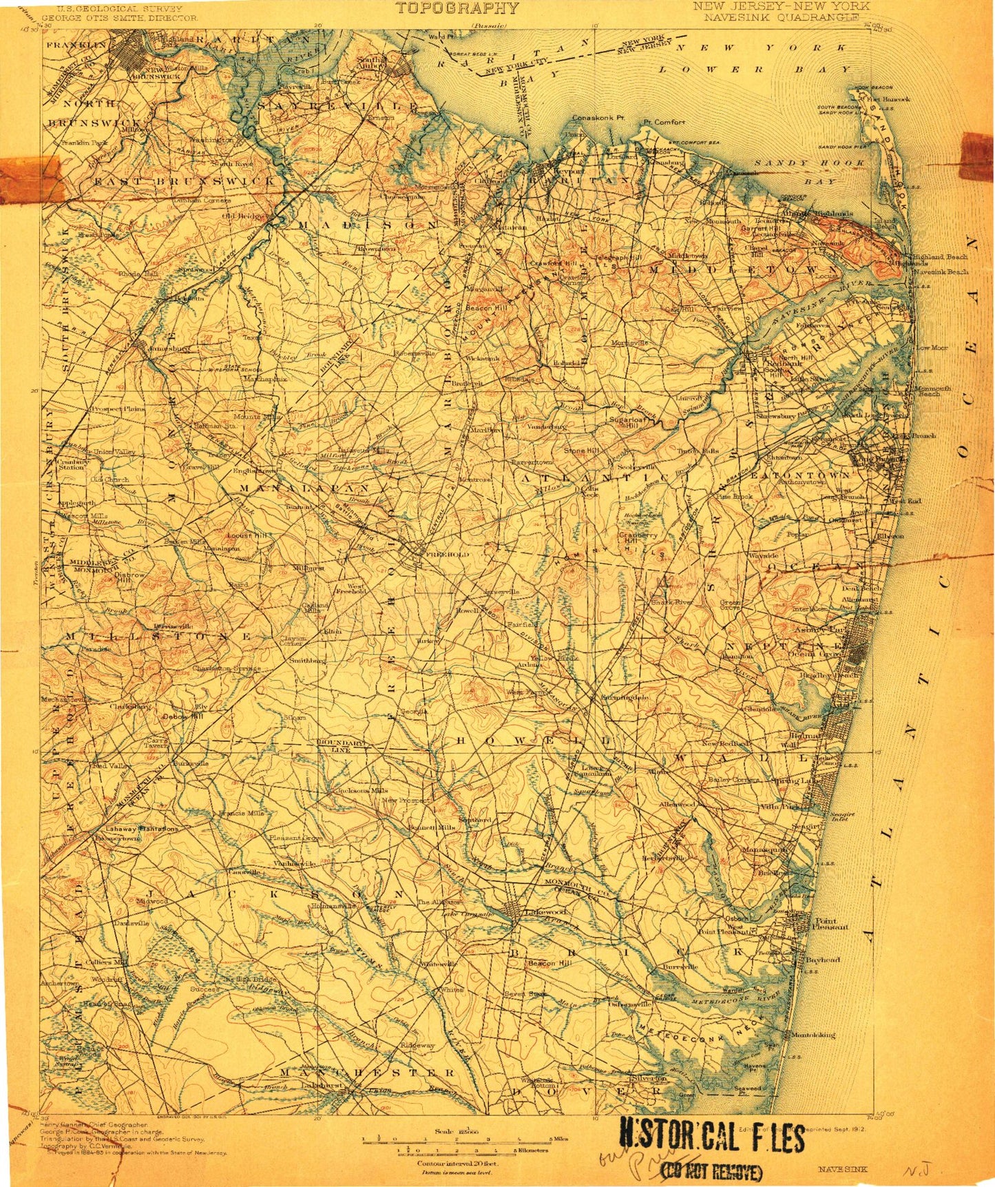
Historic 1902 Navesink New Jersey 30'x30' Topo Map
Couldn't load pickup availability
Historical USGS topographic map of Navesink in the state of New Jersey. Scale: 1:125000. Print size: 17" x 24"
This map was published in 1902 and is in the following counties: Mercer, Middlesex, Monmouth, Ocean, Richmond, Somerset.
The map contains contour lines, roads, rivers, towns, streams, and lakes. Printed on high-quality waterproof paper with UV fade-resistant inks.
Contains the following named places: East Branch Mingamahone Brook, Tide Creek, Winding River Village, Sedge Island, Point Pleasant State Marina, Windward Beach Park, Midstreams Park, Reedy Creek, Baywood, Kingfisher Cove, Jones Tide Pond, Winter Yacht Basin, Swan Point State Natural Area, Long Point Island, Green Island, Long Island Cove, Swamp Cove, Echo Lake Park, Cruz Farm Country Club, Hominy Hills, Camp Zehnder, Lake Shenandoah County Park, Lakewood Pine Park, Carasaljo Park, Greenbriar, Williams, Brick Mall Shopping Center, Birchwood Park, Laurelton Gardens, Cedar Bridge Manor, Bricktown, Riverwood Park, Slab Branch, Glen Cedar City, Leisure Village East, Seaview Square Mall Shopping Center, Edgemere Park, Sea Girt Mall Shopping Center, Robert L Brice Memorial Park, Mohingson Creek, Belvedero Beach, Thomas A Edison County Park, Lakewood Pine Park, Gander Brook, Adams, Adamston, Adelphia, Alberta Lake, Aldrich Lake, Algers Mills, Allaire State Park, Allenhurst, Allenwood, Andrew Point, Applegarth, Applegates Creek, Archers Corner, Archertown, Ardena, Asbury Park, Avon-by-the-Sea, Baileys Corner, Bairdsville, Barclay Brook, Bay Head, Bay Head Harbor, Bay Head Junction, Point Pleasant Canal, Bear Swamp Brook, Beaverdam Brook, Beaverdam Creek, Belmar, Bennetts Mills, Bennetts Pond, Berdines Corners, Bergen Mills, Big Brook, Blacks Branch, Blansingburg, Bordens Mill Branch, Boswell Park, Bradevelt, Bradley Park, Breton Woods, Brielle, Brisbane Lake, Brookview, Browntown, Brunswick Gardens, Bucks Mill, Bucks Pond, Burkes Creek, Burkesville, Burnt Fly Bog, Burt Creek, Cabinfield Branch, Camp Housman, Camp Osborne, Camp Wanda, Lake Carasaljo, Carmerville, Carrs Corner, Carrs Tavern, Cassville, Cedar Bridge, Cedar Bridge Branch, Cedar Brook, Cedarwood Park, Centerville, Charleston Springs, Cheesequake, Cheesequake Creek, Cheesequake State Park, Cherry Quay, Chingarora Creek, Clancy Island, Clarks Landing, Clarks Mills, Clarksburg, Claytons Corner, Cliffwood, Cliffwood Beach, Cliffwood Beach, Cold Indian Springs, Colliers Mills, Collingwood Park, Colts Neck, Lake Como, Conaskonk Point, Cooks Creek, Cotterals Brook, Cottrell Corners, Crab Island, Cranberry Hill, Cranbury Station, Crabtown Creek, Crawford Corners, Crawford Hill, Crescent Park, Crossmans, Crossway Creek, Dark Branch, DeVoe Lake, Deal Lake, Debbies Creek, Debois Creek, Deep Creek, Deep Run, Devine Park, Polypod Brook, Dicks Brook, Donaldson County Park, Dove Mill Branch, Drum Point, Duhernal Lake, Dunhams Corners, Eagle Point, Earle, East Creek, East Freehold, East Spotswood, Echo Lake, Edgebrook, Elisha Branch, Ellis Point, Elton, Ely, Englishtown, Ernston, Etra Lake, Everett, Fairfield, Farmingdale, Farrington Lake, Feaster Park, Ferry Point, Flat Creek, Flat Creek, Fletcher Lake, Forge Pond, Fort Plains, Francis Mills, Freehold, Freewood Acres, Freneau, Fresh Ponds, Gaskin Branch, Georgia, Gillespie, Gillilandtown, Glendola, Godfrey Lake, Gordons Corner, Grass Hollow Branch, Gravel Hill, Gravelly Brook, Great Beds, Great Beds Lighthouse, Great Ditch, Green Branch, Green Grove, Green Island, Greenville, Gunners Ditch, Half Acre, Halls Corners, Hamilton, Hankins Brook, Hannabrand Brook, Harmony, Harris Branch, Havens Cove, Havens Point, Haystack Brook, Hazlet, Helmetta, Hendrickson Corners, Herberts, Herberts Corner, Herbertsville, Herring Island, Highland Park, Hillsdale, Hoffman, Harvey Brook, Holland, Hollow Brook, Holmansville, Holmdel, Holmeson, Hominy Hills, Hooks Creek Lake, Hop Brook, Horicon Lake, Howell Station, Hurleys Pond


