MyTopo
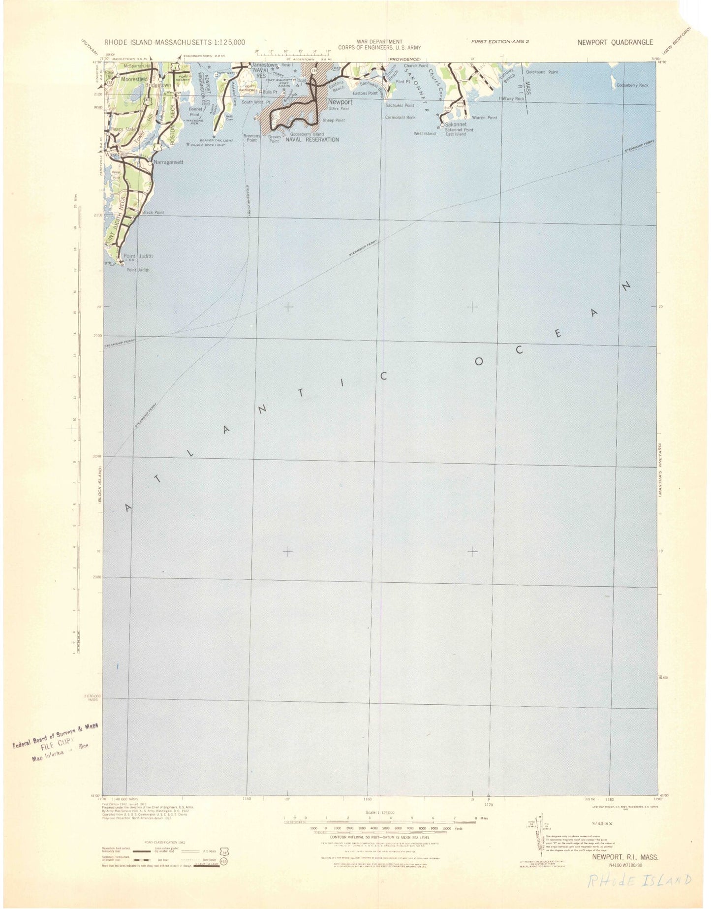
Historic 1942 New Port Rhode Island 30'x30' Topo Map
Couldn't load pickup availability
Historical USGS topographic map of New Port in the state of Rhode Island. Scale: 1:125000. Print size: 17" x 24"
This map was published in 1942 and is in the following counties: Bristol, Dukes, Newport, Washington.
The map contains contour lines, roads, rivers, towns, streams, and lakes. Printed on high-quality waterproof paper with UV fade-resistant inks.
Contains the following named places: Twomile Ledge, Hazard Beach, Cormorant Rock, Sachuest Point, Island Rocks, Flint Point, Third Beach, Woods Castle, Church Point, Church Cove, Breakwater Point, Sakonnet Harbor, Sakonnet, Watch House Pond, Long Pond, Long Pond Rock, Mill Point, Warren Point, Cullywaugh Rocks, Sakonnet Point, East Island, West Island, Briggs Marsh, Briggs Beach, Briggs Point, Halfway Rock, Little Pond Cove, Wilbours Woods, Dundery Brook, Sisson Brook, Tunipus Pond, South Shore Beach, Maidford River, Kettle Bottom Rock, West Cove, The Dumplings, Fort Cove, Fort Wetherill, Bull Point, Mitchell Rock, Rose Island, Citing Rock, Butter Ball Rock, Ragged Point, Rams Head, Castle Hill, Castle Hill Cove, Point of Trees, Brenton Village, Fort Adams, Brenton Cove, Newport Harbor, Newport, Brenton Point, Graves Point, Black Rock, Seal Rock, Price Neck, Goose Neck Cove, Newport Neck, Cherry Neck, Lily Pond, Almy Pond, Roaring Bull, Gooseberry Island, Spouting Rock, Bailey Beach, Lands End, Coggeshall Ledge, Midship Rock, Rough Point, Gull Rock, Sheep Point, Sheep Point Cove, Ochre Point, Forty Steps, Easton Bay, Marys Seat, Easton Beach, Easton Pond, Green End Pond, Easton Point, Long Rock, The Bluff, Purgatory, Sheep Pen Rock, Nelson Pond, Hanging Rock, Gardiner Pond, Sakonnet River, Gardiner Pond Dam, Easton Pond South Dam, Nelson Pond Dam, Green End Pond Dam, Lime Rock Light, Purgatory, Beach Rock, Brenton Reef, Castle Hill, Cormorant Reef, Collins Beach, Concord Gulf Cove, Church Rocks, Ellison Rock, Dolphin Rock, Dyer Point, Elbow Ledge, Elisha Ledge, Boat House Gully, Goose Neck, Gooseberry Beach, Flint Rock, Flat Rock, Sachuest, Ida Lewis Rock, Sachuest Bay, Second Beach, Paradise Brook, Schyler Ledge, Flint Point Ledge, Maiford River, Haycock Ledge, Conrad Cove, Supp Rock, Old Salt Work Beach, Pirate Cave, Seal Ledge, Newport County, Sakonnet Light, Goat Island, Rhode Island Sound, Saugatucket River, Locke Point, Point Judith, Money Pond, Point Judith, Seaweed Beach, Champlin Rock, Peaked Rock, Bluff Hill, Little League Rock, Point Judith Neck, Scarborough Hills, League Rock, Black Point, Rye Point, Welcome Cove, Horseshoe Point, Ram Island, The Brothers, Gunning Rock, Dead Man Brook, Harbour Island, Long Cove, Indian Rock, The Narrows, Upper Pond, Ram Point, Silver Spring Cove, Sprague Pond, Crooked Brook, Narragansett Pier, Silver Lake, Crying Bog, Lake Canonchet, Narragansett Beach, Little Neck, Little Neck Pond, Pettaquamscutt Cove, Gooseberry Island, Meetinghouse Hill, Indian Run Reservoir, River Ledge, Clump Rocks, Cormorant Rock, River Rock, Whale Rock, Cormorant Point, Thule Cove, The Narrows, Little Whale, Boston Neck, Peace Dale, Saugatucket Pond, Indian Run, Indian Lake, Camp Saugatucket, Bonnet Shores, Mooresfield, Rose Hill, Indian Lake Shores, McSparran Hill, Pettaquamscutt Rock, Tower Hill, Pettaquamscutt River, Pettaquamscutt Lake Shores, Bridgetown, Jones Ledge, Bonnet Point, Bonnet Shores Beach, The Bonnet, Wesquage Pond, South Ferry, Fox Hill, Fox Hill Pond, Dutch Island Harbor, Austin Hollow, Newton Rock, Beavertail Point, Lion Head, Clarks Village, Hull Cove, Southwest Point, Cedar Point, Mackerel Cove, Mackeral Cove Beach, Sheffield Cove, Jamestown, Beaverhead, Peace Dale Pond Dam, Indian Lake Dam, Beavertail Light, Scarborough State Beach, Pickerel Point, Bass Rock, Beach Rock, Big White Hill, Boiling Lot Cove, Bog Rock, Cedar Point, Dickens Reef, Black Point Rock, Frank Point, Goose Island, Fresh Meadow Brook, Watson Pier


