MyTopo
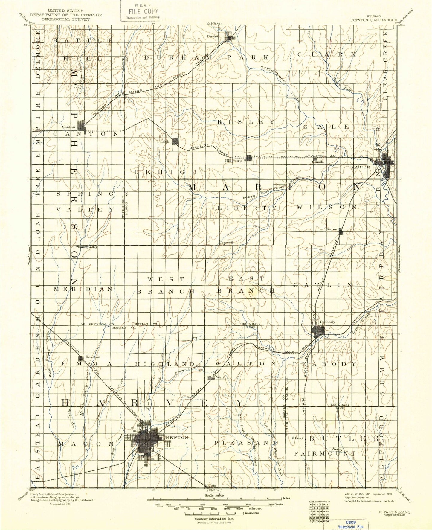
Historic 1894 Newton Kansas 30'x30' Topo Map
Couldn't load pickup availability
Historical USGS topographic map of Newton in the state of Kansas. Scale: 1:125000. Print size: 17" x 24"
This map was published in 1894 and is in the following counties: Butler, Harvey, Marion, McPherson.
The map contains contour lines, roads, rivers, towns, streams, and lakes. Printed on high-quality waterproof paper with UV fade-resistant inks.
Contains the following named places: Township of Newton, Township of Macon, Township of Pleasant, Township of Fairmount, Paden Oil Field, Township of Battle Hill, Township of Moore, Township of Durham Park, Township of Clark, Jenday Oil Field, Canton North Oil Field, Maxwell State Game Refuge, McPherson County State Lake, Township of Canton, Township of Lehigh, Lehigh, Township of Risley, French Creek, Silver Creek, Township of Gale, French Creek Cove Public Use Area, Durham Cove Public Use Area, Durham Oil and Gas Field, Durham, South Cottonwood River, North Cottonwood River, Marion Cove Public Use Area, Cottonwood Point Public Use Area, Marion Dam, Pilsen, Spring Valley Oil Field, Township of Spring Valley, Township of Menno, Township of Liberty, Stony Brook, Middle Emma Creek, Township of West Branch, Township of East Branch, Hillsboro, Antelope Creek, Spring Branch, Township of Catlin, Township of Wilson, Hillsboro Cove Public Use Area, Canada, Marion, Mud Creek, Aulne, Graber Oil Field, Hesston, Dry Creek, Township of Emma, Goessel, Beaver Creek, Township of Highland, Township of Walton, Southwest Unger Oil Field, Spring Creek, Township of Peabody, Unger Oil Field, Peabody, Zimmerdale, North Newton, Themian Park, Walton, Washington Park, Fox Ridge Golf Club and Conference Center, N N Siding, Walnut Creek, Elbing, Edmonds Pool, Paulson Northeast Oil Field, Elbing Oil Field, McPherson County State Lake Dam, Marion Wildlife Area, Cedar Village Shopping Center, The Village Center, Mud Creek, Marion Reservoir, Clear Creek, Harvey County East Park, Harvey County East Park Lake, Catfish Point, Crown Point, Lake View Landing, Needle Point, Walton Landing, Township of Meridian, Newton, Waldeck, Eastshore, Sand Creek, McGraw, Harvey County, Marion County, Newton Waterworks, Canton, City of Hillsboro, City of Marion, City of Newton, City of Canton, City of Hesston, City of Durham, City of Elbing, City of Goessel, City of North Newton, City of Lehigh, City of Peabody, City of Walton, May Branch Whitewater River, Elbing Wastewater Plant, Lehigh Wastewater Treatment Plant, Hesston Wastewater Treatment, Marion Wastewater Plant, Walton Wastewater Treatment Facility, Newton Wastewater Treatment Plant, Peabody Wastewater Plant, Goessel Wastewater Treatment Plant, Marion Industrial Park, Newton Amtrak Station, Meadow Lake Campground, Bethel College Thresher Stadium, Dyck Arboretum of the Plains, McPherson County Fairgrounds, Marion County Fairgrounds, Durham Wastewater Plant, Country Aire Mobile Home Park, Country Club Mobile Home Estates, Prairie Estates Mobile Home Park, Rollin Homes Mobile Home Court, Cottonwood Grove Recreational Vehicle Campground, Newton Public Golf Course, Hesston Golf Park, Pine Edge Golf Course, Sand Creek Station Golf Club, Hillsboro Municipal Golf Course, Marion Country Club, Peabody Golf Course, Wedgewood Golf Course, Harvey County Fairgrounds, Elbing Grain Elevator Number 1, Agricultural Producers Grain Elevator Number 3, Team Marketing Alliance Grain Elevator Number 7, Team Marketing Alliance Grain Elevator Number 8, Team Marketing Alliance Grain Elevator Number 15, Team Marketing Alliance Grain Elevator Number 19, Team Marketing Alliance Grain Elevator Number 22, Team Marketing Alliance Grain Elevator Number 24, Team Marketing Alliance Grain Elevator Number 26, Team Marketing Alliance Grain Elevator Number 29, Team Marketing Alliance Grain Elevator Number 33, Team Marketing Alliance Grain Elevator Number 35, A and D Ranch


