MyTopo
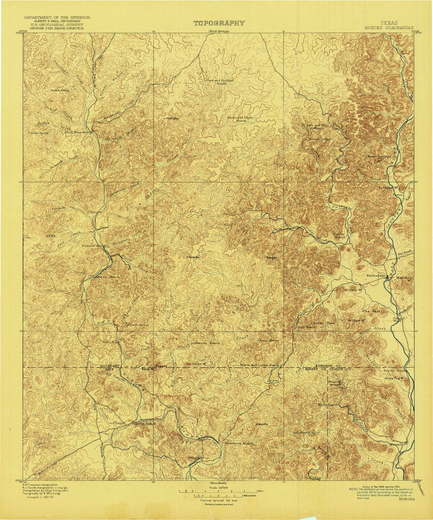
Historic 1896 Nueces Texas 30'x30' Topo Map
Couldn't load pickup availability
Historical USGS topographic map of Nueces in the state of Texas. Scale: 1:125000. Print size: 17" x 24"
This map was published in 1896 and is in the following counties: Edwards, Kinney, Real, Uvalde.
The map contains contour lines, roads, rivers, towns, streams, and lakes. Printed on high-quality waterproof paper with UV fade-resistant inks.
Contains the following named places: Allison Hollow, Barksdale, Beef Hollow, Big Canyon, Black Waterhole, Blue Waterhole, Bluff Creek, Bruce Park, Cade Hole, Cade Hollow, Camp Fawcett, Camp Wood, Camp Wood Creek, Cave Creek, Cedar Draw, Cherry Creek, Cobb Hollow, Crooked Draw, Cub Lake, Dobbs Run, Dry Sycamore Creek, Dutch Creek, Dutch Mountain, Dutch Waterhole, Family Draw, Geronimo Creek, Government Draw, Graveyard Mountain, Griffin Creek, Hackberry Creek, Hackberry Hollow, Indian Mountain, Jackson Flat, Kalentine Hole, Kelley Peak, Little Hackberry Draw, Meridian Mountain, Military Mountain, Miller Creek, Miller Draw, Newberry Draw, North Spring Creek, Open Hollow, Panther Canyon, Pikes Peak, Powers Mountain, Rainbow Bluff, Ranch Creek, Rough Sycamore Creek, Ruth Draw, Schoolhouse Mountain, Silver Lake, Silver Lake Ranch, Spring Creek, Stagecoach Waterhole, Steve Kemp Draw, Tanner Draw, Thurman Hollow, Van Buren Water Hole, Whittle Draw, Wildcat Mountain, Wiley Waterhole, Black Stump Draw, Blackhawk Hollow, Blue Creek, Blue Hole, Bullhead Creek, Bullhead Mountain, Cedar Creek, Daley Hollow, Deep Creek, Fern Bluff, Fivemile Draw, Flat Creek, Flying Bull Ranch, Half Moon Prairie, Hunter Hollow, Jade Lake, Kickapoo Creek, Little Blue Hole, Mitchell Hollow, Painted Bluff, Perkins Hollow, Perkins Mountain, Racetrack Hollow, Reagan Hollow, Reasnor Hollow, Round Hole Draw, Seep Spring Mountain, Slide Canyon, Spring Creek, Spring Hollow, Spring Hollow, Stewart Hollow, Sweeten Hollow, Terry Hollow, Threemile Draw, Turnpike Mountain, Twomile Draw, Vance, W Round Hole Draw, White Mountain Draw, Wildcat Draw, Black Mountain, Boiling Mountain, Bull Waterhole, Bull Waterhole Draw, Cherry Draw, Cow Cave Bluff, Cutting Pen Draw, Dead Pine Hollow, Dry Creek, Dry Creek, East Prong Nueces River, Fourmile Draw, Goat Waterhole, Hayes Mountain, Indian Creek, Little Hackberry Creek, Little Windmill, Loma la Cruz, Long Lake, Lost Creek, Machinery Hollow, Mail Trail Draw, Maverick Creek, Montell, Montell Creek, Nueces Lake, Plum Hollow, Polecat Creek, Possum Creek, Pulliam Creek, Rock Hollow, Shoe Peg Mountain, Silver Creek, Spring Branch, Stratler Windmill, Sycamore Creek, Wickham Waterhole, Hackberry, Lost Creek Place, Edwards County, Arnold Crossing Dam, Rocksprings South Division, Kickapoo Cavern State Park, City of Camp Wood, Mount El Shaddai


