MyTopo
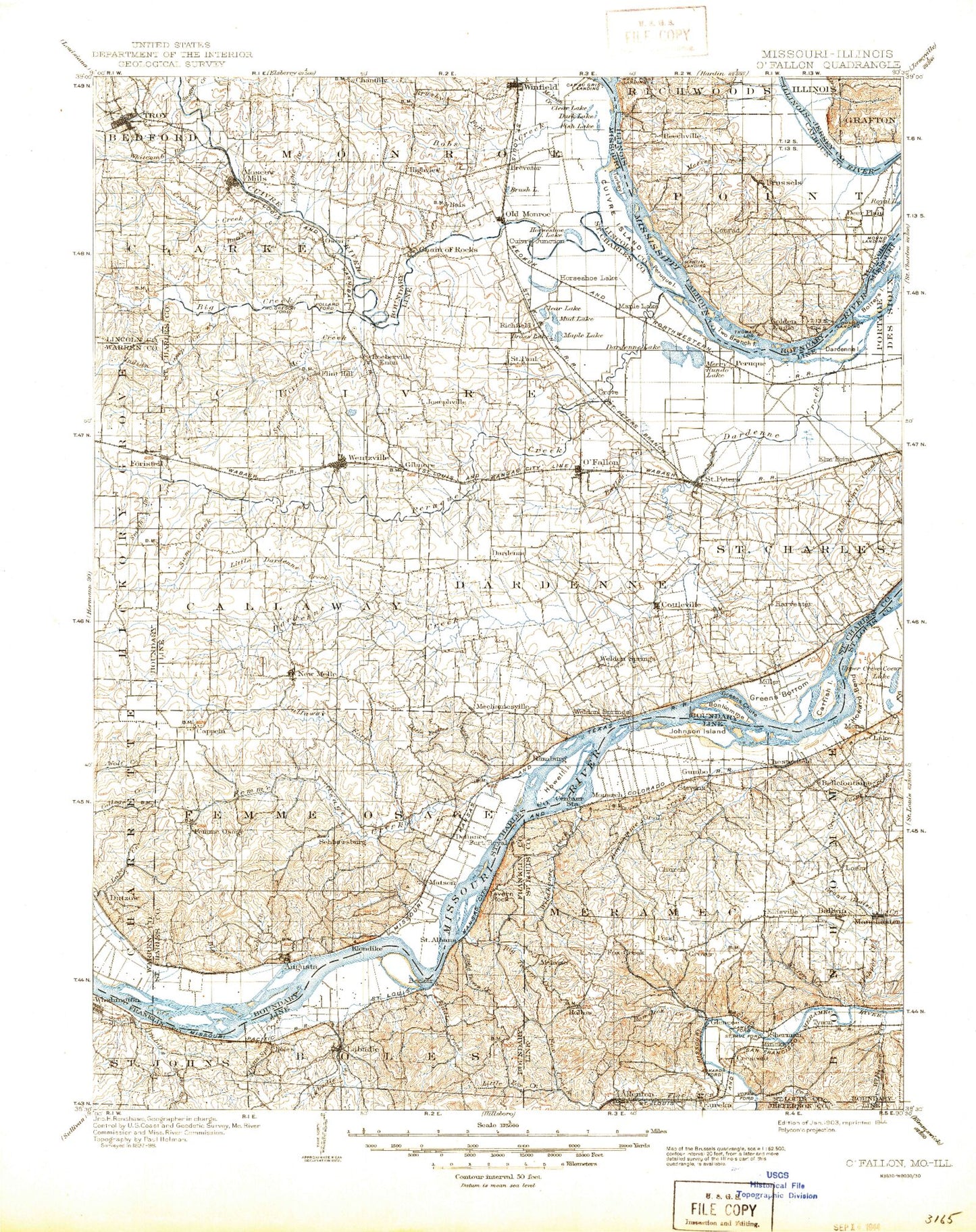
Historic 1903 O'Fallon Missouri 30'x30' Topo Map
Couldn't load pickup availability
Historical USGS topographic map of O'Fallon in the state of Missouri. Scale: 1:125000. Print size: 17" x 24"
This map was published in 1903 and is in the following counties: Calhoun, Franklin, Jefferson, Jersey, Lincoln, St. Charles, St. Louis, Warren.
The map contains contour lines, roads, rivers, towns, streams, and lakes. Printed on high-quality waterproof paper with UV fade-resistant inks.
Contains the following named places: Lake Alan, Argent Slough, Browns Branch, Brush Lake, Buchanan Creek, Camp Eter Lake, Campbell Branch, Chain of Rocks, Crooked Creek, Cuivre Island, Dark Lake, Dubois Creek, Dutzow, Ethlyn, Fiddle Creek, Fiddle Creek Camp, Fish Lake, Groshong Branch, Iman Branch, Jordan Branch, Kirbaum Branch, Labadie Creek, Lartto Creek, Little Sugar Creek, Oetters, Sand Run, Lake Sherwood, Smith Branch, South Troy, Sugar Creek, Tavern Rock, Town Branch, Troy, Turkey Island, Turkey Lake, Whitcomb Branch, Winfield, Becker Creek, Dunn Spring Creek, Big Creek, Boles, Busch Creek, Charrette Creek, Labadie, Saint Albans, Old Monroe Mounds, Cuivre Canal, Birkhead Branch, Bobs Creek, Brushy Fork, Butcher Creek, Cap au Gris, Clear Lake, Horseshoe Lake, Keelstone Branch, McLean Creek, Moscow Mills, Old Monroe, Hinckley Bend, Brevator, Petersville, Ming School, Becker School, Purina Mills Farm, Labadie Powerplant Water Tanks, Maryknoll, All Saints Village, Allenton, Antire Creek, Apple Island, August A Busch Memorial Conservation Area, Augusta, Babler State Park, Ballwin, Barrett Lake, Becker Branch, Belleau Creek, Bellefontaine, Bernard Lake, Bigelow Creek, Bolter Island, Bonhomme Creek, Bonhomme Island, Callaway Fork, Camp Hollow, Camp Wyman, Cappeln, Carr Creek, Castlewood, Catfish Island, Caulks Creek, Cedar Bluff, Centaur, Centaur Chute, Cherry Hill Country Club, Chesterfield, Clarkson Valley, Clear Lake, Cole Creek, Coon Hollow, Cottleville, Crescent, Crescent Hills, Crooked Creek, Crow Creek, Cuivre River, Cuivre Slough, Cunningham Branch, Dardenne, Dardenne Creek, Dardenne Island, Dardenne Lake, Darst Bottoms, Defiance, Dry Branch, Duckett Creek, Ellisville, Enon, Enon Branch, Eureka, Femme Osage, Femme Osage Creek, Fern Glen, Firma, Fish Slough, Fisher Creek, Flat Creek, Flatrock Creek, Flint Hill, Forest Hills Country Club, Foristell, Fort Zumwalt State Park, Fox Creek, Gardnerville, Gilmore, Glencoe, Grassy Lake, Greens Bottom, Greens Chute, Grover, Gumbo, Hamburg, Hamilton Creek, Hancock Bottom, Harvester, Hine, Hollow, Horseshoe Lake, Howard Bend, Howell, Howell Island, Indian Camp Creek, Island Number 508, Jacobs, Jane Downing Island, Jedburgh, Johnson Island, Josephville, Kampville, Keifer Creek, Klondike, Kraut Run, Labadie Bottoms, Lake, Lauer Island, Lharky Lake, Lincoln Beach, Little Antire Creek, Little Dardenne Creek, Little Femme Osage Creek, Little Fox Creek, Loehr, Manchester, Maple Lake, Matson, McCann Landing, McCoy Creek, Meadowbrook Country Club, Melrose, Mid America Raceway, Mincke Hollow, Monarch, Monarch Station, Morschels, Mountain Ridge, Mud Lake, New Melle, Nona, O'Fallon, Orrville, Pallardy Lake, Pauldingville, Peruque, Peruque Creek, Peruque Island, Pettys Hill, Pillman Creek, Pinhook Hollow, Pond, Rabbit Hollow, Ranken, Rock Hollow, Rockwoods Range, Rockwoods Reservation, Saint Albans Island, Saint Louis City Waterworks, Lone Elk County Park, Lake Saint Louis, Saint Paul, Saint Peters, Sams Creek, Sandfort Creek, Schluersburg, Schluersburg Creek, Schote Creek, Seeburger, Sehrt Creek, Sherman, Silver Lake, Six Flags Over Mid-America, South Shore, Spencer Creek, Spencer Harris Hollow, Spring Branch, Spring Creek, Sweden Island, Tavern Creek, Taylor Branch, Twin Lakes, Two Branch Island, Tyson, Tyson Hollow, Weldon, Weldon Spring, Weldon Spring Heights, Weldon Spring Ordnance Works


