MyTopo
Historic 1896 Osborn Kansas 30'x30' Topo Map
Couldn't load pickup availability
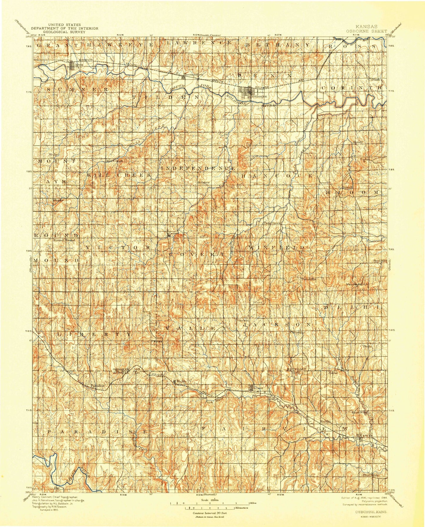
Historical USGS topographic map of Osborn in the state of Kansas. Scale: 1:125000. Print size: 17" x 24"
This map was published in 1896 and is in the following counties: Osborne, Russell.
The map contains contour lines, roads, rivers, towns, streams, and lakes. Printed on high-quality waterproof paper with UV fade-resistant inks.
Contains the following named places: Township of Sumner, Township of Mount Ayr, Alton, Crooked Creek, Township of Tilden, Township of Kill Creek, Bloomington, Kill Creek, East Kill Creek, Township of Independence, Township of Hancock, Osborne, Township of Penn, Covert Creek, Indian Creek, Twin Creek, Township of Corinth, Township of Bloom, Center Twin Creek, East Twin Creek, Downs, Medicine Creek, Township of Round Mound, Eagle Creek, Township of Covert, Township of Winfield, Township of Delhi, Township of Natoma, Township of Paradise, Township of Liberty, Township of Valley, West Fork Wolf Creek, Township of Waldo, Fourmile Creek, Coon Creek, Township of Luray, Township of Jackson, Township of Fairview, East Fork Wolf Creek, Lake Hobbie, Paradise, Waldo, Luray, Lucas, Osborne Diversion Dam, Lucas City Lake Dam, Lucas City Lake, Osborne Canal, Meades Ranch, Mount Ayr, Forney, Corinth, Covert, Vincent, Cheyenne, Osborne County, Motor Cross Race Track, Township of Victor, City of Osborne, Medicine Peak, Sand Mound, Round Mound, Cheyenne Gap, City of Alton, City of Lucas, City of Luray, City of Paradise, City of Waldo, Alton Bluffs, Dry Creek, Gimblet Creek, North Hill, Pilot Mound, Skunk Creek, South Hill, Sunny Slope Mound, Tabletop Hill, Downs Wastewater Treatment Facility, Osborne Sewer Treatment Plant, Osborne Speedway, Alton Wastewater Plant, Lucas Wastewater Treatment Facility, Luray Wastewater Plant, Paradise Wastewater Plant, Osborne Country Club, Shady Bend Golf Course, Osborne County Fairgrounds, United Agricultural Service Grain Elevator Number 4, Paradise Grain Company Grain Elevator Number 1, Midway Co - Operative Association Grain Elevator Number 2, Midway Co - Operative Association Grain Elevator Number 4, Midway Co - Operative Association Grain Elevator Number 1, Midway Co - Operative Association Grain Elevator Number 6, Midway Co - Operative Association Grain Elevator Number 9, Midway Co - Operative Association Grain Elevator Number 12