MyTopo
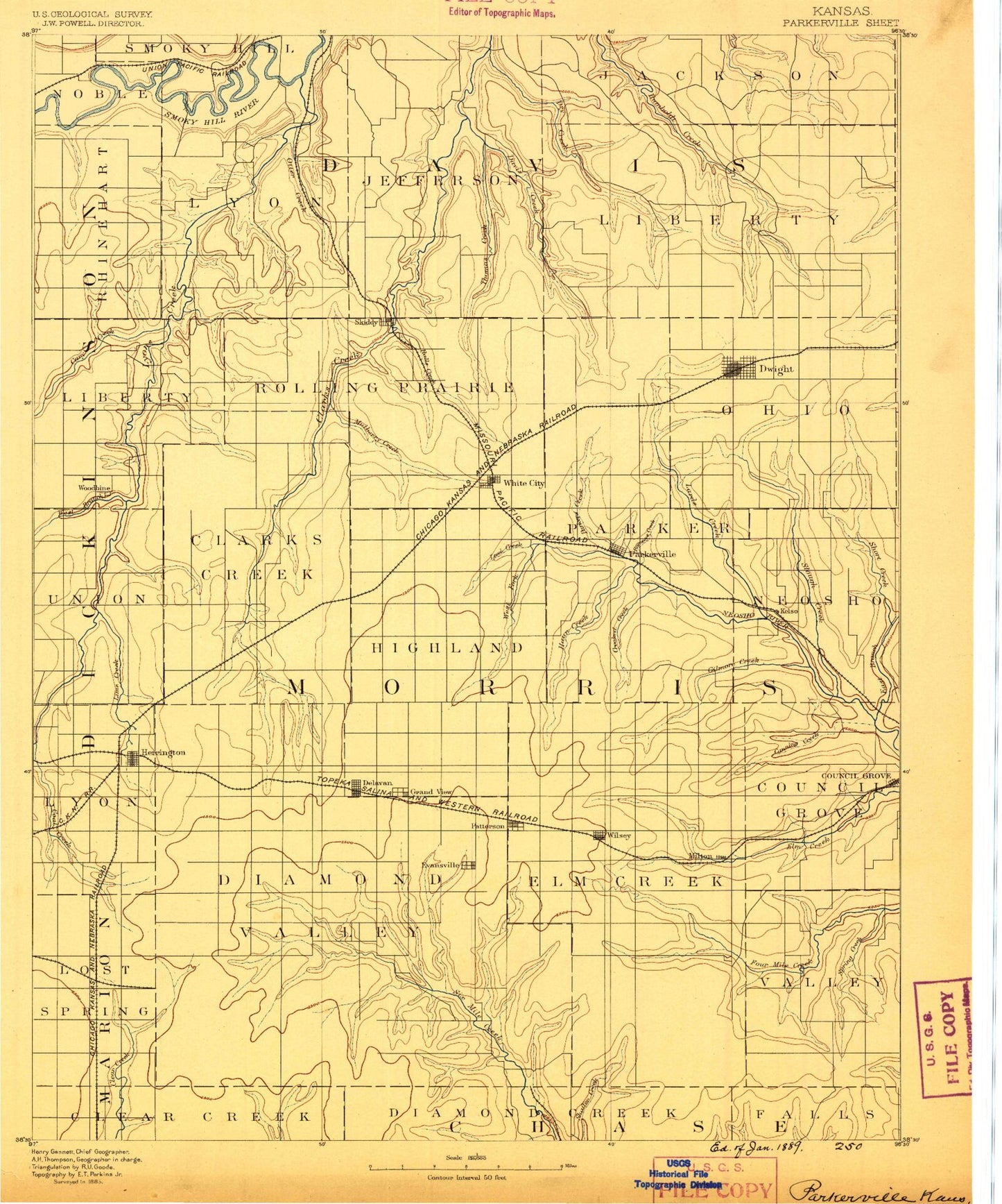
Historic 1889 Parkerville Kansas 30'x30' Topo Map
Couldn't load pickup availability
Historical USGS topographic map of Parkerville in the state of Kansas. Scale: 1:125000. Print size: 16" x 24"
This map was published in 1889 and is in the following counties: Chase, Dickinson, Geary, Marion, Morris, Wabaunsee.
The map contains contour lines, roads, rivers, towns, streams, and lakes. Printed on high-quality waterproof paper with UV fade-resistant inks.
Contains the following named places: Kansas Falls, Township of Rinehart, Camp Aubrey Henning, Schuler Branch, Goat Island, Township of Lyon, Geary County State Park, Otter Creek, Goose Creek, Lyon Creek, Logan Grove Park, Davis Creek, West Branch Davis Creek, West Branch Dry Creek, Dry Creek, Thomas Creek, Township of Liberty, West Branch Humboldt Creek, East Branch Humboldt Creek, Township of Liberty, Township of Union, West Branch Lyon Creek, Woodbine, Carry Creek, Rock Springs Ranch, Camp-Wa-shun-ga, Township of Highland, Mulberry Creek, Skiddy, Township 5, Township 6, Parkers Creek, Ramseys Creek, West Fork Neosho River, Level Creek, Ralls Creek, Haun Creek, Parkerville, White City, Township 4, West Branch Short Creek, East Branch Short Creek, Short Creek, Slough Creek, Lairds Creek, Munkers Creek, Council Grove Lake, Township of Lyon, Kohls Creek, Lime Creek, Lost Springs Oil Field, Lake Herington, Herington, Threemile Creek, Mile-and-a-Half Creek, Delavan, Latimer, Township 7, Crooked Creek, Wilsey, Township 9, Gilmore Creek, Canning Creek, Neosho Park Recreation Area, Canning Creek Cove Recreation Area, Richey Cove North Recreation Area, White Memorial Camp, Council Grove Dam, Ritchey Creek, Township of Lost Springs, Lost Springs, Sixmile Creek, Camp Creek, Mulberry Creek, Burdick, Spring Creek, Dodds Creek, Township 8, School Creek, Silver Creek, Pickett Creek, East Creek, Spring Creek, Paddy Creek, Council Grove Wildlife Area, Geary State Fishing Lake and Wildlife Area, Geary County State Lake Dam, Herington City Dam, Helmick, Geary County State Lake, The Mall, Kansas Falls, Wreford, Lyona, Diamond Springs, Shady Brook, Kelso, Morris County, Township 3, Dwight, Township of Blakely, City of Herington, Township of Overland, City of Dwight, City of Latimer, City of Lost Springs, City of Parkerville, City of White City, City of Wilsey, City of Woodbine, Herington Wastewater Plant, Dwight Wastewater Treatment Plant, Wilsey Wastewater Treatment Facility, Junction City - Southwest Wastewater Plant, White City Wastewater Treatment Facility, Union Pacific Railroad Herington Yard, Herington Fairgrounds, Lost Springs Wastewater Plant, Woodbine Wastewater Treatment Facility, Koepke Mobile Manor, Council Grove Country Club, Herington Country Club, North Central Kansas Co - Operative Association Grain Elevator Number 4, Agricultural Producers Grain Elevator Number 5, Comp Farm, Herpich Farm, Wendt Farm, Kniebel Farms, Kasten Farms, Seth Angus Farm, Calling Winds Farm, Spring Creek Ranch, Carson Dairy, Stilwell Ranch, Gieswein Farm, Oleen Farms, Johnson Farms, Miller Dairy Farm, Eisenhut Farm, Sunny Slope Farms, Pattersons Farm, Slash N Ranch, Spirit Winds Ranch, Wittman Farm, Kniebel Farms, Sacred Heart Farms, Biehler - Ecklund Farms, Two R Farms, Santa Fe Farms, Morton Farm, Gentz Farms


