MyTopo
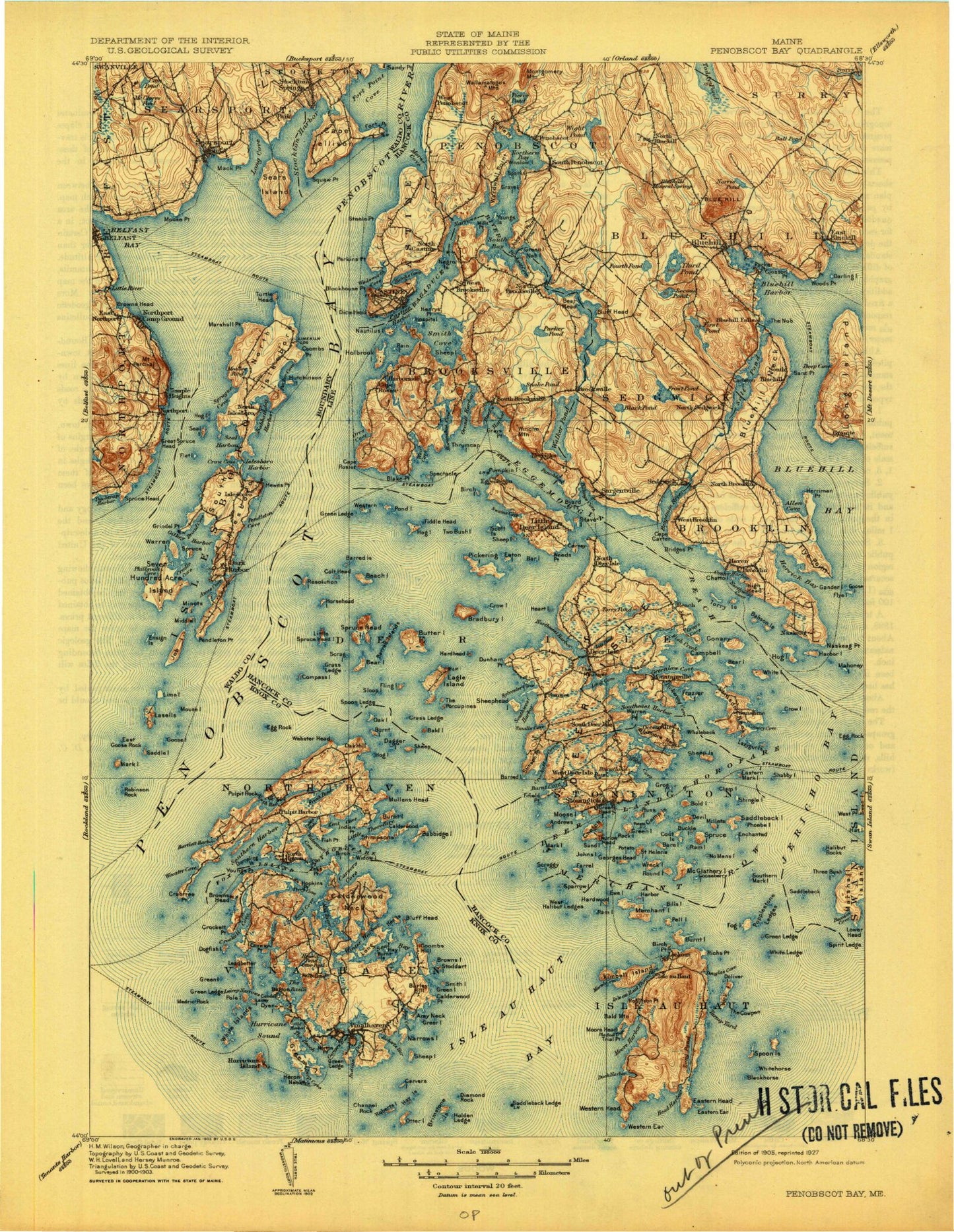
Historic 1905 Penobscot Bay Maine 30'x30' Topo Map
Couldn't load pickup availability
Historical USGS topographic map of Penobscot Bay in the state of Maine. Scale: 1:125000. Print size: 16" x 24"
This map was published in 1905 and is in the following counties: Hancock, Knox, Waldo.
The map contains contour lines, roads, rivers, towns, streams, and lakes. Printed on high-quality waterproof paper with UV fade-resistant inks.
Contains the following named places: Abrams Mountain, Allen Cove, Ames Cove, Ames Cove, Ames Point, Ames Pond, Amesbury Point, Arey Cove, Arey Ledges, Arey Neck, Babbidge Island, Babson Island, Backwood Mountain, Bagaduce River, Bakeman Beach, Bakeman Cove, Bald Island, Bald Mountain, Banks Cove, Bar Island, Bare Island, Barley Hill, Barred Island, Barred Island, Barred Islands, Bartlett Harbor, Barton Island, Battle Island, Bayside, Beach Island, Bear Head, Bear Island, Bear Island, Beech Hill, Beech Island Pond, Belfast Bay, Belfast Reservoir Number One, Bells Marsh, Benjamin River, Benson Brook, Bickmore Point, Billings Brook, Billings Cove, Billys Shore, Birch Island, Birch Island, Birch Point, Birch Point, Black Dina, Black Ledges, Black Pond, Blake Point, Blastow Cove, Blockhouse Point, Blue Hill, Blue Hill, Blue Hill Bay, Blue Hill Falls, Blue Hill Harbor, Blue Hill Neck, Bluff Head, Bluff Head, Bobs Point, Bog Brook, Bold Island, Bounty Cove, Boxam Cove, Bradbury Island, Brimstone Island, British Canal, Broad Cove, Broad Point, Brooklin, Brooksville, Broom Island, Browns Cove, Browns Head, Browns Island, Buck Island, Buckle Island, Buckmaster Neck, Bull Brook, Buring Point, Burnt Cove, Burnt Island, Burnt Island, Burntland Pond, Byard Point, Cain Pond, Calderwood Island, Calderwood Neck, Calderwood Point, Calderwood Point, Cals Beach, Camp Field Stream, Camp Island, Camp Stream, Camp Stream Bog, Campbell Island, Cape Carter, Cape Jellison, Cape Rosier, Carleton Island, Carleton Stream, Carney Island, Carter Point, Stills Point, Carver Cove, Carvers Harbor, Carvers Island, Carvers Pond, Castine, Castine Harbor, Cat Cove, Caterpillar Mountain, Cedar Island, Cedar Pond, Center Harbor, Chandler Parker Mountain, Channel Rock, Channel Rock, Channel Rock, Charles Howard Point, Charlottes Cove, Chatto Island, Clam Island, Clements Brook, Closson Cove, Coles Point, Colt Head Island, Compass Island, Conary Cove, Conary Island, Conary Point, Condon Point, Conway Point, Coombs Cove, Cooms Hill, Coombs Islands, Coombs Mountain, Coombs Neck, Coombs Point, Coot Islands, Crabtree Point, Cradle Cove, Crane Island, Hospital Island, Crockett Branch, Crockett Cove, Crockett Cove, Crockett Point, Crotch Island, Crotch Island, Crow Cove, Crow Island, Crow Island, Cubby Hole, Dagger Island, Dagger Ledge, Dark Harbor, Dark Harbor, Darling Island, Deadman Cove, Decker Point, Deep Cove, Deep Cove, Deep Cove, Deep Hole, Deer Island Thorofare, Deer Isle, Deer Isle, Devereaux Cove, Devil Island, Devils Head, Diamond Rock, Dodges Point, Dog Island, Dogfish Island, Doliver Island, Duck Harbor, Duck Harbor Mountain, Ducktrap Harbor, Duffy Cove, Duffy Point, Dunham Point, Durham State Forest, Dyer Island, Dyer Pond, Eagle Island, East Blue Hill, East Goose Rock, East Penobscot Bay, Eastern Head, Eastern Mark Island, Eaton Island, Egg Rock, Egg Rock, Eggemoggin, Eggemoggin Reach, Emerson Point, Enchanted Island, Ensign Island, Ewe Island, Farrel Island, Fiddle Head, Fiddlehead Island, Fifield Point, Fire Island, Fire Island, First Pond, Fish Creek, Fish Head, Flat Island, Flea Island, Fling Island, Flood Stream, Flye Island, Fog Island, Folly Ledge, Folly Pond, Fort Point, Fort Point Cove, Fort Point State Park, Fourth Pond, Fox Islands Thorofare, Fox Rocks, Fresh Pond, Fresh Pond, Frost Pond, Gander Island, George Head Island, George Head Ledge, Georges Pond, Goose Cove, Goose Falls, Goose Island


