MyTopo
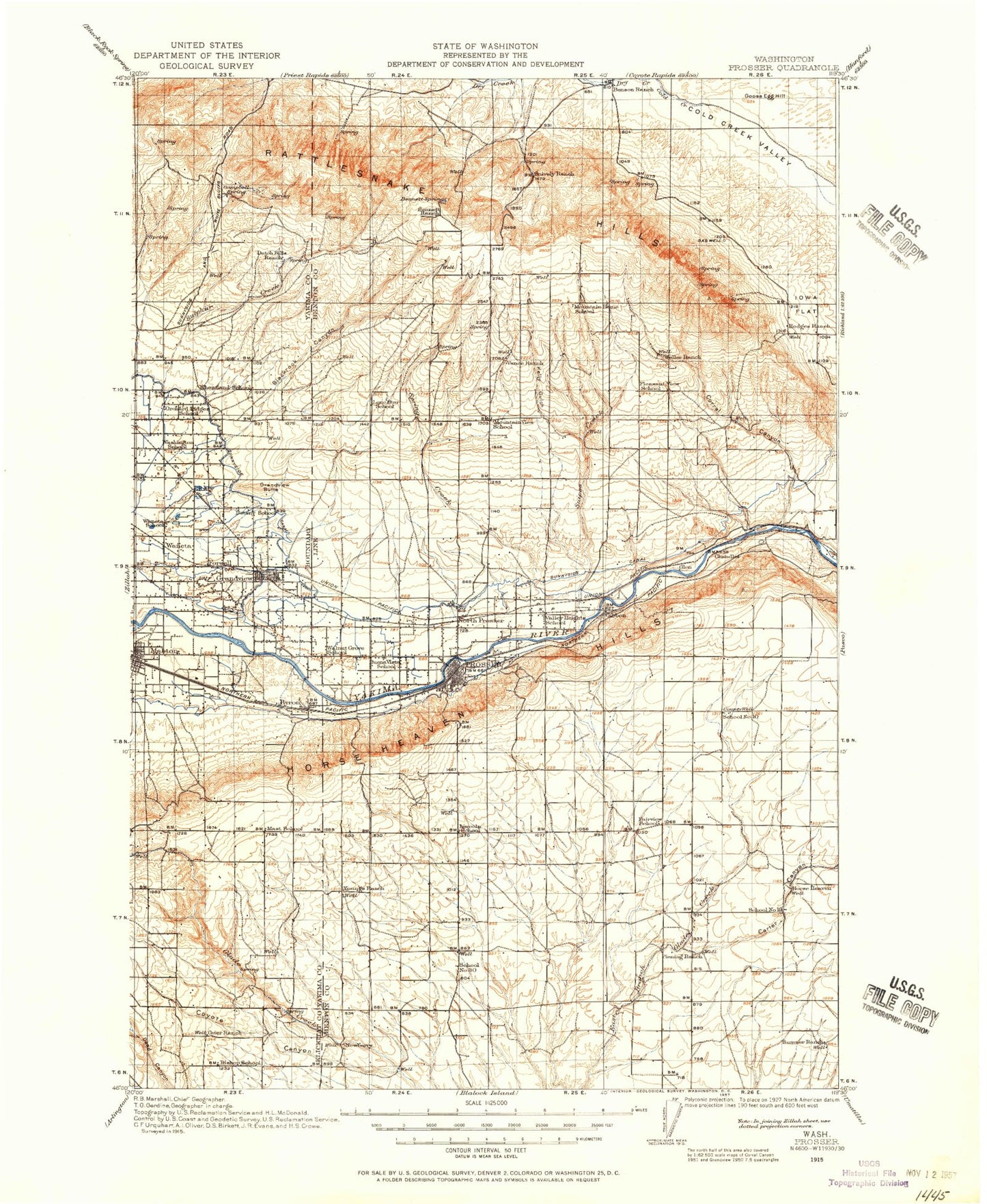
Historic 1915 Prosser Washington 30'x30' Topo Map
Couldn't load pickup availability
Historical USGS topographic map of Prosser in the state of Washington. Scale: 1:125000. Print size: 18" x 24"
This map was published in 1915 and is in the following counties: Benton, Klickitat, Yakima.
The map contains contour lines, roads, rivers, towns, streams, and lakes. Printed on high-quality waterproof paper with UV fade-resistant inks.
Contains the following named places: Airport Ranch, Anderson Ranch, Badlands Lakes, Bennett Ranch, Benson Ranch, Carter Canyon, Chandler Butte, Chandler Canal, Corral Canyon, Corral Creek, Coyote Canyon, Crow Canyon, Davis Ranch, East Turbine Lateral, Grandview Butte, Hodges Ranch, Iowa Flats, Kelly Gulch, Kiona Canal, Lenzie Ranch, Mabton Feeder Lateral, Mabton Siphon, McWhorter Ranch, Missouri Flats, Oleys Lake, Outlook Siphon, Prosser East Lateral, Prosser West Lateral, Rocky Ford Lateral, Sagebrush Ridge, Sagebrush Ridge, Snipes Creek, Snively Basin, Snively Gulch, Snively Ranch, Spring Creek, Sulphur Creek, Sulphur Creek Ranch, Sunnyside Canal, The Badlands, Washout, West Turbine Lateral, Youngs Ranch, Sagebrush Ridge, The Gap, West Grandview Lateral, Prosser West Lateral, Rattlesnake Hills Research Natural Area, Royer Hill, Apricot, Blacks Corner, Byron, Chaffee, Givens Corner, North Prosser, Black Canyon, Gibbon, Grandview Water Shed, Biggam, Goose Egg Hill, Grandview, Mabton, Prosser, Rattlesnake Mountain, Whitstran, Benton County, Eastway Shopping Center, Horse Heaven Hills, Rattlesnake Slope State Wildlife Recreation Area, Byron Ponds, Lichty, Mabton East Lateral, Mabton West Lateral, Mathieson Lateral, Stassen Park, Westside Park, Sunnyside Wildlife Recreation Area, Forsell, Lookout, Horse Heaven, Farrand Park, Byron Ponds Dam, Marvin Eberle Dam, Prosser Dam, Chandler Power and Pumping Plant, Lower Valley Golf Club, Pump Station Number 10, Pumping Station Number 12, Pumping Station Number 13, Sunny-Grand Speedway, Grandview Substation, Chandler, Benton City Division, Northwest Benton Division, City of Grandview, City of Mabton, City of Prosser, Sunnyside Waterfowl Management Area, Hanford Reach National Monument