MyTopo
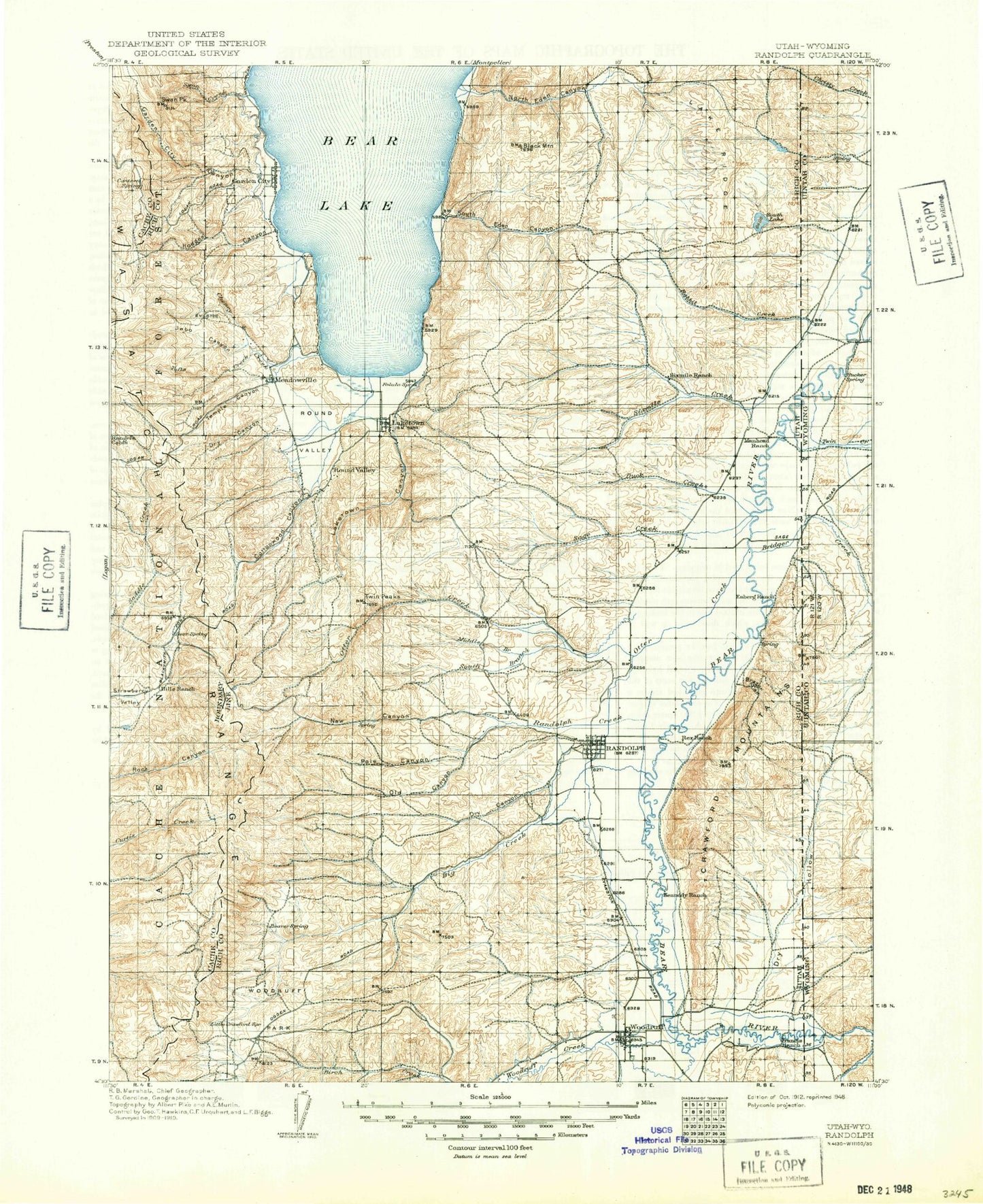
Historic 1912 Randolph Utah 30'x30' Topo Map
Couldn't load pickup availability
Historical USGS topographic map of Randolph in the state of Utah. Scale: 1:125000. Print size: 17" x 24"
This map was published in 1912 and is in the following counties: Bear Lake, Cache, Lincoln, Rich, Uinta.
The map contains contour lines, roads, rivers, towns, streams, and lakes. Printed on high-quality waterproof paper with UV fade-resistant inks.
Contains the following named places: Christy Canyon, Bear Lake, Swan Flat, Bear Lake Summit, Bear River Canal, Beckwith and Quinn Canal, Benjamin Mine, Big Ditch, Birch Creek Reservoirs, Black Mountain, Black Mountain Creek, Booth Canal, Boundary Hills, Brazier Canyon, Camp Bear Lake, Camp Hunt, Cherokee Mine, Chubby Hollow, Cisco Beach, Coal Hollow, Cottonwood Creek, Cottonwood Creek, Crawford Mountains, Crawford Thompson Canal, Currant Creek, Dry Basin, Dry Basin Reservoir, Dry Creek, Dry Hollow, Dry Hollow Flats, Dry Hollow Reservoir, Duck Creek, East Branch South Fork South Eden Canyon, Frank Mine, Garden City, Garden City Canyon, Genes Creek, Goblin Gulch, Grouse Hollow, Higgins Hollow, Higgins Hollow Reservoir, Hodges Canyon, Hogback Ridge, Horse Flat, Ideal Beach, Kearl Ranch, Kennedy Ditch, Lake Ridge, Laketown, Larson Dam, Left Hand Fork Lone Pine Canyon, Left Hand Fork Old Laketown Canyon, Left Hand South Fork North Eden Canyon, Lewis Ridge, Limestone Peak, Limestone Reservoir, Little Creek, Little Creek Reservoir, Little Long Hill, Little Long Hill Reservoir, Live Slough, Lone Pine Canyon, Lower North Eden Reservoir, Mahogany Canyon, McMinn Canal, Middle Branch South Fork South Eden Canyon, Middle Fork Tufts Creek, Middle Sink, Nebeker Ranch, Neville Canal, North Eden Canyon, North Fork Sage Creek, North Fork Sixmile Creek, North Lake, North Lake Canyon, North Sink, Old Laketown Canyon, Pickelville, Pine Canyon, Pole Fork, Pump Ditch, Randolph, Randolph Camp Historical Monument, Randolph Ranger Station, Randolph Woodruff Canal, Randolph Woodruff Extension Canal, Red Knoll, Red Knoll, Rees Canal, Rex Canal, Rex Peak, Rex Ranch, Richardson Fork, Right Hand South Fork North Eden Canyon, Sage Creek, Sage Creek Canal, Sage Hollow, Sage Hollow Reservoir, Sheeppen Creek, Sidehill Ditch, Sixmile Creek, Sixmile Reservoir, South Eden Canyon, South Eden Reservoir, South Fork Cheney Creek, South Fork North Eden Canyon, South Fork Sixmile Creek, South Fork South Eden Canyon, South Lake, South Lake Canyon, South Sink, Spring Canyon, Sugarloaf, Sunrise Campground, Swan Creek, Swan Flat, Swan Peak, Swan Peak Pond, Thousand Dollar Ridge, Twin Hollows, Upper North Eden Reservoir, Valley Ridge, Warner Hollow, West Branch South Fork South Eden Canyon, Wood Pass, Woodruff, Bear Lake Marina Campground, Bear Lake Rendezvous Beach Campground, Birch Creek Campground, Fays Trailer Park, Limber Pine Trail, Little Creek Campground, Woodruff Pastures, Lakota, Old Limber Pine, Sage Creek Junction, Allan Hollow, Arbs Basin, Baker Knoll, Basin Beaver Ponds, Baxter Sawmill, Bear Lake, Bear Wallow, Big Crawford Creek, Big Creek, Big Creek, Birch Creek, Bob Kiddys Hole, Bowery Fork, Burnt Fork, Cheney Creek, Chicken Creek, Cook Reservoir, Corral Hollow, Cottonwood Canyon, Crawford Canyon, Curtis Creek Guard Station, Curtis Ridge, Cutoff Canyon, Cutoff Ridge, Davenport Hollow, Deadman Gulch, Deer Lick Reservoir, Dry Canyon, Dry Canyon, Dry Fork, Dry Lake, Edgar Canyon, Elk Valley, Elk Valley Guard Station, Elmo Pond, Fence Reservoir, Frazier Hollow, Gorge Canyon, Green Fork New Canyon, Green Fork Reservoir, Green Fork Sink, Hardware Ranch Trail, Hells Hollow, Hump Pond, Jebo Canyon, Jebo Flats, Kearl Pond, Kearl Reservoir, Laketown Canyon, Lamb Canyon, Little Creek, Little Strawberry Valley, Lodgepole Canyon, Lodgepole Reservoir, Log Cabin Hollow, Log Cabin Ridge, Lone Pine Flat, Long Ridge, Meadowville, Meadowville Creek, Meadowville Valley, Middle Branch Otter Creek, Middle Davenport Reservoir, Mill Hollow, Monument Peak, New Canyon, North Gorge Canyon, Old Canyon, Old Canyon Basin, Otter Creek, Pole Canyon, Pole Hollow, Randolph Creek, Red Pine Canyon, Red Spur Mountain, Right Fork Old Canyon, Round Valley, Roy Hollow, Saleratus Creek, Six Bit Hollow, Slideout Canyon, South Branch Otter Creek, South Fork Jebo Canyon, South Fork Tufts Creek, Spence Basin Sink, Spencer Basin, Spring Creek, Strawberry Valley, Temple Canyon, Temple Flat, The Valley, Tufts Creek, Twin Peaks, Valley Sink, Walton Canyon, Walton Gulch, Wes Reservoir, Woodruff Park, Rich County, Bug Lake


