MyTopo
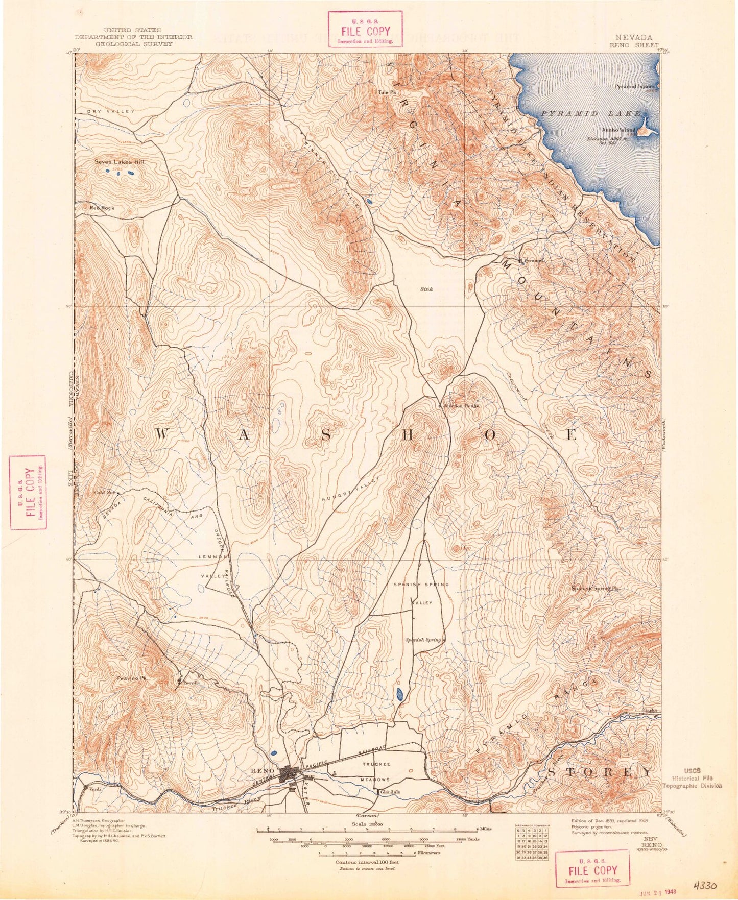
Historic 1893 Reno Nevada 30'x30' Topo Map
Couldn't load pickup availability
Historical USGS topographic map of Reno in the state of Nevada. Scale: 1:125000. Print size: 17" x 24"
This map was published in 1893 and is in the following counties: Lassen, Storey, Washoe.
The map contains contour lines, roads, rivers, towns, streams, and lakes. Printed on high-quality waterproof paper with UV fade-resistant inks.
Contains the following named places: Dog Creek, Sunrise Creek, Ambrose Park, Antelope Valley, Ardmore Park, Axe Handle Canyon, Bacon Rind Flat, Bedell Flat, Black Canyon, Canoe Hill, Cinch Mine, Cottonwood Creek, Curnow Canyon, Deer Park, Dogskin Mountain, Dry Lake, Evans Park, Golden Valley, Granite Peak, Griffith Canyon, Hardscrabble Creek, Hay Canyon, Hungry Mountain, Idlewild Park, Irving Park, Lagomarsino Canyon, Lake Park, Little Valley, Mahogany Flat, Manzanita Lake, Mullen Pass, North Fork Dry Valley Creek, North Truckee Drain, North Truckee Irrigation Ditch, Oppio Park, Panther Valley, Paradise Park, Pickett Park, Pioneer Ditch, Quail Canyon Ranch, Rattlesnake Canyon, Recall Mine, Red Rock Canyon, Red Rock Valley, Reno Mizpah Mine, Riverside Park, Scott Island, Seven Lakes Mountain, Spanish Springs Canyon, Spanish Springs Ranch, Spanish Springs Valley, Stewart Park, Taylor Memorial Park, Tick Canyon, Tule Peak, Tule Ridge, Updike Mine, Upper Dry Valley, Warm Springs Mountain, Warm Springs Valley, West Reno, Whitaker Park, Wilcox Canyon, Wilcox Ranch, Wildcat Hill, Wilkinson Park, Winnemucca Valley, Anaho Island, Hungry Valley, Perry Canyon, Mustang, Porcupine Mountain, Raleigh Heights, Red Rock, Dry Lakes, Cambell Mine, Crown Prince Mine, Pacific Pyramid Mine, Infant Mine, Delongchamps Mine, Dandrea Ranch, Jones Ranch, Kleppe Ranch, Stevens Ranch, Sparks Sewage Disposal Plant, Garayenta Ranch, Casci Ranch, Shadow Ranch, Figoni Ranch, Kimberly Hill, NAA Weather Station, Blondell Ranch, Norton Mill, Harolds Trap Shooting Club, Peri Ranch, Peri Ranch, Stead Ranch, Antelope Run, Anderson Ranch, Wedekind, Railroad Pass, Prosser Valley Ditch, Ransome, Round House, State Highway Maintenance Shops, Dickinson Ranch, Lemmon Valley Ranch, Reno Sewage Disposal Plant, BLM Fire Guard Station, Wunotoo, Sterling Village Shopping Center, University Village East Shopping Center, North Hill Shopping Center, Lemmon Valley Shopping Center, Shoppers Square, Lakeside Plaza, Park Lake Center, Plumb Lane Plaza, Town and Country Shopping Center, Silverada Mall, Pyramid Park Shopping Center, Ideal Shopping Center, Plaza 800, K-Mart Plaza, Oddie Mall, South Virginia Plaza, Keystone Square, Village Shopping Center, McCarran Plaza, Iron Horse Shopping Center, Silver State Plaza, Tuffstone Products Company Mine, Sturtevants Ranch, Mustang Ranch, McCarran Pit, Red Ravine Creek, Hells Trap Shoot, McCarran Ditch, Piute Canon, Hardscrabble Canon, Cottonwood Canon, McClellans Creek, Reno-Stead, Curnow Range, French Mountains, Greenbrae Shopping Center, Long Valley Creek, Mullen Creek, Needle Rock, Orr Ditch, Patrick, Paiute Canyon, Paiute Creek, The Pyramid, Right Hand Canyon, Sugarloaf Peak, Sun Valley, Sun Valley, Spanish Springs, Sand Hills, Lees Flat, Red Canyon, Moses Rock, Moses Rock Canyon, Eagle Canyon, Pelican Point, Lombardo Point, Mushroom Rock, Tamarack Bay, Indian Head Rock, Jackass Peak, Quail Canyon, Ruth Mine, Fraser Flat, Twentyone Mile Hill, Painted Hills, 102 Ranch, Tracy Pond, Tracy Powerplant, Old Lonesome, Chalk Bluff, Giants Throne, Giants Throne Canyon, Chalk Bluff Canyon, Hafed Canyon, Hungry Ridge, Boneyard Flat, Stormy Canyon, Sun Valley Park, Wildcreek Golf Course, Rancho San Rafael Park, Northwest Park, Governors Bowl Park, Brodhead Memorial Park, Fishermans Park, Rock Park, Glendale Park, Caughlin Park, Amione Park, Shadow Mountain Park, Shelly Park, Church Park, Longford Park, Horsemens Park, Winnemucca Ranch, South Fork Dry Valley Creek, Little Valley, Baker Park, University of Nevada Experimental Farm, Panther Valley, Golden Valley, Lemmon Valley, Grand View Terrace, Trail Ranch, Gardella Ranch, Nevada Patrol Weighing Station, Ferretto Ranch, Verdi Fish Hatchery, Junction House Range, Hungry Range, Peavine Mountain, Sugar Loaf, Meadow Valley, Blue Ravine, Yuba Canon, India Ravine, McKissick Canyon, Reno-Sparks Indian Colony, Home Ranch Canyon, Burgess Park, Anaho Island National Wildlife Refuge, Nevada Dominion Mine, Jones Kincaid Mine, Wedekind Mine, Wedekind Mining District, Arkell Mine


