MyTopo
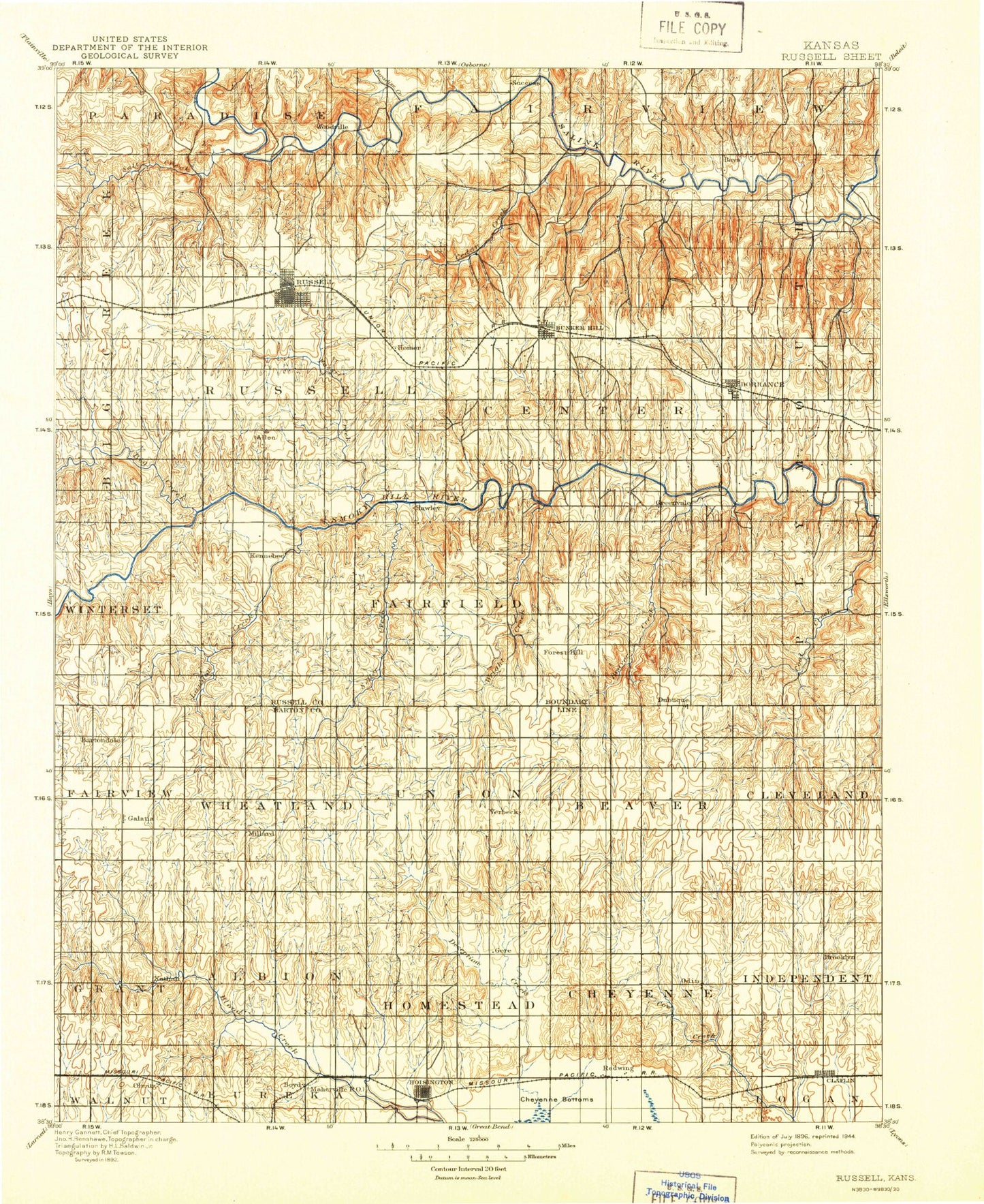
Historic 1896 Russel Kansas 30'x30' Topo Map
Couldn't load pickup availability
Historical USGS topographic map of Russel in the state of Kansas. Scale: 1:125000. Print size: 17" x 24"
This map was published in 1896 and is in the following counties: Barton, Russell.
The map contains contour lines, roads, rivers, towns, streams, and lakes. Printed on high-quality waterproof paper with UV fade-resistant inks.
Contains the following named places: Big Creek, Paradise Creek, Boswell Creek, Wilson Lake, Gorham Oil Field, Walker Creek, Salt Creek, Township of Big Creek, S and S Oil Field, Township of Russell, Russell Oil Field, Fossil Creek, Memorial Park, Russell, Claussen Oil Field, Cedar Creek, Township of Center, Bunker Hill, Elm Creek, Lucas Park Recreation Area, Wilson State Park, Minooka Park Recreation Area, Township of Plymouth, Hell Creek, Township of Winterset, Township of Grant, Township of Lincoln, Township of Fairfield, Hall Gurney Oil Field, Landon Creek, Sellens Creek, Fossil Lake, Goose Creek, Beaver Creek, Dorrance, Township of Fairview, Township of Wheatland, Galatia, Nuss Oil Field, Templing Oil Field, Milberger, Strecker Oil Field, Strick Oil Field, Boxberger West Oil Field, Roosevelt Oil Field, Susank, Township of Union, Deception Creek, Beaver, Beaver Oil Field, Kraft-Prusa Oil and Gas Field, Beaver South Oil Field, Township of Beaver, Beaver North Oil Field, Dubuque Oil and Gas Field, Hall-Gurney Oil and Gas Field, Lang Oil Field, Meier Oil Field, Hitschmann, Township of Cleveland, Davidson Oil Field, Driscoll Oil and Gas Field, Township of Grant, Township of Albion, Olmitz, Boyd Oil Field, Carroll Oil Field, Mary A Oil Field, Leoville Oil Field, Matter Oil Field, Township of North Homestead, South Hoisington, Hoisington, Redwing, Redwing Oil Field, Township of Cheyenne, Odin Oil Field, Township of Independent, Odin, Claflin, Cardinal Park Shopping Center, Balta, Homer, Millard, Stickney, Dubuque, Boyd, Russell County, City of Hoisington, City of Russell, City of Bunker Hill, City of Claflin, City of Dorrance, City of Galatia, City of Susank, City of Olmitz, Wilson State Park Hell Creek Boat Ramp, Wilson State Park Big Bluestem Campground, Wilson State Park Buffalograss Campground, Wilson State Park Foxtail Campground, Wilson State Park Grama Campground, Wilson State Park Little Bluestem Campground, Wilson State Park Lovegrass Campground, Wilson State Park Side Oats Campground, Wilson State Park Switchgrass Campground, Wilson State Park Wheatgrass Campground, Claflin Wastewater Plant, Hoisington Sewer Treatment Plant, Kansas Territory Enterprises Industrial Park, Russell County Landfill, Hoisington Municipal Power Plant, Russell Municipal Power Plant, Kansas Department of Transportation Russell County Rest Area, Russell County Fairgrounds, Susank Wastewater Plant, Bunker Hill Wastewater Plant, Olmitz Wastewater Plant, Dorrance Wastewater Plant, Russell Wastewater Treatment Plant, Dumler Mobile Home Estates, Lipprand Trailer Park, El Privado Camping and Fishing Lodge, Triple - J Camper Park, United Agricultural Service Grain Elevator Number 2, United Agricultural Service Grain Elevator Number 3, United Agricultural Service Grain Elevator Number 5, United Agricultural Service Grain Elevator Number 6, Ellsworth Co - Operative Grain Elevator Number 4, Great Bend Co - Operative Association Grain Elevator Number 3