MyTopo
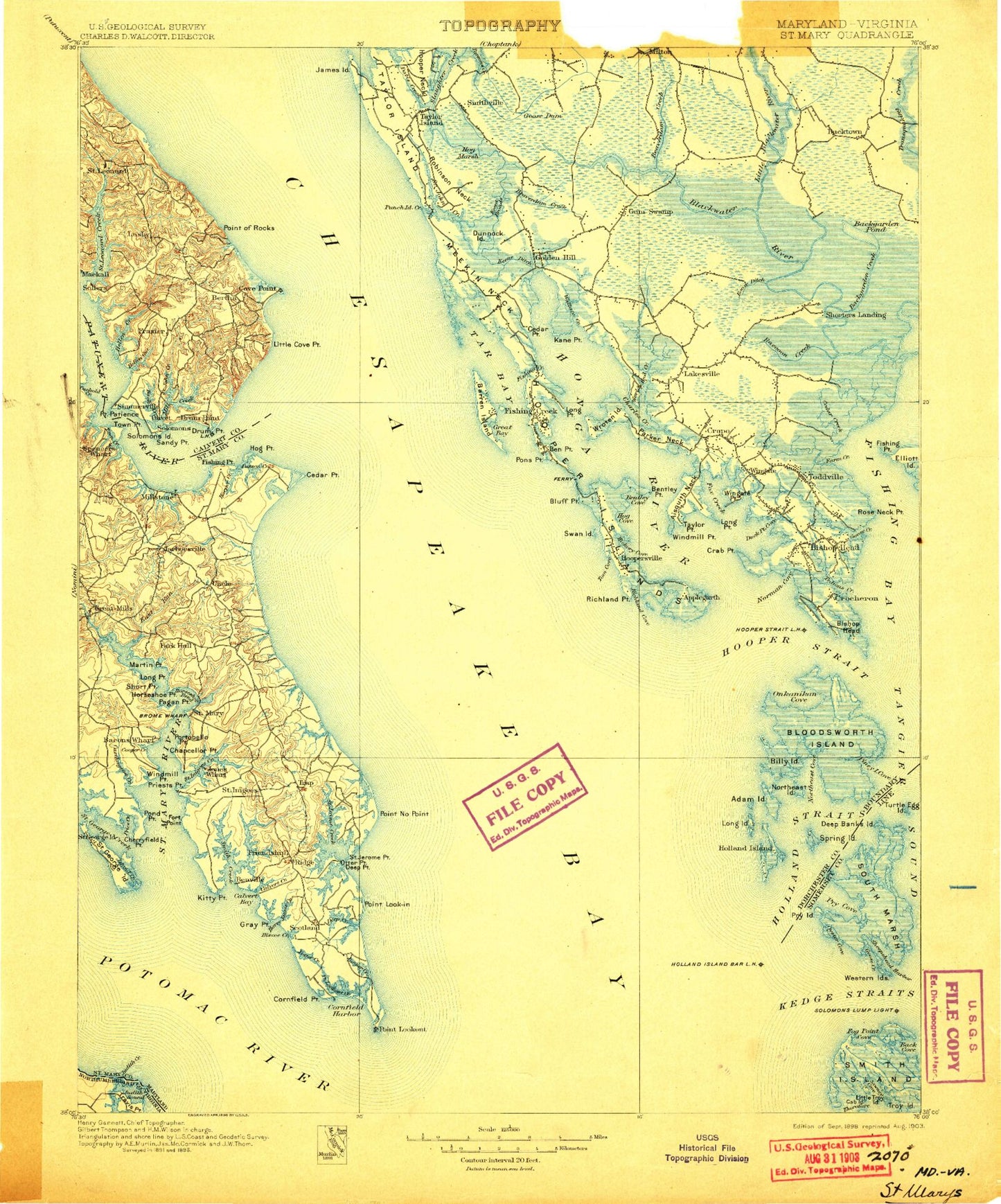
Historic 1898 Saint Marys Maryland 30'x30' Topo Map
Couldn't load pickup availability
Historical USGS topographic map of Saint Marys in the state of Maryland. Scale: 1:125000. Print size: 17" x 24"
This map was published in 1898 and is in the following counties: Calvert, Dorchester, Northumberland, Somerset, St. Mary's.
The map contains contour lines, roads, rivers, towns, streams, and lakes. Printed on high-quality waterproof paper with UV fade-resistant inks.
Contains the following named places: Aaron Cove, Andrews, Ant Bar, Appeal, Asquith Island, Back Creek, Back Creek, Backgarden Creek, Backgarden Pond, Barbadoes Pond, Barbeque Point, Bards Point, Barren Island, Barren Island Gap, Barren Island Point, Barren Island Thorofare, Beaverdam Creek, Becker Island Marsh, Bentley Cove, Bentley Point, Bettys Island, Between the Dams, Big Thorofare River West Light, Billys Point, Birch Dam Creek, Bishops Head Marsh, Bishops Head Point, Blackwater National Wildlife Refuge, Blackwater Point, Blackwater Pond, Blackwater River, Bloodsworth Point, Bluff Point, Boat Island, Boggs Gut, Bow Cove, Brant Hole, Brant Hole Point, Breedens Point, Bridge Creek, Bridge Creek, Brooks Cove, Brown Creek, Bull Point, Bull Point Island, Bullock Creek, Bullock Pond, Buttons Creek, Buttons Neck, Buzzard Island Creek, Calams Run, Calvert Beach Run, Camp Conoy, Cat Cove, Cators Cove, Cattail Island, Cattail Pond, Cedar Creek, Cedar Creek Marsh, Cedar Creek Point, Cedar Point, Cedar Point, Channel Point, Channel Point Gut, Chapel Cove, Charity Point, Charles Creek, Cherry Island, Cherry Ridge, Clay Point, Cobb Creek, Codes Point, Coles Creek, Coles Creek, Corsey Creek, Coster Cove, Coulson Pond, Cove Point, Cove Point, Cove Point, Cove Point Hollow, Cove Point Marsh, Cow Cove, Cow Island, Cow Point, Cow Point, Cow Point Marsh, Crab Point, Crab Point Cove, Creek Point, Davis Creek, Dicks Point, Dicks Point, Docs Point, Dragon Swamp, Drum Point, Drum Point Pond, Duck Point, Duck Point Cove, Dunnock Island, Dunnock Island Creek, Dunnock Slough, Edgars Ridge, Eel Hope Point, Egypt Cove, Elliott Island, Farm Creek, Farm Creek Marsh, Ferry Point, Fin Creek, Fin Creek Ridge, Fishing Bay, Fishing Creek, Fishing Creek, Fishing Creek, Fishing Point, Fishing Point, Fishing Point, Fishing Point, Fishing Point, Flag Cove, Flag Ponds, Flowers Cove, Fog Point, Fog Point Cove, Fox Creek, Fox Point, Fishing Creek, Goldstein Branch, Goose Creek, Goose Creek, Goose Dam, Goose Pond, Grays Creek, Great Cove, Great Cove, Great Cove Creek, Great Cove Island, Great Cove Point, Great Marsh, Great Marsh, Great Marsh Creek, Green Brier Swamp, Groggs Point, Grover Creek, Grovers Creek, Guinea Marsh, Gum Island, Gum Swamp, Gunbarrel Cove, Gunbarrel Point, Gunlow Point, Gunners Cove, Gunners Island, Gunners Point, Harpers Marsh, Harpers Pond, Harts Point, Hearns Cove, Hearns Creek, Hell Hook Marsh, Hellen Bar, Hellen Creek, Hickory Cove, Hickory Point, Hickory Point Gut, Hog Marsh Creek, Hog Marsh Gut, Hog Range, Hog Range Marsh, Hog Rooting Pond, Holland Island Bar Lighthouse, Holland Point, Holland Straits, Holts Ridge Gut, Honga River, Honga River Light, Hooper Island Lighthouse, Hooper Neck, Hooper Strait Light, Hope Point, Hopkins Cove, Horse Point, House Point, Houston Cove, Houston Point, Hudson Creek, Hughs Dam Creek, Hutchins Cove, Insley Cove, Jacks Creek, James Island, Janes Point, Jenny Island, Jimson Weed Marsh, Jobs Ditch, Joes Cove, Joes Ridge, Joes Ridge Creek, Johns Creek, Johns Point, Johnson Cove, Johnson Point, Kedges Straits, Keenes Ditch, Kentuck Swamp, Kirwan Neck, Kings Creek, Kits Point, Lakes Cove, Lans Pond, Laveel Branch, Leason Cove, Lighting Knot Cove, Little Blackwater River, Little Cove Point, Little Creek, Little Creek Marsh, Little Pungers Creek, Long Cove, Long Creek, Long Marshes, Long Point, Long Point, Long Point, Long Point, Lot Lane, Lower Hooper Island, Lower Island Point, Lower Keene Broad, Lower Wroten Point, Lowes Creek, Lusby Point, Ma Leg Island, Maddox Island, McCreadys Cove


