MyTopo
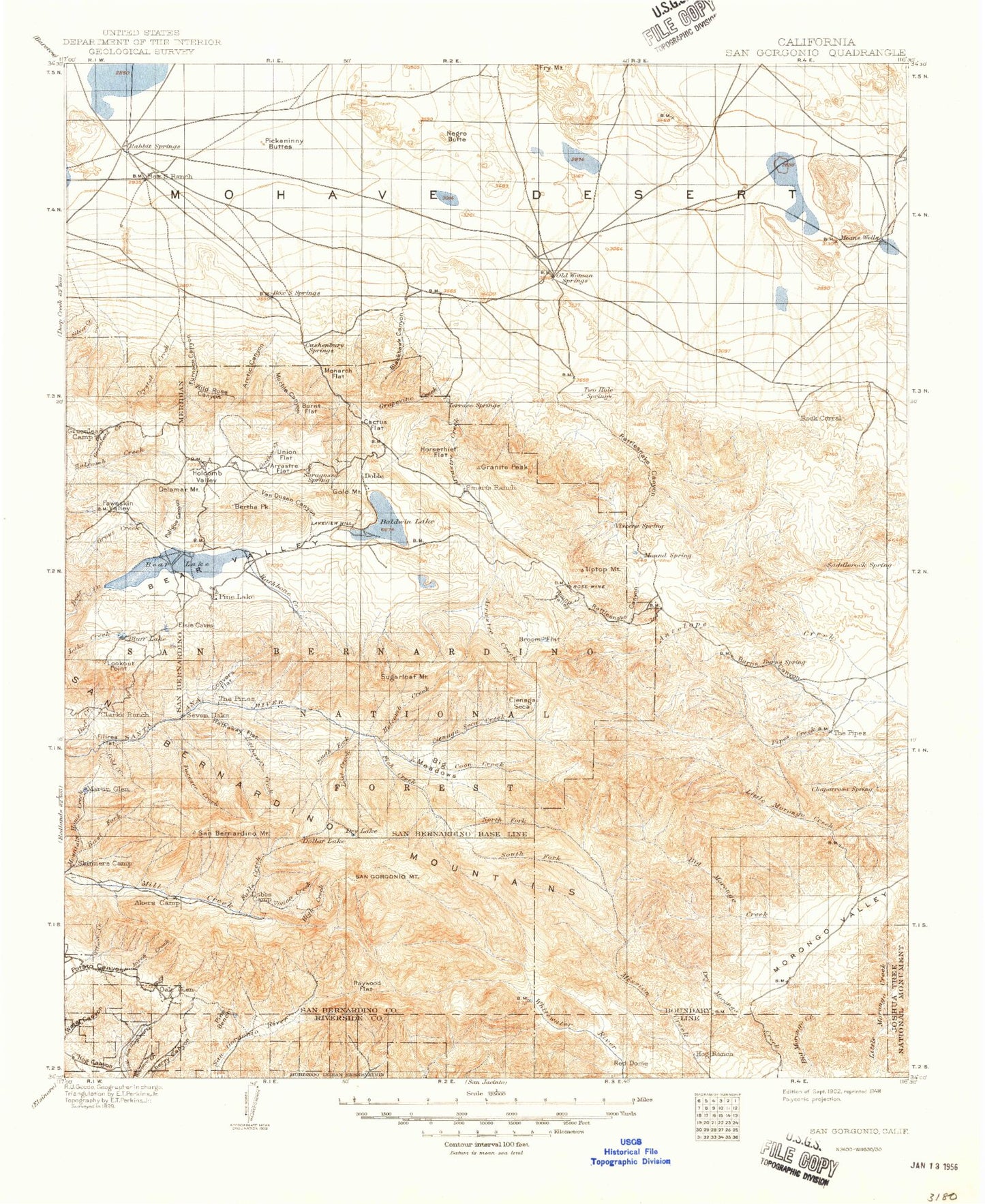
Historic 1902 San Gorgonio California 30'x30' Topo Map
Couldn't load pickup availability
Historical USGS topographic map of San Gorgonio in the state of California. Scale: 1:125000. Print size: 17" x 24"
This map was published in 1902 and is in the following counties: Riverside, San Bernardino.
The map contains contour lines, roads, rivers, towns, streams, and lakes. Printed on high-quality waterproof paper with UV fade-resistant inks.
Contains the following named places: Animal Park, Antelope Wash, Aspen Grove, Big Falls Campground, Big Meadows, Big Oaks Canyon, Black Lava Butte, Black Mountain, Bow Canyon, Bowden Flat, Burns Canyon, Burnt Canyon, Burro Flats, Camp Akela, Camp Conrad, Camp Edwards, Camp Good News, Camp JCA, Camp Nawakwa, Camp Norris, Camp Oakes, Camp Osceola, Camp River Glen, Camp Tautona, Camp Tulake, Canyon House Ranch, Chaparrosa Peak, Charlton Peak, College Camp, Cougar Buttes, Covington Park, Deadmans Canyon, Deadmans Lake, Deadmans Ridge, Deer Canyon, Devils Gate Pass, Dobbs Peak, Dollar Lake, Dollar Lake Saddle, Dry Canyon, Dry Lake, Dry Lake Trail, East Fork Cabin, East Fork Whitewater River, Fish Creek Meadows, Fish Creek Trail, Fry Valley, Galena Peak, Gamma Gulch, Gocke Valley, Gold Mine Ski Area, Green Canyon, Green Canyon Group Camp, Green Rock Mine, Green Spot Picnic Area, Gunsight Pass, Heart Bar Peak, High Creek, Horse Meadows, Jepson Peak, Kee Ranch, Lafon Ranch, Lost Creek, May Van Canyon, Means Lake, Melville Lake, Middle Branch Millard Canyon, Middle Fork Jumpoff, Mile High Pines Camp, Mill Creek Jumpoff, Mill Creek Mine, Mine Shaft Saddle, Moon Ridge, Morongo Lakes, Morongo Valley, Negro Butte, North Fork Meadows, North Fork Meadows Trail, Old Woman Spring Ranch, Oso-Lobo Campground, Parson Ranch, Pierce Ranch, Plummer Meadows, Promised Land Camp, Rattlesnake Creek, Raywood Flat, Raywood Flat Trail, Red Rock Flat, Rock Corral, San Gorgonio Campground, San Gorgonio Mountain, Sawmill Canyon, Shehorn Ranch, Silver Reef Mine, Silverwood Falls, Sky High Trail, Smith Canyon, Soggy Lake, Sorrel Horse Canyon, South Fork Cabin, South Fork Campground, South Fork Meadows, South Fork Trail, Sugarloaf Meadow, Sugarloaf Mountain, Sugarlump, T Cross K Ranch, Ten Thousand Foot Ridge, The Pipes, The Tarn, University Camp, Upper Johnson Valley, Vaquero Campsite, Vivian Creek Trail, West Branch Hathaway Creek, Wildhorse Meadows, Yucaipa Ridge, East Fork South Fork Whitewater River, Rubber Drain Two, Wildhorse Creek, Snow Peak, Alger Creek, Allen Peak, Anderson Flat, Antelope Creek, Arctic Canyon, Arctic Canyon Pit, Arrastre Creek, Arrastre Flat, Aspen Glen Picnic Area, Bain Ranch, Baldwin Lake, Balky Horse Canyon, Barton Creek, Barton Flats, Barton Flats Campground, Barton Flats Forest Service Station, Bear Valley, Belleville, Bertha Peak, Bertha Ridge, Big Bear Lake, Big Bear Ranger Station, Big Bear Solar Observatory, Big Falls, Big Morongo Canyon, Big Morongo Creek, Bighorn Canyon, Bighorn Mountains, Birch Creek, Birch Mountain, Blackhawk Canyon, Blackhawk Mine, Blackhawk Mountain, Blue Cut, Blue Quartz Mine, Bluff Lake, Boulder Bay, Boulder Bay, Boundary Canyon, Bousic Canyon, Bridal Veil Creek, Broom Flat, Burnt Flat, Cactus Flat, Camp Arbolado, Camp Cedar Falls, Camp Cohila, Camp Creek, Camp De Benneville Pines, Camp LaVerne, Camp Osito Rancho, Camp Radford, Camp Round Meadow, Camp Sky Meadow, Camp Ta Ta Pochon, Camp Tahquitz, Caribou Creek, Catclaw Flat, Cedar Lake, Cedar Mountain, Cienaga Grande, Cienaga Seca, Cienaga Seca Creek, Clarks Summit, Cold Creek, Coldbrook Campground, Constance Peak, Converse Creek, Converse Flats, Converse Forest Service Station, Coon Creek, Coon Creek Jumpoff, Council Campground, Crystal Creek, Cushenbury Canyon, Cushenbury Pit, Deep Canyon, Delamar Mountain, Doble, Doble Mine, Dollar Lake Trail, Dry Morongo Creek, Eagle Point, East Branch Millard Canyon Trail, East Fork Barton Creek, East Fork Dry Canyon, East Fork Mountain Home Creek, Erwin Lake, Falls Creek, Falls Creek Trail, Fawnskin, Fawnskin Valley, Filaree Flat, Fish Creek, Fisher Cove, Ford Canyon, Forsee Creek, Forsee Creek Trail, Frog Creek, Frustration Creek, Furnace Canyon, Gilman Canyon, Gilner Point, Glen Martin Creek, Gold Hill Mine, Gold Mountain, Grand View Point, Granite Peaks, Grape Canyon, Grapevine Creek, Grays Campsite, Greenlead Creek, Greenlead Mine, Grinnell Mountain, Grout Bay


