MyTopo
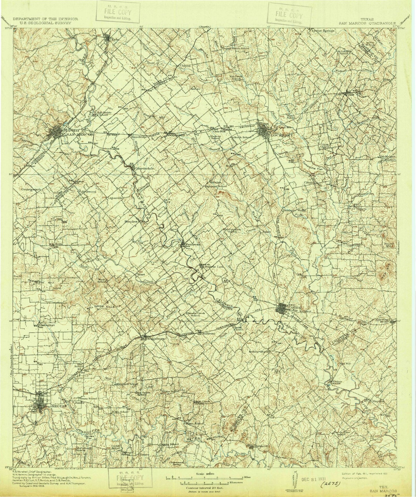
Historic 1911 San Marcos Texas 30'x30' Topo Map
Couldn't load pickup availability
Historical USGS topographic map of San Marcos in the state of Texas. Scale: 1:125000. Print size: 17" x 24"
This map was published in 1911 and is in the following counties: Bastrop, Caldwell, Comal, Gonzales, Guadalupe, Hays.
The map contains contour lines, roads, rivers, towns, streams, and lakes. Printed on high-quality waterproof paper with UV fade-resistant inks.
Contains the following named places: Artesia Creek, Bauer Park, Belmont, Brushy Creek, Brushy Creek, Brushy Creek, Buchanan Oil Field, Bunton Branch, Burroughs Creek, Campbell Creek, Canoe Creek, Cantau Flat, Cat Branch, Centex, Central Park, Clemens Creek, Comanche Flats, Copperas Creek, Cordell Creek, Cottonwood Creek, Dale, Dale Oil Field, Dam Number 4, Daniels Creek, Darst Creek, Darst Oil Field, Deer Creek, Dilworth Spr, Dry Creek, Dry Creek, Dunlap Oil Field, Elm Creek, Geronimo, Harborth Hill, Harwood, Haw Branch, Highsmith Creek, Hines Branch, House Log Branch, Iron Mountains, Iron Peak, Jerry Creek, Kingsbury, Koeglar Hill, Konde Branch, Krams Creek, Kyle, Linscome Creek, Long Branch, Longer Park, Luling, Luling Oil Field, Lytton Creek, Lytton Springs Oil Field, Marton Ranch, Max Starcke Park, Maxwell, McMahan, McNeil Creek, Meadow Lake, Mesquite Creek, Mill Creek, Mill Creek Hills, Mule Creek, Nash Creek, Nolte Dam, Ottine, Palmetto State Park, Plum Creek, Polecat Creek, Pool Hollow, Porter Creek, Prairie Lea, Rabbit Branch, Randolph Creek, Red Branch, Red Hill, Reedville, Riverview Park, Rocky Creek, Round Mountain, Saint Johns Colony, Salt Branch, Salt Creek, Salt Flat Oil Field, Salt Lake, Sandy Hollow, Saul Creek, Sawlog Creek, Seguin, Silva Park, Site Number Fifteen, Site Number Eighteen, Site Number Twentyeight, Slayden, Smith Creek, Spanish Oak Creek, Spiller Oil Field, Spring Lake, Stairtown, Tenney Creek, Tenney Creek Oil Field, Uhland, Walnut Branch, Weinert, Withers Hollow, Wolf Creek, Big West Fork Plum Creek, Branyon Oil Field, Brushy Branch, Centerpoint, Crooked Branch, Dam Number 10, Dam Number 13, Dam Number 14, Dam Number 15, Dam Number 5, Dam Number 7, Dickerson Creek, Fentress, Joliet, Little West Fork Plum Creek, Lockhart State Park, Luling Oil Field, Martindale, Pin Oak Creek, Redwood, Sixmile Branch, Staples, Water Hole Creek, Willow Springs Creek, Zorn, Bee Creek, Blanco River, Boggy Creek, Callihan Creek, Cantau Creek, Clear Fork Plum Creek, Cottonwood Creek, Cottonwood Creek, Cowpen Creek, Dry Branch, Haggai Creek, Hemphill Creek, Lockhart, Long Creek, Morrison Creek, Pecan Branch, Purgatory Creek, San Marcos, Seals Creek, Sink Creek, West Fork Plum Creek, York Creek, Geronimo Creek, Alligator Creek, Brownsboro, Galle, Lauback, McNeil, Saint James, Seawillow, Smithville, Soda Springs, Tilmon, Watts, Caldwell County, Guadalupe County, Chaparral Country Club, Wood State Fish Hatchery, Town Branch, Soil Conservation Service Site 5 Dam, Soil Conservation Service Site 5 Reservoir, John F Baugh Dam, John F Baugh Reservoir, Scrutchin Lake Dam, Scrutchin Lake, Webster Lake Dam, Webster Lake, Aquarena Dam, Soil Conservation Service Site 2 Dam, Soil Conservation Service Site 2 Reservoir, Soil Conservation Service Site 3 Dam, Soil Conservation Service Site 3 Reservoir, Soil Conservation Service Site 4 Dam, Soil Conservation Service Site 4 Reservoir, M D Heatly Dam, M D Heatly Reservoir, Rose Lake Dam, Rose Lake, Holmes Lake Dam, Holmes Lake, Bishop Lake Dam, Bishop Lake, Guadalupe-Blanco River Authority Tp-4 Dam, Soil Conservation Service Site 11 Dam, Soil Conservation Service Site 11 Reservoir, Soil Conservation Service Site 12 Dam, Soil Conservation Service Site 12 Reservoir, Soil Conservation Service Site 6 Dam, Soil Conservation Service Site 6 Reservoir, Soil Conservation Service Site 8 Dam, Soil Conservation Service Site 8 Reservoir, Soil Conservation Service Site 9 Dam, Soil Conservation Service Site 9 Reservoir, Soil Conservation Service Site 16 Dam, Soil Conservation Service Site 16 Reservoir, Soil Conservation Service Site 7 Dam, Soil Conservation Service Site 7 Reservoir, Soil Conservation Service Site 10 Dam, Soil Conservation Service Site 10 Reservoir, Soil Conservation Service Site 13 Dam, Soil Conservation Service Site 13 Reservoir, Soil Conservation Service Site 14 Dam, Soil Conservation Service Site 14 Reservoir, Soil Conservation Service Site 15 Dam, Soil Conservation Service Site 15 Reservoir, Benke Lake Dam, Benke Lake, Cooper Lake Dam, Cooper Lake, Soil Conservation Service Site 34 Dam, Soil Conservation Service Site 34 Reservoir, Soil Conservation Service Site 8 Dam, Soil Conservation Service Site 8 Reservoir, Soil Conservation Service Site 28 Dam, Soil Conservation Service Site 28 Reservoir, Soil Conservation Service Site 31 Dam, Soil Conservation Service Site 31 Reservoir, Soil Conservation Service Site 23 Dam, Soil Conservation Service Site 23 Reservoir, Soil Conservation Service Site 14 Dam, Soil Conservation Service Site 14 Reservoir, Soil Conservation Service Site 15 Dam, Soil Conservation Service Site 15 Reservoir, Soil Conservation Service Site 18 Dam


