MyTopo
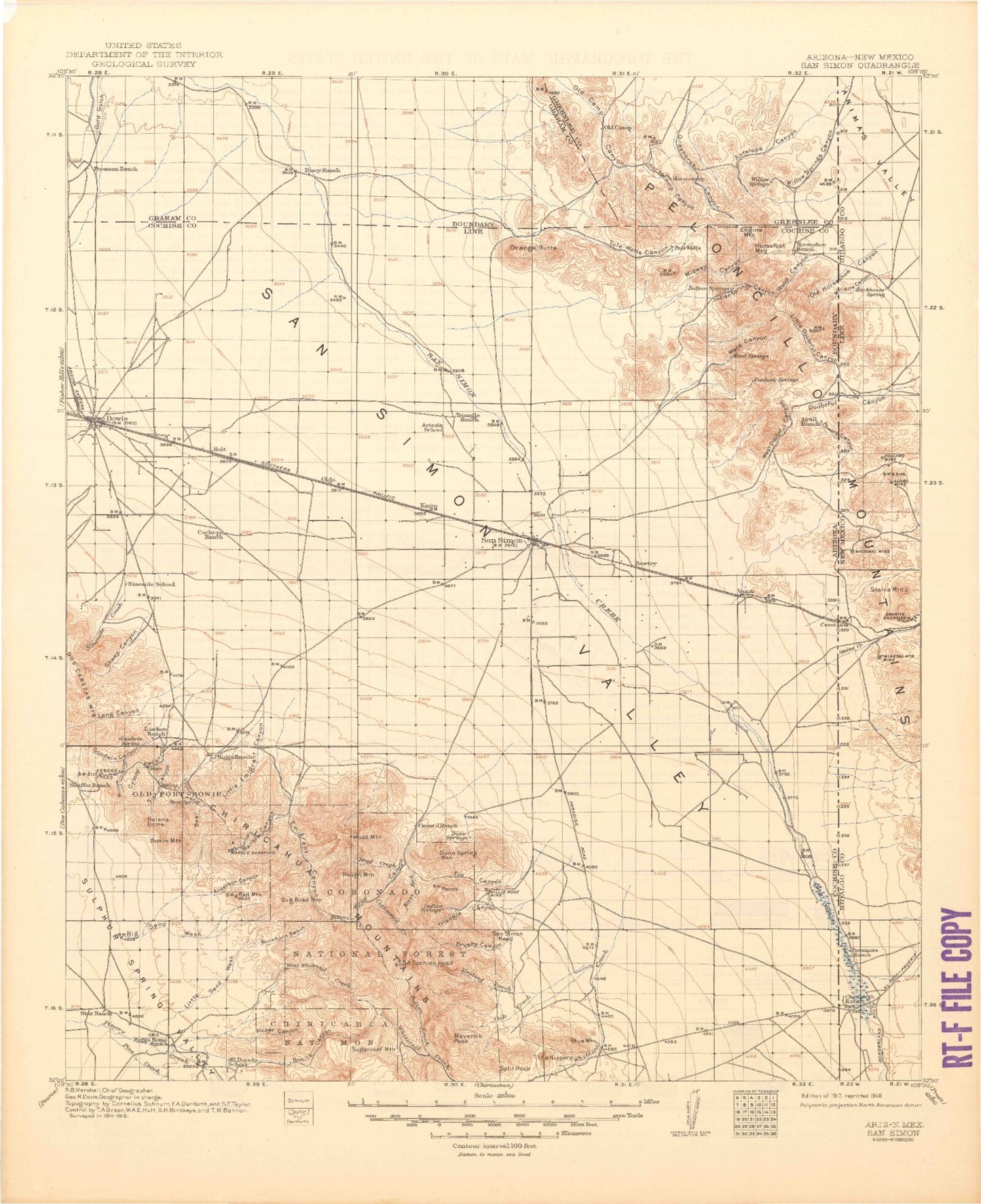
Historic 1917 San Simon Arizona 30'x30' Topo Map
Couldn't load pickup availability
Historical USGS topographic map of San Simonin the states of Arizona, New Mexico. Scale: 1:125000. Print size: 18" x 24"
This map was published in 1917 and is in the following counties: Cochise, Graham, Greenlee, Hidalgo.
The map contains contour lines, roads, rivers, towns, streams, and lakes. Printed on high-quality waterproof paper with UV fade-resistant inks.
Contains the following named places: Tule Wells Canyon, Tule Wells Draw, Ajax Mine, Anderson Canyon, Apache Pass, Bear Gulch, Bear Sign Tank, Bear Spring Pass, Big Sand Wash, Bitter Creek, Blue Mountain, Blumberg Canyon, Bonita Canyon, Bonita Park, Bowie, Bowie Mountain, Brad Creek, Brushy Canyon, Buckhorn Basin, Charco Tank, Chiricahua National Monument, Cochise Head, Cottonwood Creek, Cross J Windmill, Dickson Tank, Double Z Windmill, Dug Road Mountain, Dunn Springs Mountain, East Windmill, Echo Canyon, Echo Park, Emigrant Canyon, Emigrant Hills, Emigrant Pass, Emigrant Tank, Engine Mountain, Faraway Ranch, Foote Ranch, Fox Canyon, Gold Hill, Goodwin Canyon, HYL Ranch, Happy Camp Wash, Hat Top Tank, Haystack, Helens Dome, Hells Half Acre, Horsecamp, Horsecamp Canyon, Horsefoot Mountain, Horseshoe Ranch, Indian Creek, Indian Springs Canyon, Indian Tanks, Inspiration Point, Keating Creek, King of Lead Mine, Knape Ranch, Lighting Canyon, Little Emigrant Canyon, Little Picket Canyon, Little Sand Wash, Little Wood Canyon, Long Canyon, Lost Canyon, Madrone Canyon, Maggie Tank, Marble Canyon, Massai Point, Maverick Canyon, Maverick Peak, McKenzie Peak, Midway Canyon, Midway Peak, Millsite Canyon, Mulkins Ranch, New Pasture Tank, Newton Canyon, Ninemile Creek, Ninemile Ranch, North Bonita Canyon, Oak Creek, Old Camp, Old Horseshoe Canyon, Old McKenzie Ranch, Olga Detention Dam, Orange Butte, Overlook Ridge, Overton Canyon, Pass Tank, Picket Canyon, Picket Park, Pine Creek, Playas de los Pinos, Rattlesnake Point, Red Mountain, Red Tank, Rhyolite Canyon, Riggs Home Ranch, Riggs Mountain, Roosevelt Tank, Rough Mountain, Ryan Detention Dam, San Simon, San Simon Head, Sands Draw Detention Dam, Sarah Deming Canyon, Sheep Canyon, Silverstrike Mine, Siphon Canyon, South Fork Keating Creek, South Fork Wood Canyon, Split Rock, Sugarloaf Mountain, Surprise Canyon, Tevs Rocks, The Fan, The Nippers, Timber Mountain, Totem Canyon, Triangle Canyon, Triangle Ranch, Tule Tank, East Turkey Creek, West Well Corral, West Well Detention Dam, West Whitetail Creek, Whitehorse Canyon, East Whitetail Creek, Whitetail Pass, Willie Rose Mine, Willow Gulch Canyon, Willow Springs Canyon, Willow Springs Ranch, Winchester Peak, Wood Canyon, Wood Canyon, Wood Canyon, Wood Canyon Park, Wood Mountain, Alreds Ranch, Analong Ranch, Barnes Ranch, Bear Spring Ranch, Boggs Ranch, Bowie Substation, Chiricahua National Monument Wilderness, Cutoff Canyon, East White Tail Trail Two Hundred Fiftythree, Emigrant Canyon Trail Two Hundred Fiftyfive, Erickson Tank, Garrett Ranch, Government Tank, Lamberson Ranch, Marble Quarry, Nolan Ranch, Nolan Ranch, San Simon Substation, Shafer Ranch, Stephenson Ranch, West Doubtful Detention Dam, Whitetail Creek, YY Ranch, Buckeye Wash, San Simon Dam Drop Structure, San Simon Peak, Chaney Place, Little Franks, Olga, Taylor Place, Vanar, Yellow Hammer Mill, Dean Tank, Doubtful Canyon, Little Doubtful Canyon, McKenzie Tank, Powers Canyon, Roostercomb, Vanar Wash, Ward Canyon, West Doubtful Canyon, Wheeler Place, Peloncillo Mountains, Arizona Inspection Station, Mount Rayburne, Millsite Canyon, Old Horseshoe Canyon, Steins Creek, Wood Canyon, San Simon River, Powers Canyon, Chiricahua Natural Bridge, Fort Bowie National Historic Site, Bowie Division, Peloncillo Mountains Wilderness, Whitetail Arch, Millsite Canyon, Old Horseshoe Canyon, Doubtful Canyon, Little Doubtful Canyon, Powers Canyon, Peloncillo Mountains, Cienega Ranch, Millsite Canyon, Mineral Mountain Mine, Old Horseshoe Canyon, Playas de Los Pinos, San Simon Cienega, Steins Creek, Wood Canyon, Wood Canyon, San Simon River, Steins Mountain, Attorney Mountain, Braidfoot Ranch, Elore Mine, Guess Ranch, National Mine, Powers Canyon, Steins Peak, Volcano Mine, Flourite Pits, Ironclad Prospect, Mineral Mountain Mine, Horseshoe Prospect, Dewey Prospect, Buckhorn Prospect, Black Face, Mayflower Prospect, Merrimac Prospect, Eloro Mine, Steins Peak Station, Steins Peak Range, Peloncillo Mountains Wilderness Study Area, Hattie Lee Mine, Sweet Mine


