MyTopo
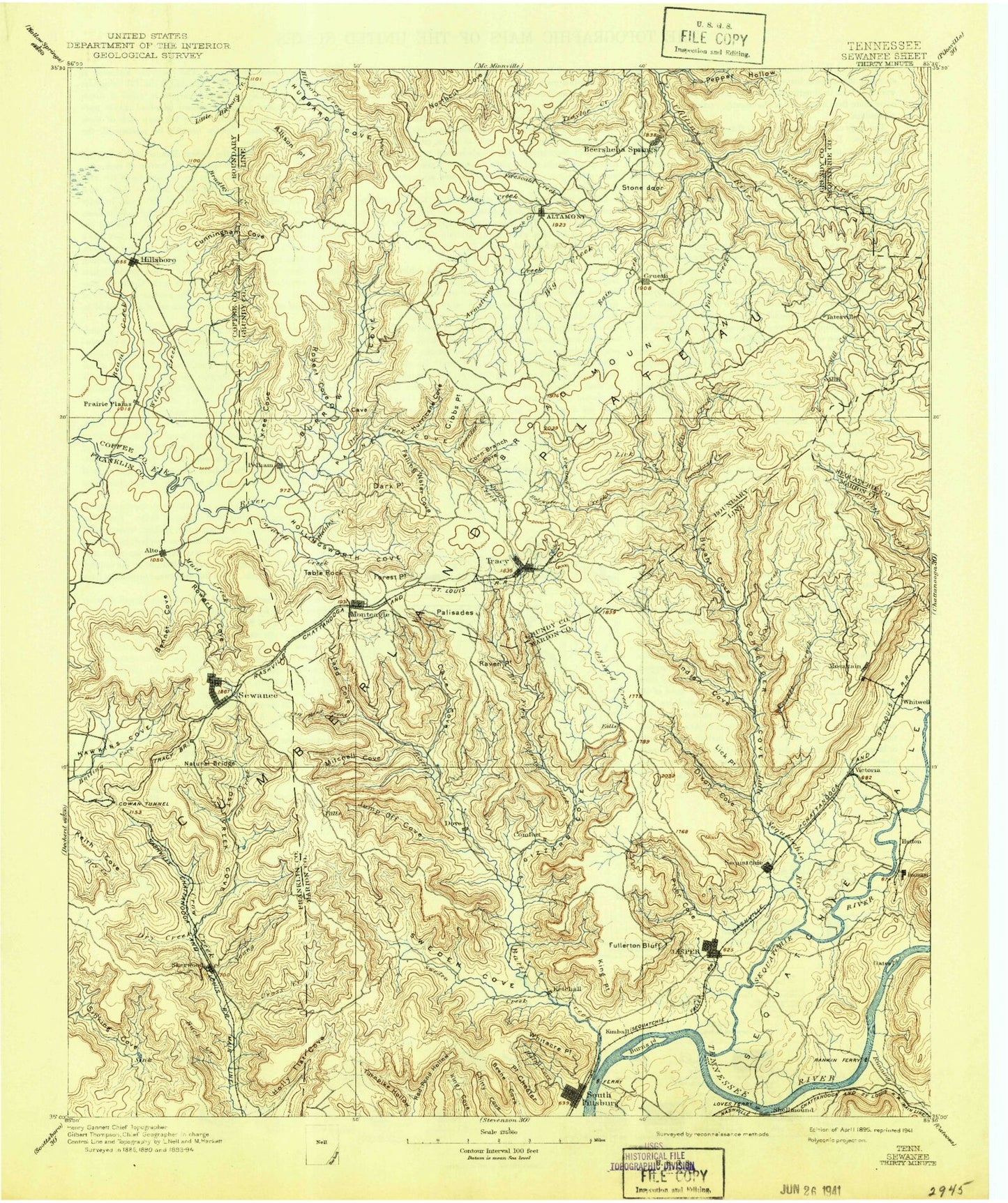
Historic 1895 Sewanee Tennessee 30'x30' Topo Map
Couldn't load pickup availability
Historical USGS topographic map of Sewanee in the state of Tennessee. Scale: 1:125000. Print size: 17" x 24"
This map was published in 1895 and is in the following counties: Coffee, Franklin, Grundy, Marion, Sequatchie.
The map contains contour lines, roads, rivers, towns, streams, and lakes. Printed on high-quality waterproof paper with UV fade-resistant inks.
Contains the following named places: Graham Branch, Tennessee Valley Divide, Big Fiery Gizzard Creek, Billy Hollow, Butterstack Ridge, Cedar Ridge, Champion Cove, Collins Cove, Eagle Cliff, Fults Creek, Grundy State Forest, Indian Camp Creek, Lick Branch, Mill Branch, North Fork Pryor Cove Branch, Rocky Creek, Rusty Cup Creek, Shelton Creek, Shiloh Branch, Shingle Mill Hollow, Sinking Cove, Smith Hollow, Snake Pond, South Prong Poor Fork, Speegle Cove, Speegle Point, Speegle Point, Spring Hollow, Spruce Creek, Standifer Branch, Star Gap, Stillhouse Hollow, Stillhouse Hollow, Stinnette Point, Stocker Hill, Stoner Mountain, Straight Cove, Sugarcamp Hollow, Sugarcamp Hollow, Summerfield, Tanyard Hollow, Tanyard Point, Thacker Pond, The Big Sink, The Blockade, The Chimneys, The Cowbones, The Gap, The Hurricane, The Levels, The Narrows, The Narrows, The Pinnacles, The Pocket, The Saddle, The Spur, Thurman Point, Tip Top, Tom Pack Hollow, Torbet, Town Creek, Trussell Creek, Trussell Point, Tunnel Point, Turnpike Point, Two Mile Branch, Tyree Cove, Vaughn Hollow, Vineyard Point, Vulcan Gulf, Walker Branch, Warren Branch, Water Fall Cove, West Fork Pryor Cove Branch, West Ramsey, Whitacre Point, White City, Whitwell Mine, Wiggins Creek, Wild Boar Bluff, Wildcat Branch, Wilkson Hollow, Winding Stairs, Yellow Branch, Laurel Creek, Alley Gulf, Alpine View Point, Altamont, Alum Cove, Anderson Cove, Anderson Point, Apps Hollow, Armfield Bluff, Armstrong Creek, B Lakes, Bailey Branch, Ballard Point, Barnes Branch, Barnes Point, Basin Hollow, Battle Creek, Bear Den Cove, Bear Hollow, Bearhole Hollow, Bearpen Gulf, Bee Branch, Bee Cliff Hollow, Beene Cove, Bell Branch, Bennett Hollow, Berner Creek, Big Butte, Big Creek, Big Creek, Big Fork, Big Ridge, Billy Goat Cliff, Billy Ought Hollow, Black Bottom, Black Creek, Blevins Hollow, Blue Spring Creek, Bluebell Island, Bobtown, Bolton Point, Bone Ridge, Bostick Creek, Boyd Hollow, Bray Branch, Bridal Veil Cove, Bridal Veil Creek, Bridal Veil Falls, Brooks Point, Brown Spring Branch, Brush Creek, Brushy Ridge, Bryant Cove, Bryant Ridge, Buck Creek, Buck Creek, Bunker Hill, Burrow Cove Ridge, Caldwell Ridge, Camp Glancy, Camp Unaka, Campbell Hollow, Campbell Hollow, Cane Hollow, Cane Hollow, Cane Mountain, Caney Point, Cannon Hollow, Cape of Good Hope, Caruenger Creek, Cascade Falls, Castle Rock Point, Cave Cove, Cedar Hollow, Cedar Hollow, Cedar Mountain, Cedar Point, Cedar Ridge, Cedar Ridge, Cherry Point, Lake Cheston, Chitty Cove, Claibornes View, Clear Spring Branch, Clifty Creek, Clouse Hill, Collier Branch, Coolies Rift, Coon Branch, Copper Branch, Corn Branch, Counter Pen, Cow Rock, Cowan Spring Branch, Cowan Tunnel, Cowen Point, Crabtree Hollow, Crooked Tree Hollow, Cross Creek, Cumberland Heights, Custard Hollow, Davis Branch, Davis Point, Day Lake, Deep Hollow, Deer Lick Falls, Deerstand Hill, Delly Hole, Denny Cove, Depot Branch, Dick Cove, Dick Creek, Dickey Bottom, Dicks Branch, Distribute Branch, Dittany Point, Dixon Cove, Dogwood Flat, Dotson Point, Double Branch, Drip Spring Cove, Dry Creek, Dry Creek, Dry Creek, Dry Creek, Dry Creek, Duck Point, Duck Pond, Dunaway Creek, Dykes Hollow, East Hill, East Ramsey, Ebenezer, Elder Thicket Gulf, Ellidge Point, Elliot Point, English Cove, Eva Lake, Evans Point, Fall Creek, Falling Cliff, Falling Water Cove, Falls Branch, Falls Branch, Farmer Camp Hill, Farris Pond, Firescald Creek, First Branch, Fishtrap Point, Flat Branch, Flat Mountain, Flatbench Point


