MyTopo
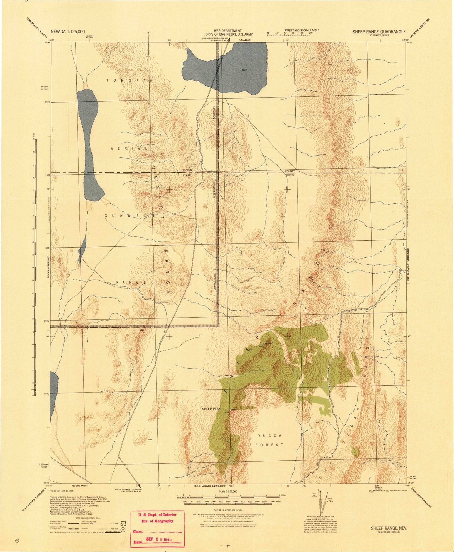
Historic 1945 Sheep Range Nevada 30'x30' Topo Map
Couldn't load pickup availability
Historical USGS topographic map of Sheep Range in the state of Nevada. Scale: 1:125000. Print size: 18" x 24"
This map was published in 1945 and is in the following counties: Clark, Lincoln.
The map contains contour lines, roads, rivers, towns, streams, and lakes. Printed on high-quality waterproof paper with UV fade-resistant inks.
Contains the following named places: Banded Ridge, Basin Canyon, Black Gate, Black Gate Canyon, Black Hills Gap, Burro Basin, Chowderhead Canyon, Chuckwalla Guzzler, Dead Horse Ridge, Dead Horse Trail, Deadman Canyon, Desert Lake, Dog Bone Lake, East Desert Range, Hayford Peak, Horse Canyon, Joe May Canyon, Joe May Guzzler, Johns Canyon, Little Joe May Canyon, Mule Deer Ridge, North Fork Sawmill Canyon, Peek-a-boo Canyon, Picture Canyon, Pine Canyon, Pine Nut Camp, Pocket Canyon, Quartzite Mountain, Quijinump Canyon, Saddle Mountain, Sawmill Canyon, Searles Reservoir, Sheep Basin, Sheep Pass, Sheep Pass Guzzler, Sheep Peak, Snow Basin, Snow Canyon, Spring Canyon, Surprise Basin, Surprise Canyon, Three Lakes Valley, Timber Canyon, Twin Buttes, Twin Caves Canyon, Wagon Canyon, Wagon Gap, White Rock Canyon, White Sage Flat, White Sage Gap, White Sage Guzzler, White Sage Reservoir, Wildhorse Pass, Yellowjacket Canyon, Yucca Forest, Desert Range, Hidden Forest Ridge, Three Lakes Valley Reservoir, Black Hills, Hidden Forest Cabin, Las Vegas Range, Spanish Mine, Bald Knob, Desert Valley, Mormon Pass, Mormon Pass Picnic Area, Sawmill Wash, Mormon Well Corral, Sheep Range, Johns Peak, Negrohead Peak, Desert National Wildlife Range


