MyTopo
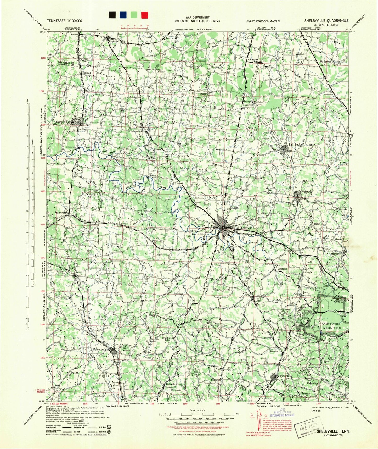
Historic 1944 Shelbyville Tennessee 30'x30' Topo Map
Couldn't load pickup availability
Historical USGS topographic map of Shelbyville in the state of Tennessee. Scale: 1:100000. Print size: 24" x 27"
This map was published in 1944 and is in the following counties: -.
The map contains contour lines, roads, rivers, towns, streams, and lakes. Printed on high-quality waterproof paper with UV fade-resistant inks.
Contains the following named places: Fay Creek, Anthony Branch, Bryant Hollow, Butler Creek, Chapel Hill, Charity Creek, Fall Creek, Gingerbread Creek, Goose Creek, Gordon Branch, Knob Creek, Long Ridge, Puncheon Camp Creek, Richmond, Shearin Bend, Shelbyville, Shelbyville Mills, Short Branch, Short Creek, Simmons Branch, Sims Spring Branch, Sinking Creek, Slip Hill, Smith Hollow, Soapstone Hill, Sorrells Hollow, South Fork Flat Creek, Sawmill Spring Branch, Spring Branch, Spring Creek, Spring Lake, Stamp Gap, Steep Hollow, Stokes Branch, Stone Creek, Stoneborough Hollow, Straight Creek, Sugar Creek, Sugarcamp Hill, Sutton Creek, Swaim Knob, Swings Lake, Talley Hill, Tankersley Branch, Tankersley Ridge, Tarpley Bluff, Tate Hollow, Taylor Branch, Taylor Hill, Tennessee Walking Horse National Showgrounds, The Narrows, Thick, Thick Creek, Tillett Branch, Todd Hollow, Toll Gate Hill, Troup Hill, Tuley Hill, Turkey Creek, Twitty Knob, Union Branch, Union Hollow, Unionville, Versailles Knob, Wagoner Hill, Wakefield Hollow, Wakefield Hollow, Wallace Branch, Wallace Hill, Wanslow Hollow, Ward Hollow, Warren Hollow, Wartrace Creek, Weakly Creek, Welch Hill, Welch Hill, Wells Hollow, West Cane Creek, West Fork Spring Creek, Wheel, Whitaker Hollow, Whiteside Hill, Whorley Hollow, Wiggins Branch, Wiggins Hill, Wilhoite Mills, Wiseman Hollow, Woodfin Valley, Woods Bluff, Wool Hollow, Adams Hollow, Albright Hollow, Anderton Branch, Anthony Branch, Ashland Branch, Bagley Gap, Bagley Hollow, Bagley Hollow, Bailey Branch, Bakertown, Bare Knob, Barham Branch, Bartlett Hollow, Bates Branch, Baxter Branch, Baxter Hollow, Bearden Branch, Beasley, Bedford, Bedford Hollow, Beech Creek, Belfast, Belfast Creek, Bell Buckle, Bell Buckle Creek, Benford Creek, Bennett Branch, Bett Ray Hill, Blackman Hollow, Bledsoe Hollow, Bobo Creek, Bobo Hollow, Bomar Creek, Booneville, Bottle Hollow, Brady Knob, Branchville Branch, Browns Shop, Bruce Hollow, Buchanan Branch, Buckeye Hollow, Buckeye Ridge, Bugscuffle, Buzzard Branch, California Hollow, Campbell Gap, Caneer Hollow, Cannon Branch, Caperton Lake, Carr Creek, Caruthers Hill, Catfish Lake, Cave Branch, Cave Spring Hollow, Cedar Ridge, Center Lake, Chestnut Ridge, Chestnut Ridge, Chestnut Ridge, Christiana, Christmas Creek, Claxton Hill, Cobb Hollow, Cobb Hollow, Cold Spring Hollow, Coleman Fork, Comstock Branch, Concord, Coney Island, Coops Branch, Copperas Hill, Cortner Branch, Crabtree Hollow, Creekwood, Creson Hollow, Crooked Run, Crouch Branch, Daniel Hill, Daniel Hollow, Davidson Hill, Davis Branch, Davis Lake, Deason, Delina, Dismal Hollow, Dockworth Hollow, Dogtail Creek, Dolly Branch, Douglas Hollow, Dry Branch, Dry Creek, Dry Creek, Dry Fork Creek, Dry Run, Dryland Creek, Duckworth Hollow, Dyer Branch, Eagleville, East Fork Spring Creek, Eaton Hollow, Eddy Hill, Eden Hollow, Elbethel, Enoch Hollow, Epps Hills, Epps Hollow, Fairfield, Fairlane Estates, Fall Lick Creek, Farmington, Farrar Branch, Fay Hill, Flat Creek, Flat Creek, Flat Creek School, Floyd Branch, Forest Hills, Fosterville, Fox Hollow, Fox Hollow, Fruit Valley, Fuss Hollow, Gaither Pond, Garrison Fork, Gaunt Hill, Giles Hill, Glenn Hill, Good Branch, Goshen Hollow, Gould Hill, Gourdneck Hollow, Grandview Ridge, Green Island, Gum, Haislip Hollow, Haley, Hampton Hollow, Hannah Gap, Happy Valley, Hardison Hollow, Hasty Branch, Hatchett Hollow, Hatchett Hollow, Haunt Hollow, Hawkins Branch, Hazelwood Hill


