MyTopo
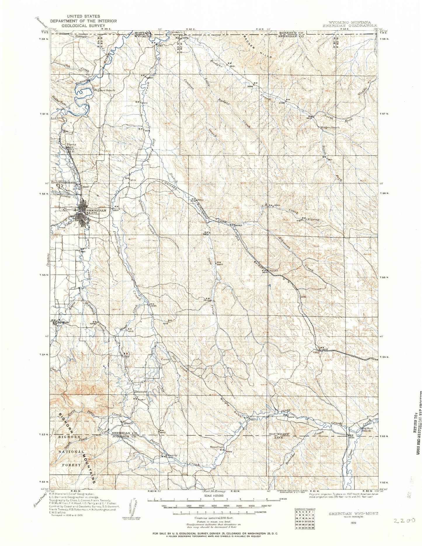
Historic 1909 Sheridan Wyoming 30'x30' Topo Map
Couldn't load pickup availability
Historical USGS topographic map of Sheridan in the state of Wyoming. Scale: 1:125000. Print size: 17" x 24"
This map was published in 1909 and is in the following counties: Big Horn, Johnson, Sheridan.
The map contains contour lines, roads, rivers, towns, streams, and lakes. Printed on high-quality waterproof paper with UV fade-resistant inks.
Contains the following named places: Badger Hills, Little Youngs Creek, Youngs Creek, Goose Creek, Acme, Allens Draw, Arkansas Creek, Ash Creek, Ash Draw, Ash Draw, Athorpe Rogers Ditch, Bar N Draw, Barnes Draw, Barr Draw, Bates Draw, Baxter Draw, Beatty Gulch, Beaver Creek, Big Bonanza Ditch, Big Draw, Big Draw Reservoir, Big Horn, Blazer Hill, Bourret Draw, Boxelder Creek, Boxelder Ditch, Brug-lusher Draw, Brush Creek, Buffalo Run Creek, Bull Creek, Burlington Reservoir, Burn Cleuch Ditch, Butterfield Draw, Cameron Gulch, Cedar Canyon, Cedar Draw, Cemetery Draw, Chapek Draw, Chapparal Draw, Coal Bank Gulch, Coal Creek, Coleman Draw, Connley Ditch, Connley Draw, Copps Draw, Coutant Creek, Coyote Creek, Coyote Draw, Dawson Draw, Dead Indian Draw, Deadman Gulch, Deep Creek, Demple Draw, Donkey Creek, Dow Prong, Dry Creek, Dry Creek, Dry Creek, Dunlap Ditch, Dutch Creek, East Fork Dow Prong Dutch Creek, East Side Ditch, Enochs Draw, Eyechaner Draw, Fairbanks Draw, Fetterman Monument, Fields Draw, Flat Draw, Flying E Creek, Four X Draw, Fowler Draw, Gerdel Ditch, Gillispie Draw, Gladewater Ditch, Grinnell Ditch, Grinnell Livestock Company Ditch, Grouse Draw, Grouse Draw, Hamburger Draw, Hamilton Draw, Hamma Draw, Hanes Reservoir, Harper Draw, Hazel Peak, Helvey Draw, Heppner Draw, Hickey Draw, Hidden Water Creek, Highline Ditch, Hill Prong Badger Creek, Holly Ponds, Home Draw, Horse Hill, Hume Ponds, Hunter Draw, Ike Draw, Iron Gulch, Jenks Creek, Jennings Gulch, Jim Creek, Jim Crow Creek, Joe Draw, John Draw, Johnson Draw, Johnston Draw, Jones Draw, Jones Draw, Junk Draw, Kendrick Park, Krenzien Draw, Lanters Draw, Larison Swale, Last Chance Ditch, Lee Creek, Leiter Ditch, Lewis Draw, Little Badger Creek, Lodge Trail Ridge, Lotspeich Prong Waddle Creek, Lower Flying E Ditch, Massacre Hill, May Draw, McCormick Creek, Meade Creek Ranch, Menardi and White Reservoir, Middle Fork Arkansas Creek, Middle Fork Badger Creek, Middle Fork Dow Prong Dutch Creek, Mile Draw, Mile Long Draw, Mooney Draw, Moose Draw, Murphy Gulch, N X Bar Ranch, Negro Creek, Negro Draw, Nelson Draw, Ninemile Ditch, North Prong Arkansas Creek, North Prong S R Creek, North Prong Shell Creek, P K Draw, Parken Fork, Parker Draw, Parker Prong Badger Creek, Peno Creek, Peters Gulch, Pilot Knob, Piney Creek, Pinhead Reservoir, Pitsch Reservoir, Plum Creek, Prusak Draw, Rice Draw, Riley Draw, Robb Draw, Rock Draw, Roode Draw, S R Creek, Sandy Draw, Sandy Draw, Sears Draw, Senff Draw, Sennett Draw, Seventy-seven Ranch, Sheep Draw, Shell Creek, Sheridan, Sheridan Heights Draw, Sheridan Inn National Historical Landmark, Silver Lake, Snake Hill, South Airport Draw, South Fork Badger Creek, South Fork Harper Draw, Spear Draw, Spring Creek, Spring Creek, Spring Draw, Spring Draw, Spring Draw, Spring Draw, Stanko Draw, Story Creek, Stout Draw, Sturdevant Ditch, Thorne Ridge Stadium, Tibbets Gulch, Twin Fork Draw, University of Wyoming Experiment Station, Upper Flying E Ditch, Upper Phil Kearny Ditch, Upton Gulch, Wagner Prong Dutch Creek, Wallow Draw, Weaver Draw, Weltner Draw, West Fork Little Badger Creek, West Fork Weaver Draw, Wheat Draw, Wildcat Creek, Williams Draw, Windmill Draw, Windmill Draw, Wiselka Draw, Wyarno Draw, Senff Ditch, Soldier Creek Ditch, WJD Ditch, West Branch Little Youngs Creek, West Fork Wildcat Creek, Big Goose Creek, Banner, Kearny, Verona, Wakeley, Wyarno, Bear Gulch, Big Piney Divide Ditch, Denio Draw, Duncan Draw, East Fork Kruse Creek, East Fork Sackett Creek, Gin Creek, Hanes Fork, Hanna Creek, J A Creek, Jackson Creek, Jeffries Draw, Johnson Creek, Jones Draw, Kemp Creek, Kruse Creek, Kusel Creek, Leach Draw, Little Goose Creek


