MyTopo
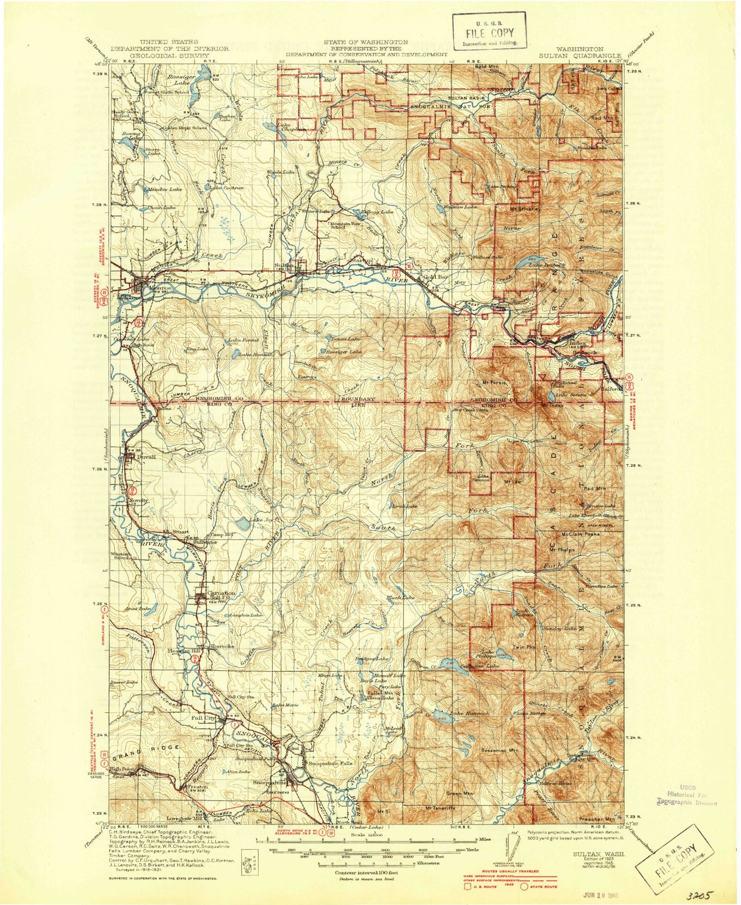
Historic 1923 Sultan Washington 30'x30' Topo Map
Couldn't load pickup availability
Historical USGS topographic map of Sultan in the state of Washington. Scale: 1:125000. Print size: 18" x 24"
This map was published in 1923 and is in the following counties: King, Snohomish.
The map contains contour lines, roads, rivers, towns, streams, and lakes. Printed on high-quality waterproof paper with UV fade-resistant inks.
Contains the following named places: Ames Lake, Camp Gilead, Horseshoe Lake, Langlois Lake, Sikes Lake, Tolt Hill Flat, Tuck Creek, Valley Memorial Park, Novelty, Stillwater, Duvall, Ames Lake Pothole, Essency Creek, MacDonald Memorial Park, Taylor Park, Lake Alice, Anderson Creek, Apex Mine, Austin Creek, Barclay Creek, Bare Mountain, Barr Creek, Bear Creek, Bear Creek, Bear Creek, Beaver Creek, Beaver Lake, Beaverdale Mine, Bench Lake, Bengston Lake, Bessemer Mountain, Bevis Lake, Big Bend, Big Creek, Big Four Creek, Big Greider Lake, Bitter Creek, Black Lake, Blackhawk Mine, Lake Blethen, Sultan Ridge, Boomerang Lake, Boss Creek, Boulder Creek, Boulder Lake, Boyle Lake, Bridal Veil Creek, Bridal Veil Falls, Bridges Lake, Brockway Creek, Lake Bronson, Calligan Creek, Calligan Lake, Camp Brown Guard Station, Camp Don Bosco, Canyon Creek, Canyon Creek, Canyon Creek, Canyon Falls, Carpenter Creek, Little Cavanaugh Lake, Cedar Ponds Lake, Chain Lake, Chaplain Creek, Lake Chaplain, Cherry Creek, Cherry Lake, Cherry Valley, Chief Seattle Boy Scout Reservation, Coal Creek, Lake Cochran, Copperbelt Mine, Cougar Creek, Cougar Lake, Crandall Creek, Crater Lake, Crater Lake, Crystal Creek, Dagger Lake, Damon Mine, Deep Creek, Deer Creek, Deer Creek Flat, Devils Canyon, Devils Slide, Dog Mountain, Drunken Charlie Lake, Dry Creek, Duffey Creek, Eagle Falls, East Fork Griffin Creek, East Fork Index Creek, East Fork Kimball Creek, Echo Lake, Echo Lake, Elbow Lake, Lake Elizabeth, Elk Basin, Elk Creek, Ellisville, Lake Elsie, Elwell Creek, Ernies Grove, Evergreen State Fairgrounds, Fitchener Slough, Flowing Lake, Lake Fontal, Forest Glade, Foye Creek, Frozen Mountain, Fuller Mountain, Fury Lake, Gilbert Creek, Goat Mountain, Goat Mountain Lake, Gold Bar, Grand Ridge, Green Mountain, Green Slough, Greider Creek, Griffin Creek, Halford, Hancock Creek, Lake Hancock, Hannan Creek, Lake Hannan, Hanstead Creek, Harris Creek, Harts Swamp, Haskel Slough, Haystack Lookout, Haystack Mountain, Haywire Ridge, High Point, High Rock, High Rock, High Rock Creek, Hogarty Creek, Honey Lake, Honeymoon Mine, Horseshoe Bend, Horseshoe Lake, Horseshoe Slough, Hughes Lake, Hull Lake, Icy Creek, Illinois Basin, Illinois Creek, Index, Mount Index, Lake Isabel, Lake Isabella, Janicke Slough, Japanese Lake, Jay Lake, Johnsons Swamp, Lake Joy, Junction, Kellog Lake, Kelly Creek, Kimball Creek, King Lake, Kings Lake, Klaus Lake, Kromona Mine, Lake Creek, Langlois Creek, Mount Lee, Lennox Creek, Lennox Mines, Lewis Creek, Little Calligan Lake, Little Greider Lake, Loch Katrine, Lockwood Mine, Lost Lake, Lynch Lake, Margaret Creek, Lake Margaret, Lake Marie, Marsh Creek, Marten Lake, Maud Lake, May Creek, McCarty Creek, McCauley Falls, McCoy Creek, Mount Phelps, McLeod Lake, Meadow Lake, Meadowbrook Slough, Metcalf Lake, Metcalf Marsh, Middle Fork Snoqualmie River, Middle Fork South Fork Sultan River, Mitchell Hill, Monroe, Monroe Junction, Monroe Reservoir, Lake Moolock, Moss Lake, Mowitch Lake, Mud Creek, Mud Lake, Lake Nadeau, Nine Hour Lake, Noname Creek, North Fork Cherry Creek, North Fork Creek, North Fork Guard Station, North Fork Skykomish River, North Fork Snoqualmie River, North Fork South Fork Sultan River, North Fork Tolt River, North Fork Tolt Watershed, North Fork Wallace River, North Star Creek, Olney Creek, Olney Falls, Olney Pass, Paradise Lakes, Patterson Creek, Pearson Eddy, Peoples Creek, Mount Persis, Phelps Creek, Philadelphia Creek, Philadelphia Mountain, Philippa Creek, Lake Philippa, Pleasant Hill, Pratt River, Preston, Proctor Creek, Prospect Peak, Prospectors Ridge


