MyTopo
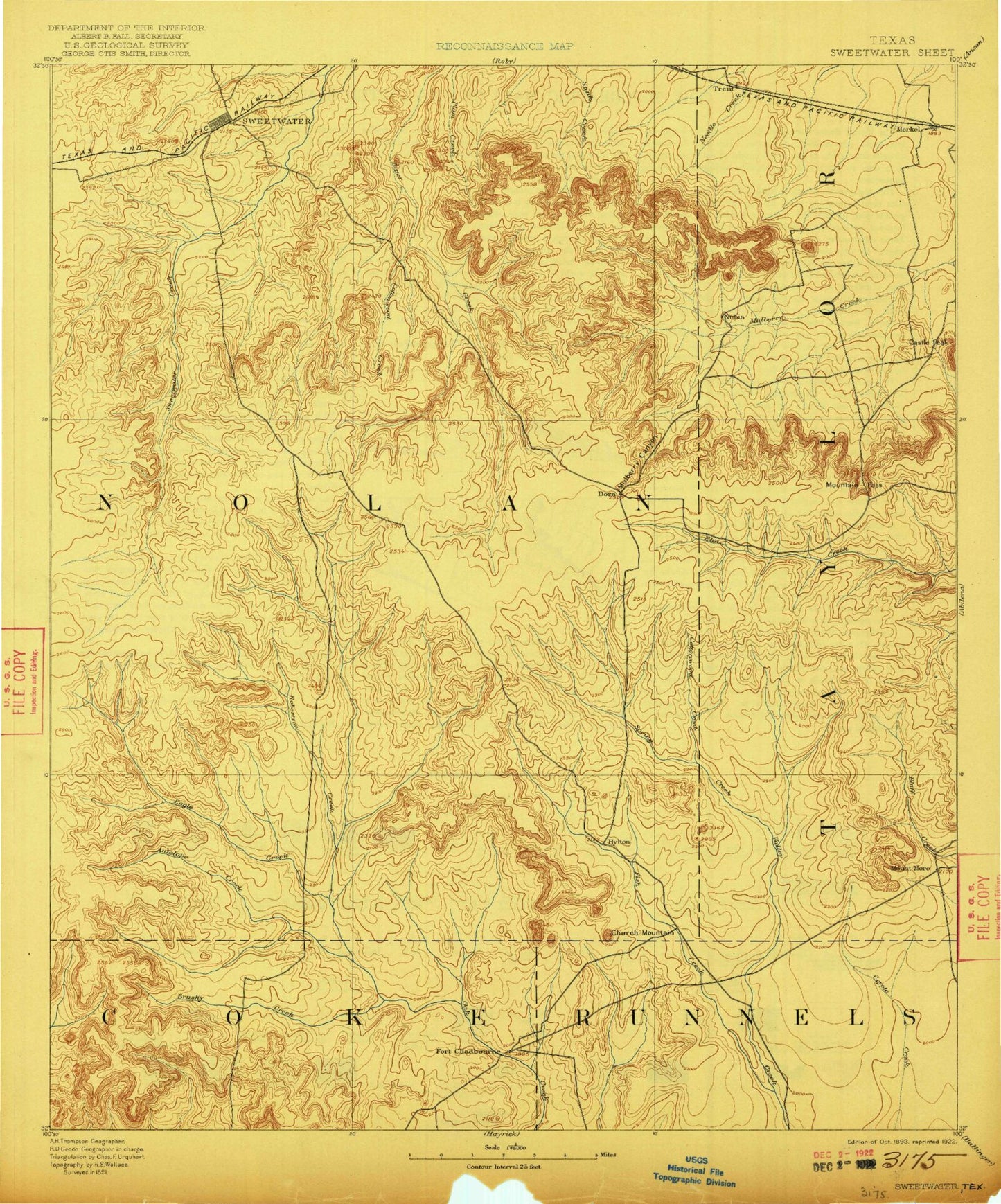
Historic 1893 Sweetwater Texas 30'x30' Topo Map
Couldn't load pickup availability
Historical USGS topographic map of Sweetwater in the state of Texas. Scale: 1:125000. Print size: 17" x 24"
This map was published in 1893 and is in the following counties: Coke, Nolan, Runnels, Taylor.
The map contains contour lines, roads, rivers, towns, streams, and lakes. Printed on high-quality waterproof paper with UV fade-resistant inks.
Contains the following named places: Adrian Ranch, Antelope Creek, Avenger Village, Beacon Hill, Bear Creek, Black Point, Blackwell, Blair Oil Field, Blowout Mountain, Blue Gainey Point, Bonner Point, Bouzier Creek, Brushy Robertson Creek, Butman Camp, Cas Russell Creek, Cedar Gap, Cedar Mountain, Chalk Peak, Church Peak, Cottonwood Creek, Cottonwood Creek, Cottonwood Creek, Cottonwood Creek, Cottonwood Mountain, Cow Creek, Coxs Gap, Dill Canyon, Double Heart Ranch, Dug Spring Canyon, Eagle Creek, East Fork Spring Creek, Finn Creek, Firemans Point, Fish Creek, Fort Chadbourne Oil Field, Fox Hollow, Fraley Park, Gibson Oil Field, Grimes Gasoline Plant, Gulf Peninsula, Hendry Point, High Lonesome Windmill, Holder Creek, Hoodoo Draw, Humble Neck, Hylton Mountain, Idlewild Creek, Jackson Mountain, Kaiser Creek, Lake Trammell, Lake Trammell Oil Field, Little Blue Gainey Points, Long Branch, Magness Draw, Maryneal, Mathis Mountain, McDowell Point, Merry Point, Middle Fork Spring Creek, Mountain Pass, Newman Park, Ninemile Hill, Nolan, Nolan Divide Lake, North Branch Oak Creek, North Dora Oil Field, North Fork Valley Creek, Northwest Dora Oil Field, Oak Creek Reservoir, Oaties Hollow, Outlaw Canyon, Pace Point, Paige Flat, Pecan Creek, Prong Creek, Rhodes Ranch, Ringtop, Robertson Creek, Robtann Draw, Rocky Point, Ross Creek, Rowan Hope Oil Field, Salt Branch, Salt Creek, Santa Fe Lake, Scenic Point, Seale Creek, Shep, Sixtynine Ranch, South Fork Valley Creek, Spears Mountain, Spring Creek, Spring Creek, Sweetwater, Sweetwater Park, Lake Sweetwater, The Divide, Town Creek, Weaver Springs Creek, West Fork Spring Creek, White Flat Oil Field, White Hall Ranch, White Oil Field, Whiteside Ranch, Wildcat Mountain, Wiley Bluff, Williams Branch, Wilson Creek, Wingate, Wolf Draw, Wolf Hollow, Flat Top Mountain, Horse Hollow, Kildoogan Creek, Merkel, Trent, Blair, Fort Chadbourne, Grimes, Happy Valley, Herndon, Hylton, Pumphrey, Shaufler, Tesco, Toland, Nolan County, Soil Conservation Service Site 17 Dam, Soil Conservation Service Site 17 Reservoir, Soil Conservation Service Site 16 Dam, Soil Conservation Service Site 16 Reservoir, Soil Conservation Service Site 3 Dam, Soil Conservation Service Site 3 Reservoir, Soil Conservation Service Site 9 Dam, Soil Conservation Service Site 9 Reservoir, Soil Conservation Service Site 8 Dam, Soil Conservation Service Site 8 Reservoir, Soil Conservation Service Site 7 Dam, Soil Conservation Service Site 7 Reservoir, Soil Conservation Service Site 10 Dam, Soil Conservation Service Site 10 Reservoir, Soil Conservation Service Site 15 Dam, Soil Conservation Service Site 15 Reservoir, Soil Conservation Service Site 14 Dam, Soil Conservation Service Site 14 Reservoir, Soil Conservation Service Site 13a Dam, Soil Conservation Service Site 13a Reservoir, Soil Conservation Service Site 11 Dam, Soil Conservation Service Site 11 Reservoir, Billy Doan Dam, Billy Doan Reservoir, Hugh Lilly Lake Dam, Hugh Lilly Lake, Soil Conservation Service Site 1 Dam, Soil Conservation Service Site 1 Reservoir, Soil Conservation Service Site 4a Dam, Soil Conservation Service Site 4a Reservoir, Soil Conservation Service Site 5 Dam, Soil Conservation Service Site 5 Reservoir, Soil Conservation Service Site 6 Dam, Soil Conservation Service Site 6 Reservoir, Lake Trammel Dam, Sweetwater Country Club Lake Dam, Country Club Lake, Lake Sweetwater Dam, Odom Currie Wylie Estate Lake Number 1 Dam, Odom Currie Wylie Estate Lake Number 1, Odom Currie Wylie Estate Lake Number 2 Dam, Odom Currie Wylie Estate Lake Number 2, Soil Conservation Service Site 4 Dam, Soil Conservation Service Site 4 Reservoir, Oak Creek Dam, Mitchell Dam, Mitchell Lake, Soil Conservation Service Site 2a Dam, Soil Conservation Service Site 2a Reservoir, Turner May Dam, Turner May Lake, Boothe Lake Dam, Boothe Lake, Nubia Creek, Bald Mountain, Riney Peak, Mulberry Canyon, Indian Hand Bluff, Butman Falls, Pat Powers Cove, Coffee Hollow, Mapes Hollow, Birdsnest Bluff, Blackwell-Nolan Division, Merkel Division, Sweetwater Division, Rolling Plains Girls Softball Park, Mustang Bowl, Fort Chadbourne, Lake Sweetwater Municipal Park, Santa Fe Park, Sweetwater Commercial Historic District, Bankhead Highway Historic District, Shep, City of Blackwell, City of Sweetwater, Town of Merkel, Town of Trent


