
MyTopo
Historic 1900 Syracuse Kansas 30'x30' Topo Map
Couldn't load pickup availability
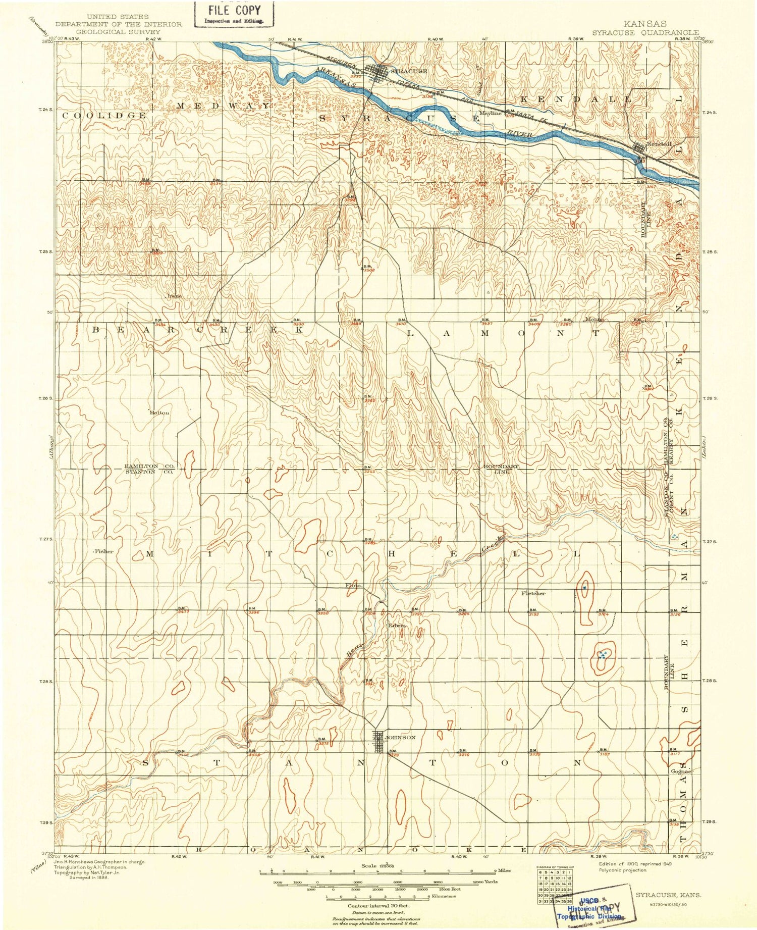
Historical USGS topographic map of Syracusein the states of Kansas, Colorado. Scale: 1:125000. Print size: 17" x 24"
This map was published in 1900 and is in the following counties: Grant, Hamilton, Kearny, Stanton.
The map contains contour lines, roads, rivers, towns, streams, and lakes. Printed on high-quality waterproof paper with UV fade-resistant inks.
Contains the following named places: Beaty Creek, Township of Bear Creek, Township of Lamont, Syracuse, Fort Aubrey Ditch, Kendall, Dry Creek, North Bear Creek, Little Bear Creek, Manter, Johnson, Big Bow, Hamilton County Fairgrounds, Mayline, Julian, Stanton County, Township of Stanton, Township of Manter, Spring Creek, Township of Big Bow, Syracuse Creek, Township of Syracuse, Sand Creek, Hamilton County, City of Johnson City, City of Manter, City of Syracuse, Hamilton County Landfill, Johnson City Municipal Power Plant, Stanton County Fairgrounds, Johnson City Wastewater Plant, Manter Wastewater Plant, Syracuse Wastewater Plant, Stanton County Prairie Pines, Tamarisk Golf Course, Winger Feedyard, Beaty Creek, Dry Creek, North Bear Creek, Little Bear Creek


