MyTopo
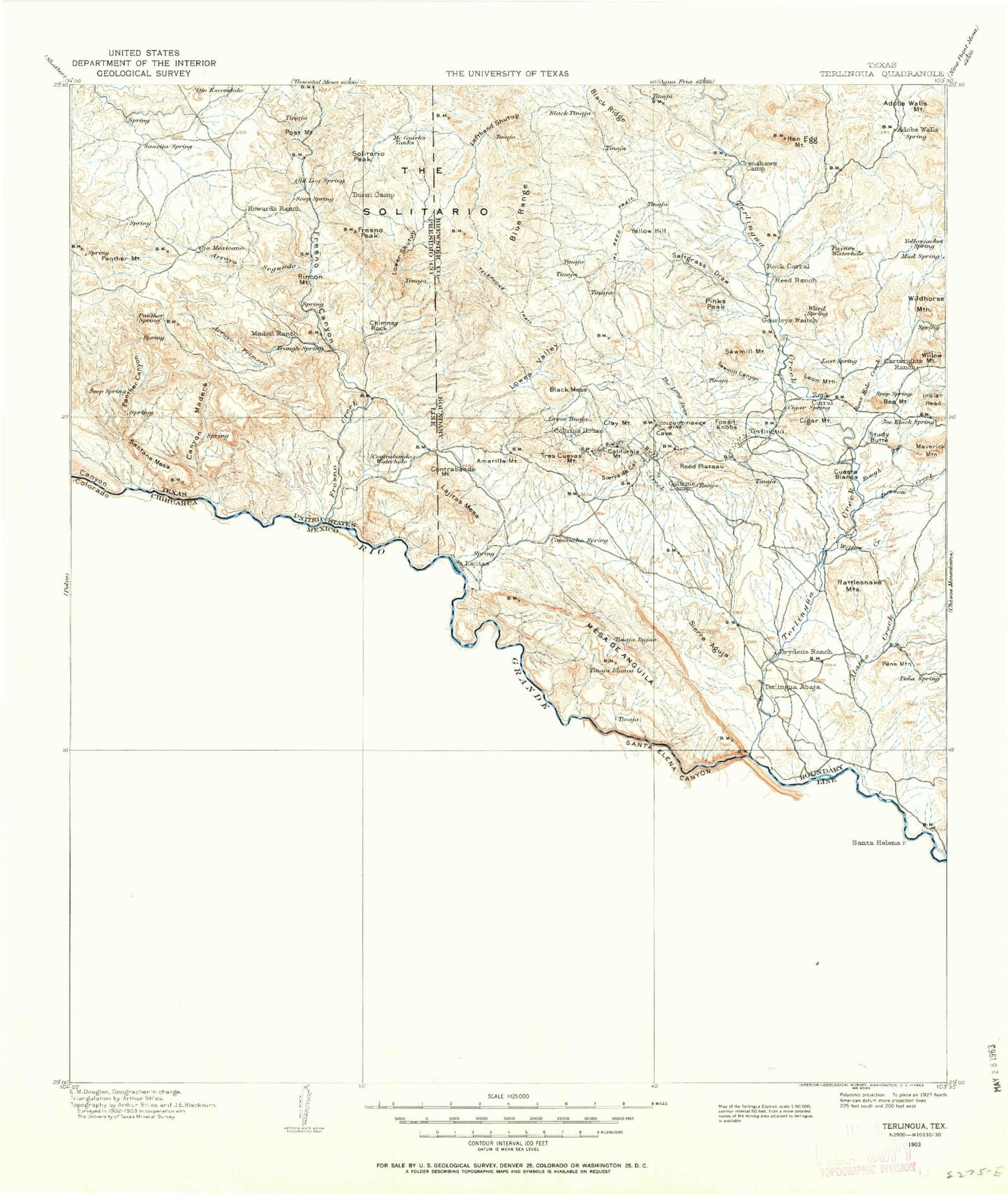
Historic 1903 Terlingua Texas 30'x30' Topo Map
Couldn't load pickup availability
Historical USGS topographic map of Terlingua in the state of Texas. Scale: 1:125000. Print size: 18" x 24"
This map was published in 1903 and is in the following counties: Brewster, Presidio.
The map contains contour lines, roads, rivers, towns, streams, and lakes. Printed on high-quality waterproof paper with UV fade-resistant inks.
Contains the following named places: Adobe Walls, Adobe Walls Draw, Adobe Walls Mountain, Amarilla Mountain, Arroyo Primero, Arroyo Segundo, Bee Mountain, Bens Hole Creek, Black Ridge, Blue Range, Burnt Camp, California Hill, Canyon Madera, Chimney Rock, Chorro Canyon, Cigar Mountain, Clay Mountain, Coltrins Camp, Contrabando Canyon, Contrabando Mountain, Contrabando Waterhole, Crenshaw Camp, Croesus Canyon, Cuesta Blanca, Dark Canyon Creek, Dawson Creek, Eagle Mountain, Fossil Knobs, Fresno Canyon, Fresno Mine, Fresno Peak, Indian Head Mountain, Lajitas, Lefthand Shutup, Leon Mountain, Lone Star Mine, Lower Shutup, Lowes Tinaja, Lowes Valley, Madrid Ranch, Mariposa Mine, Maverick Mountain, McGuirks Tanks, Needle Peak, Panther Canyon, Panther Creek, Panther Mountain, Paynes Canyon, Paynes Waterhole, Pinks Peak, Post Mountain, Reed Plateau, Righthand Shutup, Rincon Mountain, Rough Run, Saltgrass Draw, Santana Mesa, Sauceda Ranch, Sawmill Canyon, Sawmill Mountain, Sierra de Cal, Solitario Peak, Steep Draw, Study Butte, Terlingua Sinkhole, The Long Draw, The Solitario, Thirtyeight Hill, Tres Cuevas Mountain, Wax Factory Laccolith, Whitroy Mine, Wildhorse Mountain, Willow Creek, Willow Mountain, Yellow Hill, Blue Creek, Cottonwood Campground, Javelina Wash, Pena Mountain, Santa Elena Canyon Lookout, Tinaja Blanca, Tinaja Lujan, Canyon Colorado, Contrabando Creek, Fresno Creek, Lajitas Mesa, Madrid Falls, Mesa de Anguila, Rattlesnake Mountains, Rio Vista Campsite, Terlingua Creek, Well Creek, Lajitas Vehicle Crossing, Lajitas Boat Crossing, Hen Egg Mountain, Three Bar Ranch, Sierra Aguja, Alamo Creek, La Escondida, Little Thirty-Eight Mine, Piedra Lumbre, Black Mesa, Comanche Creek, Santa Elena Canyon, Papalote Escondido, Papalote Llano, Papalote Seco, Terlingua, Tres Papalotes, Castolon, Lunas, Terlingua Abaja, Santa Elena Crossing, Waldron Mine, Maggie Mine, Tinaja Rana, Tinaja Grande, Terlingua Historic District, Castolon Historic District, Big Bend Ranch State Park Trail, Santa Elena Canyon Trail, Study Butte, Lajitas Natural Bridge, Cerro Castellan Window


