MyTopo
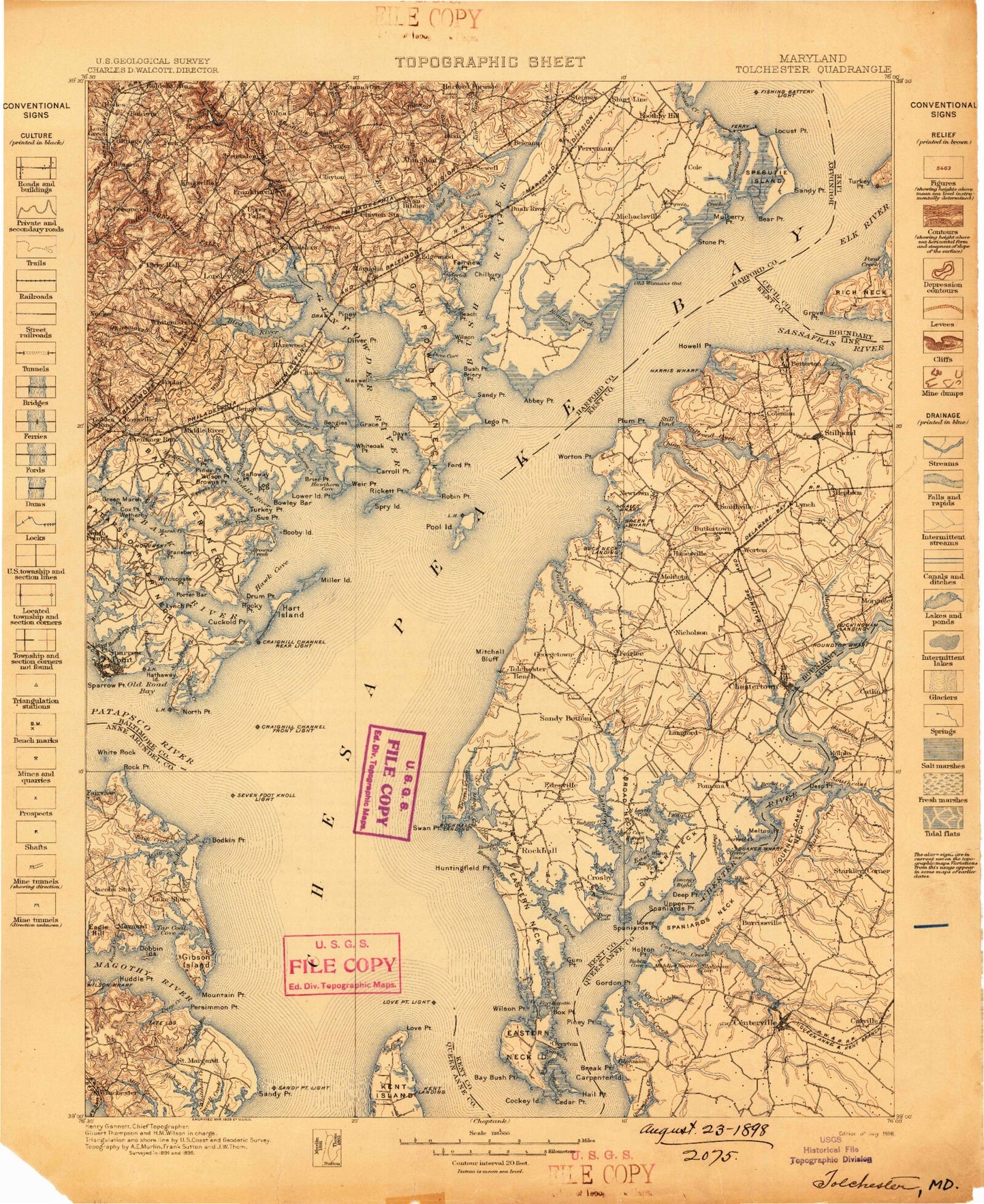
Historic 1898 Tolchester Maryland 30'x30' Topo Map
Couldn't load pickup availability
Historical USGS topographic map of Tolchester in the state of Maryland. Scale: 1:125000. Print size: 17" x 24"
This map was published in 1898 and is in the following counties: Anne Arundel, Baltimore, Cecil, Harford, Kent, Queen Anne's.
The map contains contour lines, roads, rivers, towns, streams, and lakes. Printed on high-quality waterproof paper with UV fade-resistant inks.
Contains the following named places: Sassafras River, Redman Cove, Abbey Creek, Abbey Point, Abingdon, Adams Point, Alpine Beach, Ashlar Pond, Atkisson Reservoir, Back Creek, Back Creek, Back Creek, Back Creek Point, Back River, Back River Neck, Bagley, Balliston Point, Baltimore Lighthouse, Barroll Point, Barren Point, Barren Point, Battery Point, Baybush Point, Baybush Point, Bayside Beach, Beach Point, Bear Point, Belcamp Beach, Belts Bar Point, Bengies Point, Betterton, Big Marsh, Big Marsh Point, Bigwoods, Bird River, Black Marsh, Black Point, Blackhole Creek, Blooming Turkey Farm, Bodkin Creek, Bodkin Neck, Bodkin Point, Bogle Cove, Boone Creek, Boxes Point, Boyd Pond, Bradshaw Station, Bread and Cheese Creek, Brewerton Channel Eastern Extension, Briar Point, Bridge Creek, Brien Run, Brier Point, Brier Point, Briery Point, Broad Creek, Broad Creek, Broad Neck, Broad Neck, Browns Cove, Browns Creek, Browns Creek, Browns Point, Buckingham Wharf, Bullneck Creek, Bungay Creek, Burnt House Cove, Bush Point, Bush Point, Bush River, Bynum Run, Cabin Cove, Cacaway Island, Cacaway Point, Calfpasture Cove, Camp TockwoghYMCA, Canal Creek, Carroll Island, Carroll Point, Cattail Point, Cedar Point, Cedar Point, Cedar Point, Cedar Point, Cedar Point, Cherry Tree Point, Chesaco Park, Chest Neck, Chest Neck Point, Chilbury Point, Chink Creek, Church Creek, Church Creek, Church Point, Churn Creek, Churn Creek Farm, Clark Point, Claybank Point, Cliffs Bight, Cliffs Wharf, Cod Creek, Codjus Cove, Coleman, Cooks Pond, Cool Spring Cove, Cooleys Pond, Coopers Creek, Cornfield Creek, Cowpen Creek, Cox Point, Cox Point Park, Cranberry Run, Cuckold Point, Cunninghill Cove, Dam Creek, Dark Head Creek, Davis Creek, Days Cove, Days Island, Days Point, Deadman Point, Deep Cove, Deep Creek, Deep Creek, Deep Point, Deep Point, Delph Creek, Devils Reach, Dick Branch, Dipper Creek, Dobbins Island, Drum Point, Drum Point, Dundee Creek, Durdin Creek, Eagle Hill, Eagle Point, East Branch Canal Creek, East Fork Langford Creek, Eastern Neck, Eastern Neck Island, Eastern Neck Narrows, Elk River, Elm Tree Point, Fair Promise Stock Farm, Fairlee Lake, Fairlee Neck, Fairview Point, Five Rivers Farm, Flat Point, Flying Point, Ford Point, Fore Creek, Forked Creek, Fort Smallwood Park, Foster Branch, Fox Point, Frankie Point, Fresh Pond, Frog Mortar Creek, Fryingpan Point, Fryingpan Cove, Galloway Creek, Galloway Point, Georgetown, Gibson Island, Gibson Island Beach, Glen Arm, Goose Cove, Goose Cove, Graveyard Cove, Graveyard Point, Grays Creek, Grays Inn Creek, Grays Inn Point, Grays Point, Grays Run, Green Point Wharf, Greenhill Cove, Greenmarsh Point, Grove Point, Gum Point, Gum Point, Gunpowder Falls, Gunpowder Neck, Gunpowder River, Gut Marsh, Haha Branch, Hail Creek, Hail Point, Handys Point, Harris Wharf, Hawbush Point, Hawk Cove, Hawthorn Cove, Henekes Corner, Herringtown Creek, Hickory Point, Hickory Point, High Point, Hines Ponds, Hog Neck, Hog Point, Hogpen Creek, Holland Point, Hollow Marsh Point, Honeygo Run, Hopkins Creek, Horner Cove, Howell Point, Humphrey Creek, Hunters Harbor, Huntingfield Creek, Huntingfield Point, Iron Point, Island Point, Island Point, Island Point, Jacks Cove, James Pond, James Run, Jarrett Creek, Jennifer Branch, Johnson Point, Joiners Cove, Jones Creek, Jubb Cove, Kings Creek, Kingsville, Kinnaird Point, Langford Creek, Lauderick Creek, Lawyers Cove, Lereley, Letha Ponds, Little Gum Point