MyTopo
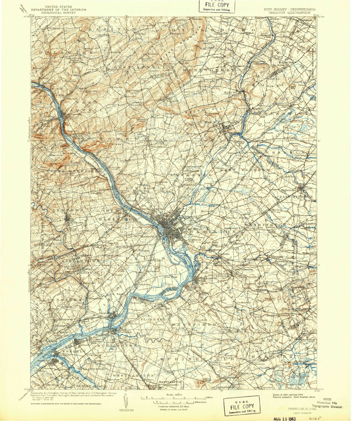
Historic 1907 Trenton New Jersey 30'x30' Topo Map
Couldn't load pickup availability
Historical USGS topographic map of Trenton in the state of New Jersey. Scale: 1:125000. Print size: 17" x 24"
This map was published in 1907 and is in the following counties: Bucks, Burlington, Hunterdon, Mercer, Middlesex, Monmouth, Ocean, Philadelphia, Somerset.
The map contains contour lines, roads, rivers, towns, streams, and lakes. Printed on high-quality waterproof paper with UV fade-resistant inks.
Contains the following named places: Bear Brook, Fiddlers Creek, Ackers Corner, Alexauken, Alexauken Creek, Allentown, Amwell, Annaricken Brook, Arneys Mount, Arneytown, Assiscunk Branch, Assiscunk Creek, Assunpink Creek, Back Brook, Back Brook, Back Creek, Bacons Run, Bakersville, Baldpate Mountain, Baldwins Corner, Baldwins Creek, Barkers Brook, Bear Tavern, Beden Brook, Belle Mead, Belle Mountain, Beverly, Blacks Creek, Blauguard Island, Blawenburg, Bloomingdale, Bordentown, Borton Landing, Boundary Creek, Bowne, Braeburn Heights, Brainerd Lake, Branch of Pond Run, Branch Back Brook, Bridegroom Run, Bridgeboro, Bridgepoint, Bridgepoint Lake, Brindle Lake, Brindletown, Bromley Park, Brookville, Buckhole Creek, Burlington, Burlington Island, Bustleton, Buttonwood Corners, Cadwalader Park, Cambridge, Camp Harmony, Mount Canoe, Capitol Hill, Carnegie Lake, Carslake Pond, Carsons Mills, Carters Brook, Cat Tail Brook, Cedar Brook, Cedar Grove, Centerville, Ceva Lake, Chambers Corners, Chesterfield, Chewalla Park, Clarksville, Cloverhill, Clyde, Colliers Pond, Colonial Lake, Colonial Memorial Park, Columbus, Conines Millpond, Cookstown, Cookstown Pond, Cooleys Corner, Coopers Corner, Copper Hill, Corn Hill, Cow Yard Brook, Coxs Corner, Crafts Creek, Cranberry Hall, Cranbury, Cranbury Brook, Cream Ridge, Creston, Crosswicks, Crosswicks Creek, Cruser Brook, Crystal Lake, Davidsons Millpond, Davis Station, Dayton, Deacons, Deans, Deans Pond, Delanco, Delaware and Raritan Canal, Devils Brook, Diehl Point, Dilts Corner, Doctors Creek, Dredge Harbor, Duck Creek, Duck Island, Duck Pond Run, Dunns Mills, Dutch Neck, Dutchtown, Eagle Island, East Burlington, East Riverton, East Trenton Heights, Edgebrook, Edges Brook, Edgewater Park, Edinburg, Eilers Corner, Eldridge Park, Ellisdale, Etra, Ewing, Ewing Park, Ewingville, Extonville, Fairview, Fairview, Fern Brook, Fernwood, Fieldsboro, First Neshanic River, Florence, Florence Station, Fort Dix, Franklin Corner, Franklin Park, Furmans Corner, Georgetown, Mount Gilboa, Glenmoore, Goat Hill, Gold Run, Gordon Pond, Great Bear Swamp, Griggstown, Gropp Lake, Grovers Mill, Groveville, Haines Corner, Hamilton Square, Harbourton, Harlingen, Harrys Brook, Harts Corner, Hawk Island, Headquarters, Heathcote Brook, Heathcote Brook Branch, Hedding, Hickory Corner, Hightstown, Hillsborough, Hockamik, Holcombe Island, Holiday Lake, Homes Mills, Honey Branch, Hopewell, Hornerstown, Hutchinson Mills, Imlaystown, Imlaystown Lake, Jacksonville, Jacobs Creek, Jacobstown, Jobstown, Juliustown, Jumping Brook, Kendall Park, Kendles Run, Kingston, Kinkora, Kirbys Mills, Kuser Pond, Lahaway Creek, Lakeside Park, Lambertville, Larisons Corners, Laurel Run, Lawrence, Lawrenceville, Lewis Brook, Lewisville, Linvale, Little Bear Brook, Little Rocky Hill, Little Shabakunk Creek, Locktown, Locust Corner, Long Bog Run, Lake Lonnie, Mansfield, Mansfield Square, Marshalls Corner, Martins Beach, Mercerville, Mettler, Middlebush, Middlebush Brook, Mile Hollow, Mill Creek, Millside Heights, Millstone, Miry Run, Miry Run, Monmouth Junction, Montgomery, Moore, Moores Creek, Mount Airy, Mount Rose, Muirhead, Ashby Creek, Nelsonville, Neshanic, New Albany, New Canton, New Egypt, New Sharon, New Sharon Branch, Newbold Island


