MyTopo
Historic 1911 Tularosa New Mexico 30'x30' Topo Map
Couldn't load pickup availability
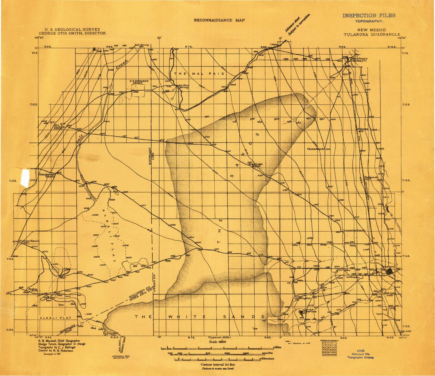
Historical USGS topographic map of Tularosa in the state of New Mexico. Scale: 1:96000. Print size: 24" x 20"
This map was published in 1911 and is in the following counties: Dona Ana, Lincoln, Otero, Sierra, Socorro.
The map contains contour lines, roads, rivers, towns, streams, and lakes. Printed on high-quality waterproof paper with UV fade-resistant inks.
Contains the following named places: Allen Draw, Big Tank, Big Tank, Black Tank, CCC Tank, Capitol Peak, Capitol Peak Tank, Chosa Tank, Dog Town Tank, Double Mills Reservoir, Falls Ranch, Hatchet Ranch, Joe West Tank, Johnson Park Canyon, Line Tank, Lone Cedar Tank, Lower Snake Tank, MacDonald Camp, Malpais Camp, McDonald Tank, Mine Tank, Mockingbird Gap Mine, North Siding, Phillips Hills, Purday Ranch, Reagan Draw, Red Tank, Sand Tank, Snake Tank, Stover Ranch, Tularosa Range Camp, Upper Dog Town Tank, Mayday Number 2, Mayday Number 3, The Sands, Oscura Range Center, Tularosa Peak, White Sands Lakes, Mason Tank, Thurgood Canyon, Lee Canyon, Little Salt Lake, Lumley Lake, Nelson Tank Number 1, Salt Creek, Smith Tank, Sweetwater Creek, Cora Crew, Kimmons, Roberson Place, Sheep Mountain, Tularosa, Red Hill, Sly Gap, Johnson Park, Bull Gap Ridge, Milagro Hill, Brownstein Windmill, Salina de San Andres, Lava Gap, Salinas Draw, Sand Well Draw, Guilez Draw, Coyote Canyon, Coyote Hills, Husk Windmill, Jackass Mountain, Taylor Windmill, Three Rivers Pertoglyph, New Well Draw, Lopez Canyon, Crosby Windmill, Temporal, Fifteenmile Lake, Horseshoe Lake, Big Salt Lake, Turner Lake, Bull Tank, Boone Draw Tank, Crossroad Tank, Rock Tank, West Tank, Coyote Tank, Upper Steer Pasture Tank, Long Tank, Lower Steer Pasture Tank, Road Tank, Good Fortune Creek, North Mill Arroyo, Jackson Draw, Rocky Arroyo, Rhodes Canyon Range Center, Crawford Draw, Tecolote Canyon, Thoroughgood Canyon, Boone Draw, Brazel Lake, Rocky Arroyo, Hays Gap, Basso Four Mine, B E Edwards Number 127, Sly Canyon, Temporal Creek, Tularosa Creek, Three Rivers, Section 29, Stiles, Mockingbird Gap, Baso Four, Mason Tank, Rey Mine, May Day Number 1 Claim, Section 29 Prospect, American Fluorspar Group, Baso Four Deposit, Salinas, Three Rivers, Oscura, Three Rivers Petroglyph Recreational Site, Three Rivers Petroglyphs Historical Marker, Tularosa Weather Station, Three Rivers Historical Marker, Tularosa Historical Marker, Tularosa Original Townsite Historic District, C C C Tank, Tularosa Division, Village of Tularosa