MyTopo
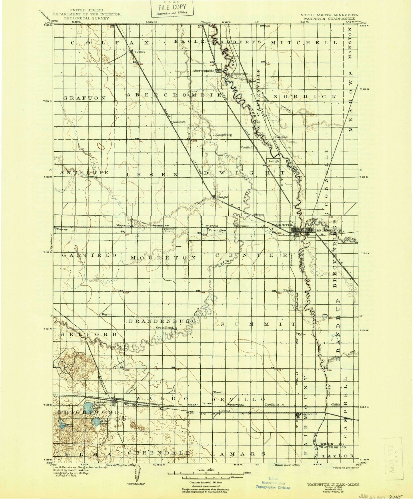
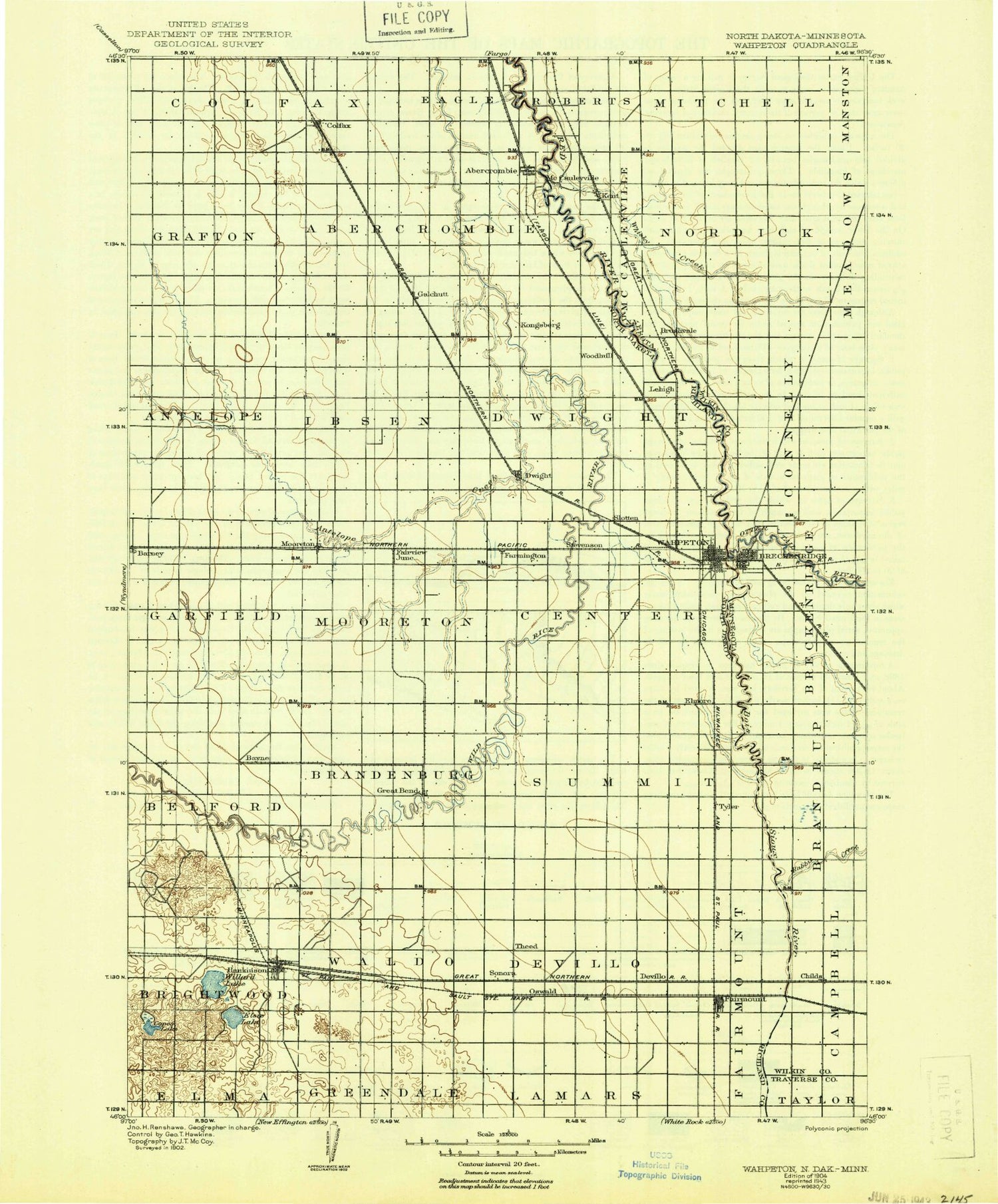
Historic 1904 Wahpeton North Dakota 30'x30' Topo Map
Couldn't load pickup availability
Historical USGS topographic map of Wahpetonin the states of North Dakota, Minnesota, South Dakota. Scale: 1:125000. Print size: 17" x 24"
This map was published in 1904 and is in the following counties: Richland, Traverse, Wilkin.
The map contains contour lines, roads, rivers, towns, streams, and lakes. Printed on high-quality waterproof paper with UV fade-resistant inks.
Contains the following named places: Bois de Sioux River, Abercrombie, Bois de Sioux Country Club, Chahinkapa Park, Colfax, County Ditch Number 1, County Ditch Number 26, County Ditch Number 3, County Ditch Number 30, County Ditch Number 34, County Ditch Number 35, County Ditch Number 55, County Ditch Number 58, Devils Nest, Dwight, Fairmount, Fort Abercrombie State Park, Galchutt, Great Bend, Mooreton, Pitcairn Creek, Sonora, Hanson Dam, Wahpeton, De Villo, Elmore, Enloe, Fairview Junction, Farmington, Oswald, Pitcairn, Tyler, Antelope Creek, Bayne, Lake Elsie, Frying Pan Lake, Grass Lake, Hankinson, Horseshoe Lake, Lake Elsie National Wildlife Refuge, Mantador, Round Lake, South Branch Antelope Creek, Willard Lake, Richland County, Richland County Water Plant, City of Abercrombie, City of Barney, City of Colfax, City of Dwight, City of Fairmount, City of Great Bend, City of Hankinson, City of Mantador, City of Mooreton, City of Wahpeton, Township of Fairmount, Township of Devillo, Township of Waldo, Township of Brightwood, Township of Summit, Township of Center, Township of Moore, Township of Brandenburg, Township of Mooreton, Township of Belford, Township of Barney, Township of Dwight, Township of Ibsen, Township of Antelope, Township of Grafton, Township of Abercrombie, Township of Nansen, Frank Vertin Athletic Field, Earl Skip Bute Alumni Stadium, Gayle Miller Softball Complex, Ed Werre Arena, Chahinkapa Zoo, Richland County Waterfowl Production Area, Mooreton Pond, Bois de Sioux River, Breckenridge, Breckenridge Lake, County Ditch Number One-a, County Ditch Number One-b, County Ditch Number Twentythree, County Ditch Number Twentyfive, County Ditch Number Twentynine, County Ditch Number Thirtynine, County Ditch Number Six-a, Judicial Ditch Number Eleven-Ten, Kent, Manston State Wildlife Management Area, McCauleyville, Rabbit River, State Ditch Number Fifteen, Welles Park, Whisky Creek, Brushvale, Childs, Otter Tail River, Township of Breckenridge, Township of Connelly, Township of McCauleyville, Township of Nordick, Fort Abercrombie State Park, Breckenridge Lake Dam, Breckenridge Lake, County Ditch Number Twentyeight, Breckenridge, Kids Korner Playground, Jefferson Park, Railroad Park, Gewalt Park, Lions Park, Ox Cart Trail Park, Main Street Rotary Park, Friendship Sculpture Monument, Headwaters Park, Breckenridge Historical Marker, Boise De Sioux Mobile Estates, Kent, Fort Abercrombie Historical Marker, City of Breckenridge, City of Kent, Wilkin County Waterfowl Production Area, Bois de Sioux River, Richland County Waterfowl Production Area