MyTopo
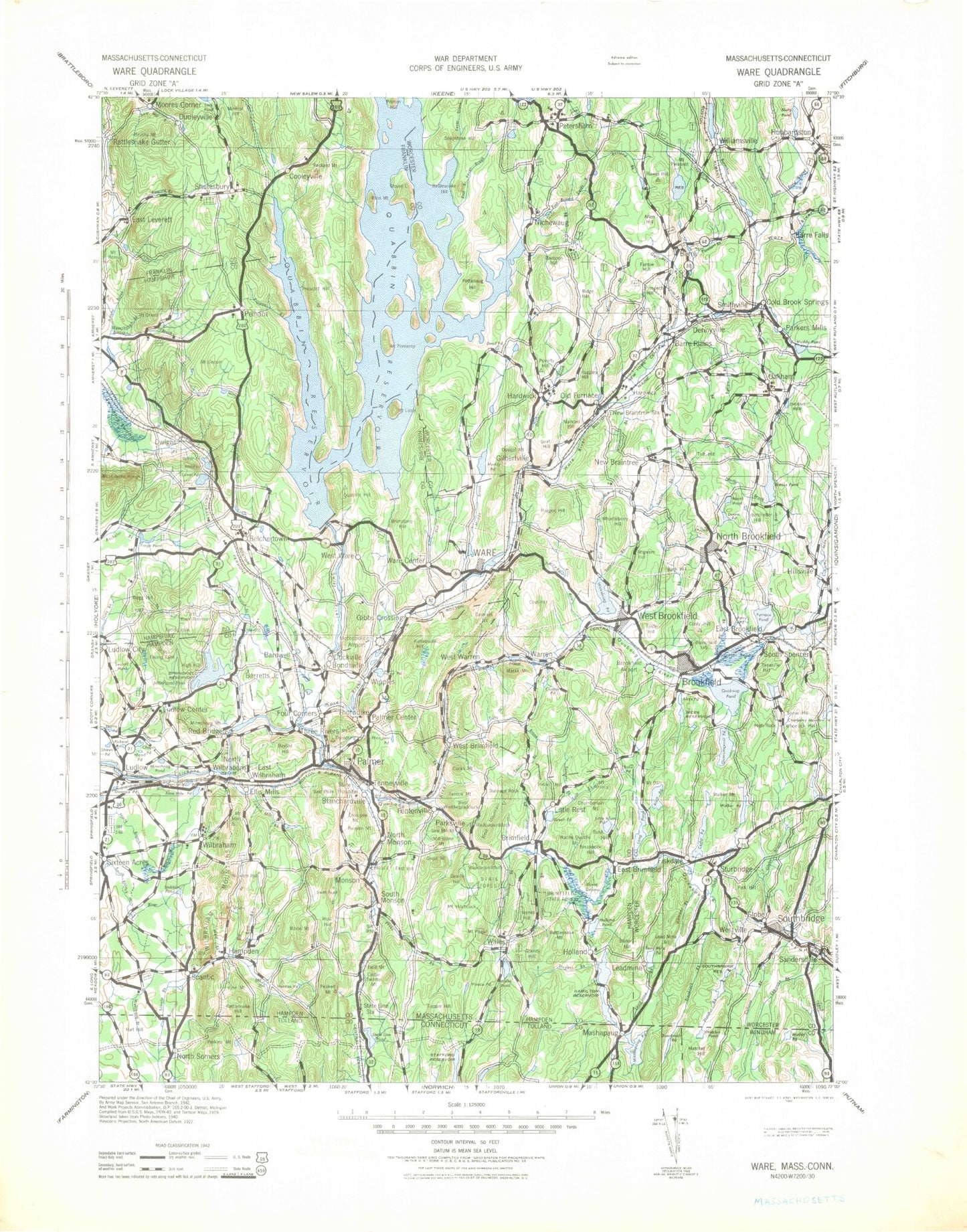
Historic 1942 Ware Massachusetts 30'x30' Topo Map
Couldn't load pickup availability
Historical USGS topographic map of Ware in the state of Massachusetts. Scale: 1:125000. Print size: 18" x 24"
This map was published in 1942 and is in the following counties: Franklin, Hampden, Hampshire, Tolland, Windham, Worcester.
The map contains contour lines, roads, rivers, towns, streams, and lakes. Printed on high-quality waterproof paper with UV fade-resistant inks.
Contains the following named places: Breakneck Pond, Browns Brook, Cohasse Brook, Crow Hill Brook, Hamilton Reservoir, Hatchet Brook, Hatchet Pond, May Brook, Muddy Pond, Potash Brook, Rattlesnake Hill, Rockadundee Brook, Sawmill Brook, Stevens Brook, Thrasher Brook, Tray Hollow, Watchaug Brook, Soapstone Hill, Barre Town Reservoir, Walnut Hill, Chopin Pond, Quabbin Aqueduct, Wells State Park, Camp Day, Felton Field, Shutesbury State Forest, Cohasse County Club, Robinson Crusoe Camp, Heritage Country Club, Horse Pond Dam, Oakham State Forest, Camp Putnam, Barre Falls Dam, Greenville Park, West Brookfield State Forest, Dean Park, Brimfield State Forest, South Baffle Dam, Wilbraham Country Club, Hubbard Park, Ludlow Country Club, North Branch Park, East Longmeadow Rod and Gun Club, Pelham Country Club, Sportsman Club, Rod and Gun Club, Springdale Mall, Iinast Shopping Center, Eastfield Mall, Boston Road Shopping Center, Meadowbrook Shopping Center, Ludlow Shopping Center, Ludlow Shopping Plaza, Sixteen Acres Shopping Center, Springfield Shopping Mall, George Washington Plaza, Big Y Plaza, Spencer Shopping Center, Southbridge Plaza, Sturbridge Plaza, Cadwell Memorial Forest, Barre State Forest, Norcross Number Four Dam, Number Five Reservoir Dam, Norcross Number Three Dam, Rockwell Dam, Cohasse Reservoir Dam, Norcross Number 2 Dam, Boulder Hill Pond Dam, Quinebaug River Reservoir, Number Four Reservoir Dam, Vinica Pond Dam, Reservoir Number Three Dam, Hamant Brook Reservoir, Cohasse Country Club Dam, Lunden Dam, Lake George Dam, Hamilton Reservoir Dam, Diversion Dam, Lensdale Pond, Lensdale Pond Dam, Conant Brook Dam, Calkins Pond Lower Dam, Calkins Pond Upper Dam, Wenworth Farm Dam, Westville Dam, Russell Harrington Mill Pond Dam, Chicopee Brook Reservoir, Zero Manufacturing Company Dam, Bennett Pond Dam, Bennett Pond, Woodman Pond Dam, Paradise Lake Dam, Dean Pond Dam, Bradway Dam, Sturbridge Village Pond Dam, East Brimfield Dam, Mill Pond Dam, Prindle Lake Dam, Cedar Pond Dam, Moulton Dam Dropped, Wheeler Pond, Wheeler Pond Dam, Church Manufacturing Company Dam, Chicopee Brook Reservoir, Baldwin Pond Dam, Alum Pond Dam, Pulpit Rock Pond West Dam, Pulpit Rock Pond New Dam, Fish Pond Dam C, Fish Pond, Lower Sibley Pond, Lower Sibley Pond Dam, Upper Sibley Pond, Ashworth Dam, Western Mass Electric Dam, Chicopee River Reservoir, W D Cheney Dam, Palmer Reservoir Upper Dam, Thompson Lake Dam, Red Bridge Dam, Chicopee River Reservoir, Harris Pond Dam, Ware River Dam, Ware River Reservoir, Ware River Dam, Ware River Reservoir, Cranberry Meadow Pond Dam, Nash Hill Reservoir Dam, Saw Mill Pond Dam, Alden Pond Dam, Ludlow Dam, Comins Pond Dam, Forest Lake Dam, Quoboag River Reservoir, West Warren Mill Pond Dam, Swift River Reservoir, Bondsville Lower Dam, Howe Pond Dam, Swift River Reservoir, Textile Printing Company Upper Dam, Lake Lashaway Dam, Beaudry Pond Dam, Buxton Hill Pond Dam, Lamberton Brook Dam, Lamberton Brook Reservoir, Beaver Lake Dam, Pilchs Number Three Dam, Brookhaven Lake Dam, Ware River Reservoir, Lower Canal Dam, Bachelor Brook Dam, Ware River Reservoir, Ware Industries Main Upper Dam, Snow Pond Dam, Forge Pond Dike, Forge Pond Dam, Kittredge Dam Reservoir, Horse Pond Brook Reservoir, Peppers Mill Pond Dam, Doane Pond Dam, Quabbin Spillway, Sportsmen Club Dan, Horse Pond Dam, Juda Dam, Brooks Pond Dam, Hardwick Pond Dam, Intake Reservoir Dam, Holden Dam, Carter Pond Dam, Barre Reservoir Dam, Gaston Pond Dam, Connor Pond Dam, Wax Factory Pond Dam, Wax Factory Pond, Williamsville Pond Dam, Dudleyville Pond Dam, Brown Pond Dam, Brooks Pond Dam, Gauco Pond Dam, Gauco Pond, Ames Pond Upper Dam, Dimmock Pond, Bonds Hill, Prospect Hill, Honey Brook, Globe Village, Bald Mountain, Bare Hill, Albertines Cove, Parkers Brook, Felton Field, Pine Ridge Ski Area, Walker Hill, Baffle Dam, School Hill, Southworth Island, Prescott Center, Federated Womens Club State Forest, Mill Pond, Quarry Pond, Adams Brook, Ames Pond, Amethyst Brook, Arcadia Lake, Atherton Brook, Atkins Reservoir, Baconville, Baker Brook, Baker Reservoir, Belchertown, Mount Boreas, Briggs Brook, Brushy Mountain, Buffam Brook, Butter Hill, Camel Brook, Cobb Brook, Cooks Corner, Dean Brook, Dodge Hill, Doolittle Brook, Dudleyville, Dunlop Brook, Dwight, East Hill, East Leverett, East Village, Flat Hills, Forge Pond, Gates Brook, Harris Brook, Hawley Reservoir, Hearthstone Brook, Hill Reservoir, Holland Glen


