MyTopo
Historic 1905 Watkinsglen New York 30'x30' Topo Map
Couldn't load pickup availability
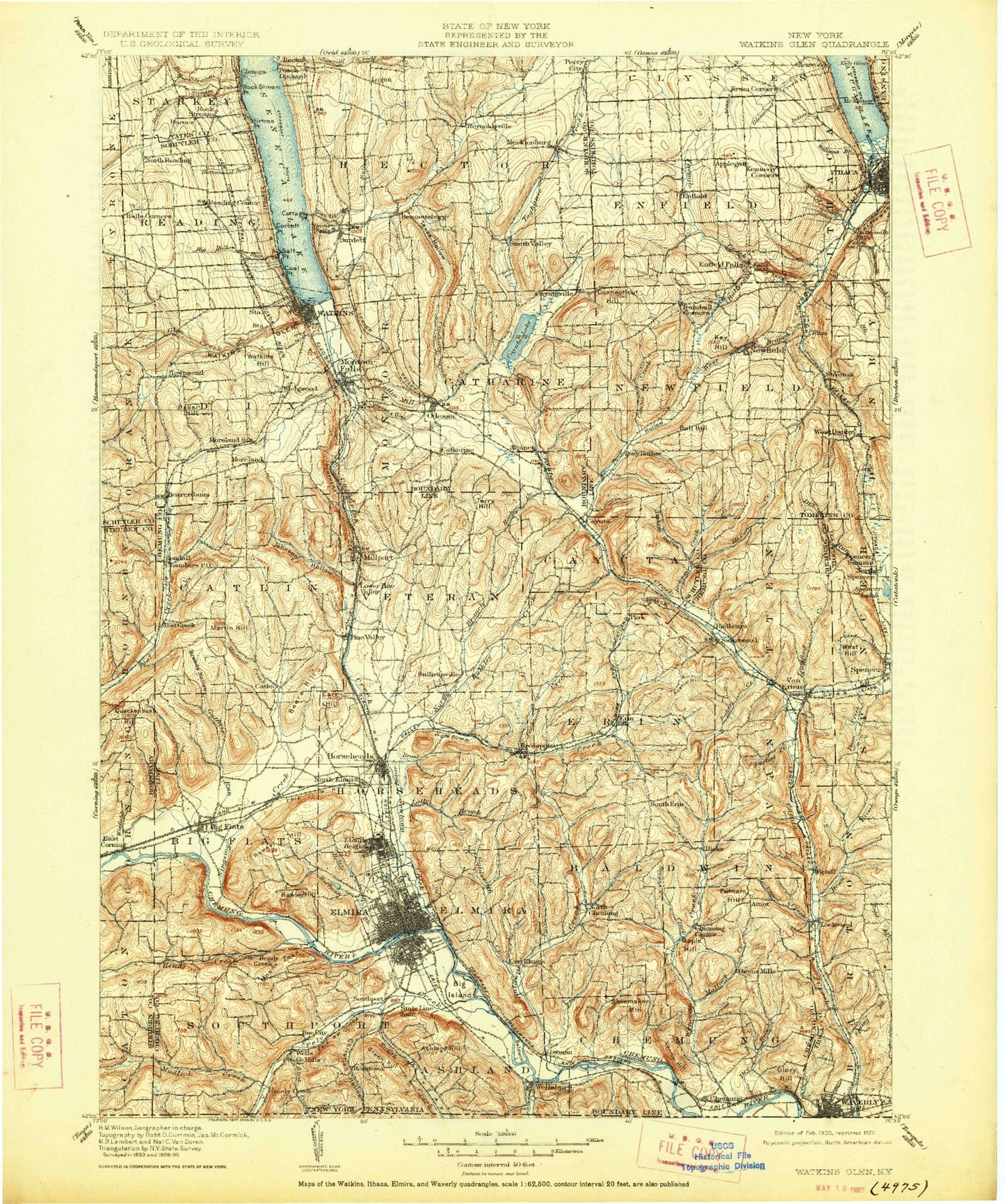
Historical USGS topographic map of Watkinsglen in the state of New York. Scale: 1:125000. Print size: 17" x 24"
This map was published in 1905 and is in the following counties: Bradford, Chemung, Schuyler, Steuben, Tioga, Tompkins, Yates.
The map contains contour lines, roads, rivers, towns, streams, and lakes. Printed on high-quality waterproof paper with UV fade-resistant inks.
Contains the following named places: Alan Treman State Marine Park, Alpine, Applegate Corner, Aunt Sarahs Falls, Badger Creek, Baker Creek, Baker Hill, Baker Park, Baldwin Creek, Baldwin Island, Banfield Creek, Barnes Hill, Barnes Hill, Barnes Station, Beantown, Beardsley Hollow, Beaver Brook, Beaver Dams, Beaver Pond, Beaver Pond, Beech Hill, Beers Hill, Benjamin Hill, Bentley Creek, Big Flats, Big Hollow Run, Big Island, Big Stream, Birch Creek, Bird Creek, Blake Hill, Bogart Hill, Bowman Hill, Brand Park, Breed Hollow, Breesport, Brown Hill, Bruce Hill, Buckeys Pond, Bulkley Creek, Burheight Creek, Buttermilk Creek, Buttermilk Falls State Park, Carr Hill, Carter Creek, Cascadilla Creek, Catharine, Catharine Creek, Cayuga Inlet, Cayuta, Center Street Park, Chaffee Creek, Chambers, Chapel Park, Chapman Corners, Chemung, Chemung Feeder Canal, Christian Hollow, Clark Hollow, Cleveland Hill, Cliff Park Brook, Cliffside State Forest, Clinton Island, Coal Point, Coldbrook Creek, Coles Corners, Comfort Hill, Cooper Hill, Corbett Point, Cornish Hollow, Coy Glen, Crandall Mountain, Cuthrie Run, Darling Creek, Dawes Hill, Dean Creek, Deckertown, Diven Creek, Dodge Pond, Doll Hill, Doolittle Hill, Dry Brook, Dry Run, Dunn Hill, Dutch Hill, Eacher Hollow, East Corning, East Creek, East Hill, East Waverly, Eldridge Lake, Eldridge Park, Elmira, Elmira Heights, Elmira Reservoir, Elston Hill, Elston Hollow, Enfield Glen, Erin, Esty Glen, Esty Point, Fall Creek, Fir Tree Point, Fish Kill, Fisherville, Foster Pond, Gingerbread Corners, Glenora, Glenora Falls, Glenwood Creek, Glenwood Point, Glory Hill, Golden Glow Heights, Goldsmith Creek, Green Hill, Grove Park, Halls Corners, Hamilton Creek, Harris Hill, Harris Hill Manor, Havana Glen, Hawes Hill, Hawley Hill, Heller Creek, Hendershot Gulf, Hendy Creek, Henyon Hollow, Hidden Valley Camp, Hinman Swamp, Hoffman Brook, Hoffman Hollow, Hooker Creek, Horseheads, Huddle Hill, Hulburt Hollow, Indian Creek, Inwood Point, Irelandville, Irish Hill, Jackson Creek, Jackson Creek, Jersey Hill, Johnson Creek, Johnson Hollow, Jones Island, Kellogg Corners, Kelly Hill, Kennedy Corner, King Hollow, Kinner Hill, Krum Corner, L'Hommedieu Creek, Langdon Hill, Langford Creek, Latta Brook, Laurel Hill, Leach Hill, Lick Brook, Linderman Creek, Lockwood, Lockwood Run, Lowe Pond, Lowman, Lucifer Falls, Madison Creek, Mallory Creek, Mallory Hill, Martin Hill, McCorn Creek, McDuffy Creek, McGrath Point, McKinneys, McKinneys Point, McKinnon Park, Midway, Miller Pond, Millport, Mitchell Hollow, Moreland, Mud Ditch, Mudlick Creek, Narrow Hill, Newfield, Newfield State Forest, Newfield Station, Newtown Battlefield Reservation, Newtown Creek, Nobles Hill, North Branch Newtown Creek, North Chemung, North Spencer, North Waverly, Oak Hill, Oak Hill, Odessa, Orchard Knoll, Owen Hollow, Park Hill, Park Station, Parker Field, Peach Orchard Point, Pine City, Pine Valley, Pine Wood Campground, Pinnacle Rock, Mount Pleasant, Pony Hollow, Pony Hollow Creek, Porter Hill, Protts Hill, Putnam Hill, Quackenbush Hill, Quarter Mile Creek, Reading Center Station, Reasor Hollow, Red Chalk Hill, Reniff Run, Renwick Brook, Roberts Hollow, Rock Stream, Rock Stream, Rock Stream Point, Roricks Camp, Rosar Hill, Rose Hill, Rowell Hill, Rumsey Hill, Salt Point, Scout Point, Seeley Creek, Seely Hill, Shequaga Creek, Shequaga Falls, Shoemaker Mountain, Six Mile Creek, Sleeper Creek