MyTopo
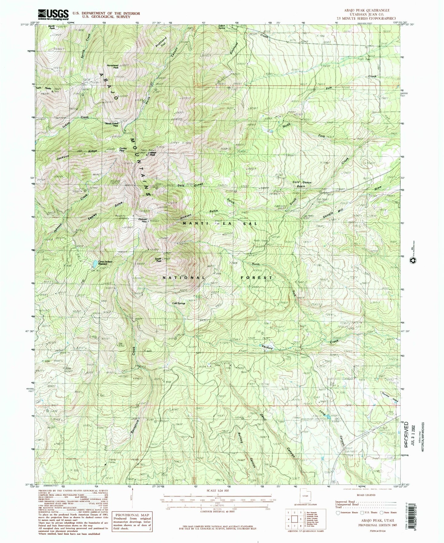
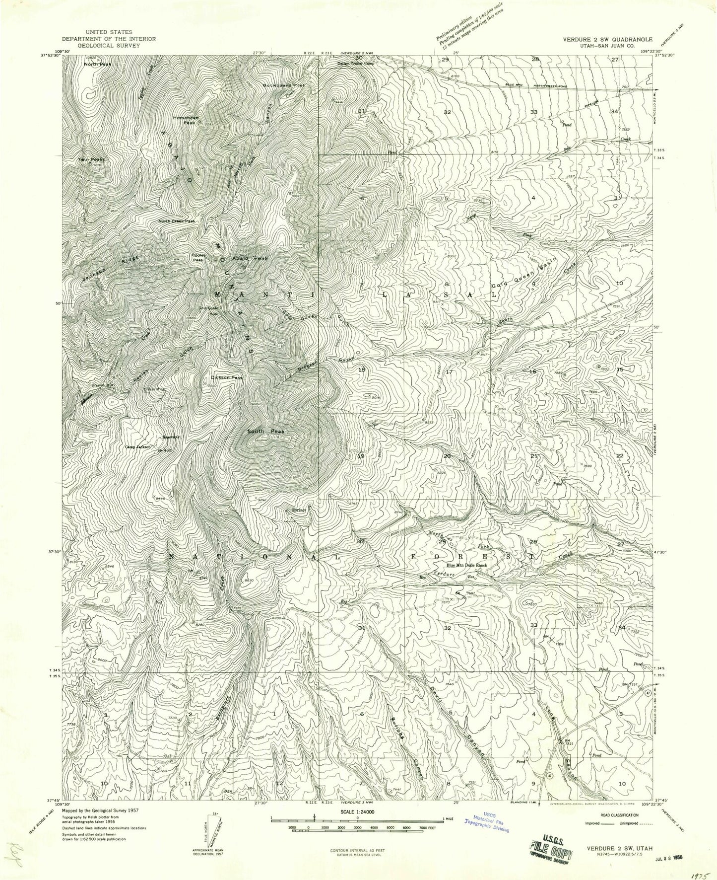
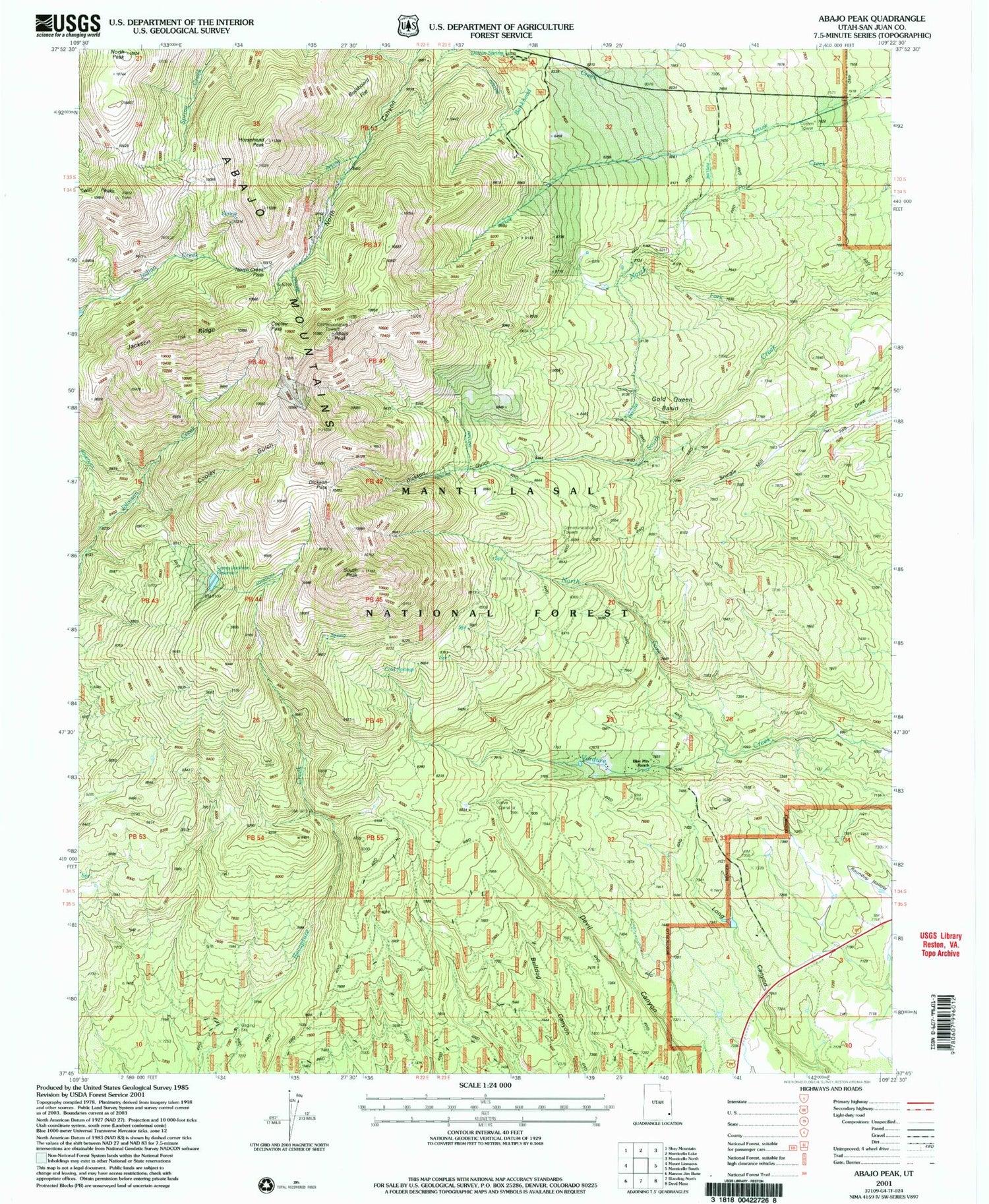
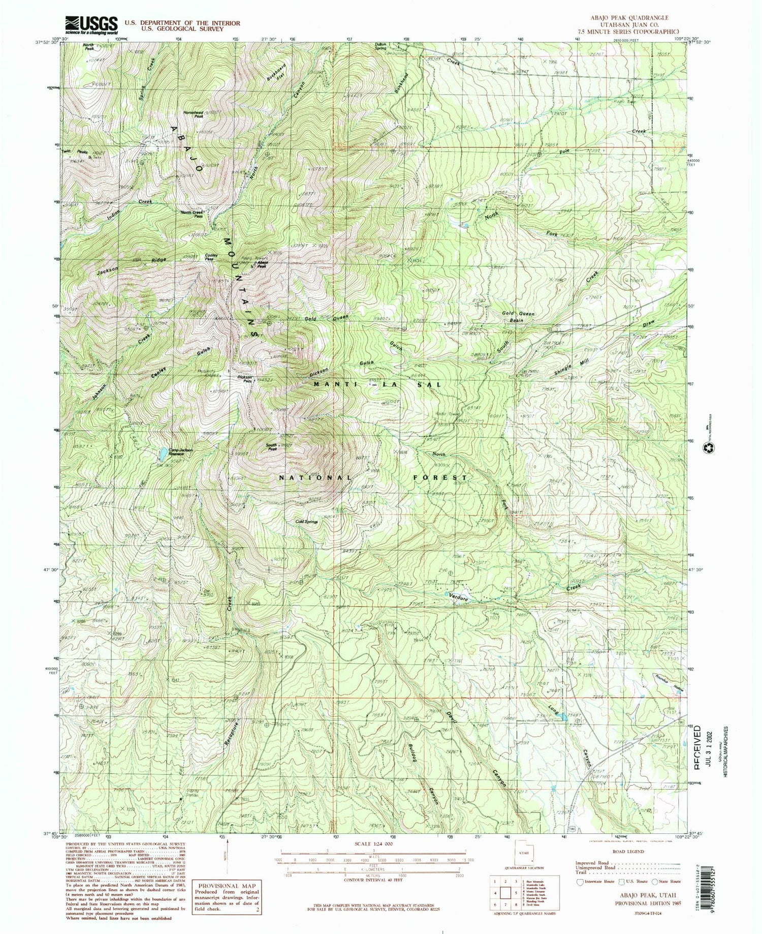
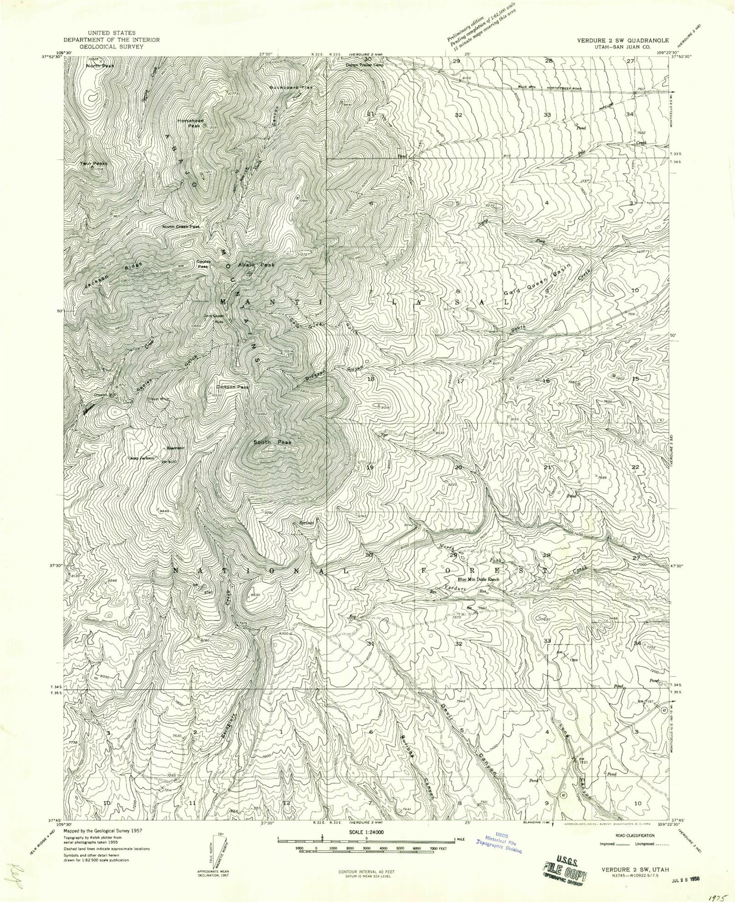
Classic USGS Abajo Peak Utah 7.5'x7.5' Topo Map
Couldn't load pickup availability
Historical USGS topographic quad map of Abajo Peak in the state of Utah. Typical map scale is 1:24,000, but may vary for certain years, if available. Print size: 24" x 27"
This quadrangle is in the following counties: San Juan.
The map contains contour lines, roads, rivers, towns, and lakes. Printed on high-quality waterproof paper with UV fade-resistant inks, and shipped rolled.
Contains the following named places: Abajo Peak, Blue Mountain Dude Ranch, Buckboard Flat, Camp Jackson, Cooley Gulch, Cooley Pass, Dalton Trailer Camp, Dickson Gulch, Dickson Pass, Dream Mine, Dream Mine, Gold Queen Basin, Gold Queen Gulch, Gold Queen Mine, Horsehead Peak, Jackson Ridge, North Canyon, North Creek Pass, North Fork South Creek, North Fork Verdure Creek, North Peak, South Peak, Twin Peaks, Camp Jackson Reservoir, Camp Jackson Dam, Roundup Hollow, Jackson Camp, Dalton Spring Campground, Blue Mountain Ski Area, Baker Guard Station, Cold Springs Electronic Site, Cold Springs, Dalton Spring, Abajo Peak, Blue Mountain Dude Ranch, Buckboard Flat, Camp Jackson, Cooley Gulch, Cooley Pass, Dalton Trailer Camp, Dickson Gulch, Dickson Pass, Dream Mine, Dream Mine, Gold Queen Basin, Gold Queen Gulch, Gold Queen Mine, Horsehead Peak, Jackson Ridge, North Canyon, North Creek Pass, North Fork South Creek, North Fork Verdure Creek, North Peak, South Peak, Twin Peaks, Camp Jackson Reservoir, Camp Jackson Dam, Roundup Hollow, Jackson Camp, Dalton Spring Campground, Blue Mountain Ski Area, Baker Guard Station, Cold Springs Electronic Site, Cold Springs, Dalton Spring