MyTopo
Classic USGS Abbeville North Georgia 7.5'x7.5' Topo Map
Couldn't load pickup availability
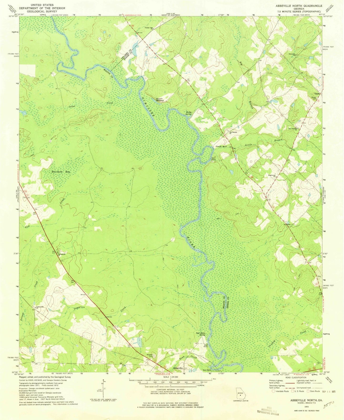
Historical USGS topographic quad map of Abbeville North in the state of Georgia. Map scale may vary for some years, but is generally around 1:24,000. Print size is approximately 24" x 27"
This quadrangle is in the following counties: Dodge, Pulaski, Wilcox.
The map contains contour lines, roads, rivers, towns, and lakes. Printed on high-quality waterproof paper with UV fade-resistant inks, and shipped rolled.
Contains the following named places: Big Branch, Bowen Cemetery, Burnham Bay, Cannonville Cemetery, Cannonville Church, Cedar Creek, County Line Church, Crooked Creek, Daniels Millpond, Englewood Church, Folsom Creek, Free Gift Church, Gum Creek, Harrell Pond, Harrell Pond Dam, Little Branch, Manley Estate Dam, Manley Estate Lake, Mitchell Family Cemetery, Mitchell Volunteer Fire Department, New Daniels Church, Old Daniels Church, Phelps Bluff, Poor Robin Spring, Rocky Spring, Sagegrass Creek, Springfield Church, Town Creek, Union, Wilcox County Public Boat Ramp