
MyTopo
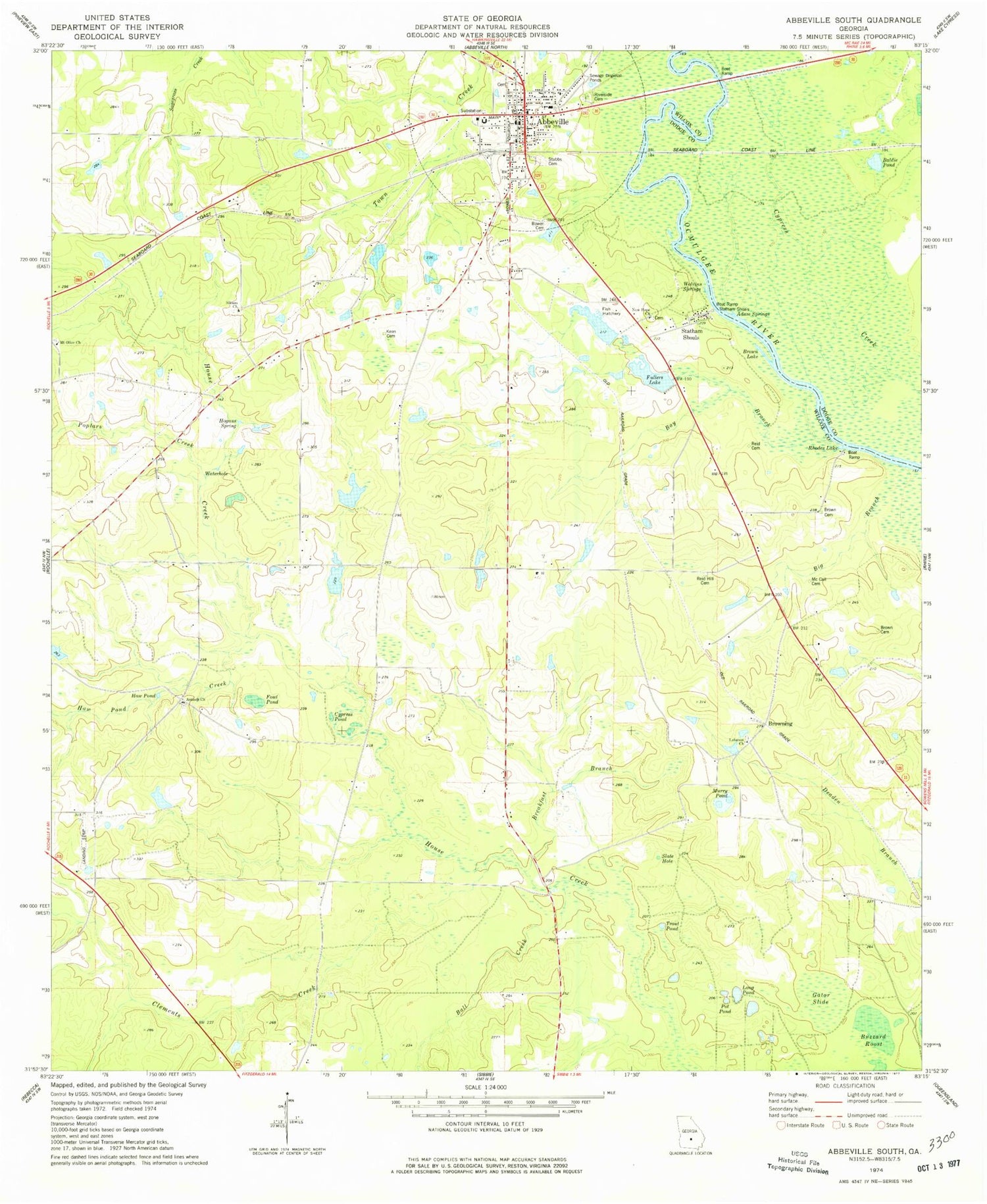
Classic USGS Abbeville South Georgia 7.5'x7.5' Topo Map
Couldn't load pickup availability
Historical USGS topographic quad map of Abbeville South in the state of Georgia. Map scale may vary for some years, but is generally around 1:24,000. Print size is approximately 24" x 27"
This quadrangle is in the following counties: Dodge, Wilcox.
The map contains contour lines, roads, rivers, towns, and lakes. Printed on high-quality waterproof paper with UV fade-resistant inks, and shipped rolled.
Contains the following named places: Abbeville, Abbeville Division, Abbeville Elementary School, Abbeville Police Department, Abbeville Post Office, Abbeville Volunteer Fire Department, Adam Springs, Addison Dam, Addison Lake, Antioch Cemetery, Antioch Missionary Baptist Church, Baldie Pond, Ball Creek, Bay Branch, Big Branch, Boat Ramp Statham Shoals, Bowell Cemetery, Breakfast Branch, Brown Cemetery, Brown Lake, Browning, Buzzard Roost, Cannon Lake, Cannon Lake Dam, Church of God, City of Abbeville, Clements Creek, Cypress Creek, Cypress Pond, Fowl Pond, Fuller Dam, Fullers Lake, Fulmer Lake, Fulmer Lake Dam, Gator Slide, Haw Pond, Haw Pond Creek, Hogans Spring, Keen Cemetery, Lebanon Cemetery, Lebanon Church, Long Pond, McCall Cemetery, Mount Olive Church, Murry Pond, New Hope Cemetery, New Hope Church, Poplars Creek, Pot Pond, Reid Cemetery, Reid Hill Cemetery, Rhodes Lake, Riverside Cemetery, Siloam Cemetery, Siloam Church, Slate Hole, Statham Shoals, Stubbs Cemetery, Trout Pond, Waterhole, Wilcox County Courthouse, Wilcox County Jail, Wilcox County Sheriff's Office, Wilcox State Prison, Wilcox State Prison Fire Department, Wolvins Springs, ZIP Code: 31001


